Light snow, icing through Wednesday could make Massachusetts roads slippery
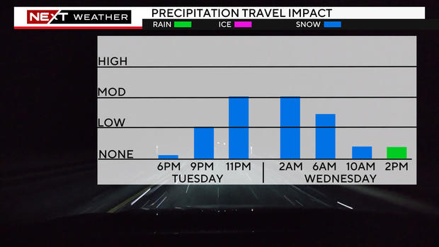
BOSTON - The WBZ Weather Team has issued a NEXT Weather Alert for some light snow and potentially hazardous travel Tuesday night.
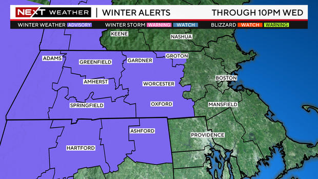
The National Weather Service has also issued a Winter Weather Advisory through 7 p.m. Wednesday for central and western Massachusetts for the possibility of some slippery travel.
When will it start snowing in Massachusetts?
Periods of light snow will break out Tuesday evening and continue overnight. Untreated roads may become slippery and snow covered, particularly after 9 p.m.
By dawn Wednesday, the snow will largely be done, with some leftover showers near the Massachusetts and New Hampshire border.
How much will it snow in Massachusetts?
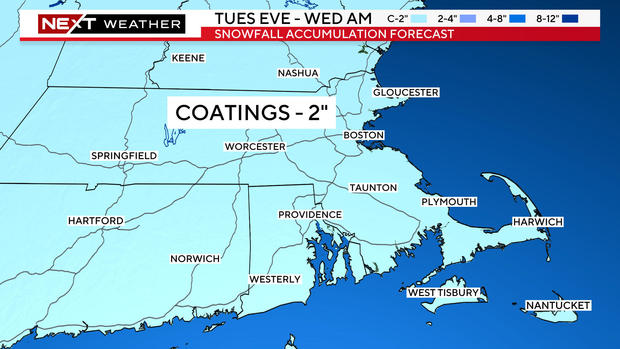
Total accumulations will be light, generally between a coating to an inch or two.
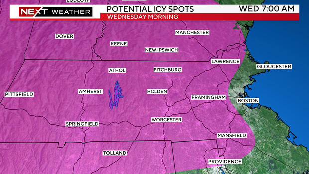
Early Wednesday morning, temperatures will hover near or slightly below freezing in most of the area.
Even though the snow will largely be ending, untreated surfaces could be very slick. If you are headed out on foot or by car early in the morning, use caution!
During the daylight hours of Wednesday, temperatures will tick up very slowly. There may be some leftover, very light drizzle. In elevated areas in Worcester County, this drizzle will fall into subfreezing temperatures creating some light icing. For the rest of the area, including all of eastern Mass., temperatures will rise above 32 degrees during Wednesday morning.
More rain and snow in the forecast for Massachusetts
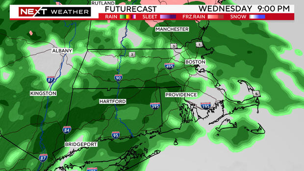
Another wave of precipitation will arrive Wednesday after dark.
By this point, temperatures will be above freezing across the entire area, so this will be all rain.
The rain will continue, off and on, through Thursday and Friday.
Not expecting huge rainfall amounts, but .5" to 1" of additional water is likely in most of the area through Friday.
It sure would be nice to get a sunny, dry weekend after this wet and gloomy week. But, alas, that does not appear to be in the cards.
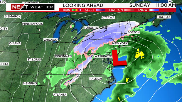
There will be a fairly sizeable storm approaching the Northeast late Saturday. This has the potential to cause multiple hazards including flooding rainfall, plowable snow (in some areas), and gusty winds along the coastline.
Who gets rain and who gets snow? And how much?
These are questions we will begin to answer later this week as the storm comes into better focus.
For now, keep the Sunday and Monday timeframe in the back of your minds for some potentially impactful and disruptive weather.
