Snow Coming For Tuesday Afternoon Commute
BOSTON (CBS) — Blame Canada. That is where all of our frigid, Arctic air has been coming from for the last several weeks and now they are sending some snow our direction.
Check: Current Conditions | Interactive Radar | WBZ Weather Blog
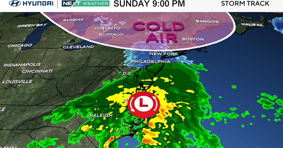
Typically, our big snow storms come up the East Coast, drawing in moisture from the south and the Gulf of Mexico, sort of like what happened this weekend. We do not typically get a whole lot of snow when a storm comes from the northwest or from Canada. These storms tend to be on the wimpy side without a whole lot of moisture to work with. We call them, "Alberta Clippers" because they come out of the Province of Alberta, Canada. They tend to zip right by New England, clipping us along the way with a touch of snow and then on to bigger and better things out over the open ocean.
That will essentially be the case with Tuesday's storm, but this "Clipper" will begin to develop rapidly once it hits our coastline and we will catch just the beginning of this intensification. The tricky call is just how quickly it will develop and how much snow can it drop as it passes by.
Here is our latest projection, step by step, inch by inch:
10 a.m. and Noon:
The snowfall will likely start around 10 a.m. in western and central Massachusetts and around noon in eastern sections including Boston. It will start as snow everywhere even down on the Cape. Temperatures will be very cold tonight and tomorrow, so expect a very fluffy snow anywhere away from the Coast.
2 p.m. and 5 p.m:
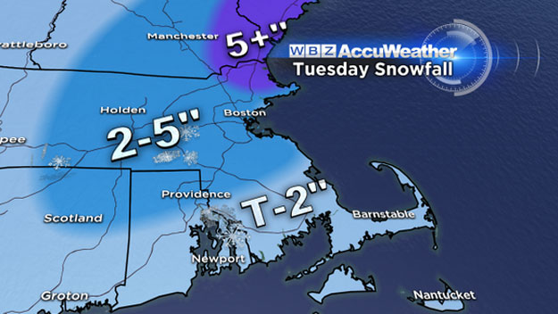
Between 2 and 5 p.m. the snow will become steady and will accumulate an inch or two prior to the evening commute. Some warming will occur from south to north, changing the snow over to a mix and rain over extreme southeastern Massachusetts and Cape Cod. This will limit the total snowfall down there to an inch or less on the Cape and 1-to-2 inches over inland southeastern Massachusetts.
5 p.m. and 8 p.m:
Between 5 and 8 p.m. the snow will continue steadily for areas north and west of Boston. There may be some additional northward movement of the mixing line in this time frame. The South Shore and even as far north as Boston may experience some mixing. Regardless, the snow will be much wetter along the coast and in southeastern Massachusetts, compacting more readily and not accumulating as well as north and west. Most of the snow accumulation will be over by 8 p.m., dropping a widespread total of 2-to-4 inches in most areas.
8 p.m. and 11 p.m:
Between 8 and 11 p.m., the rain and snow will taper off, but there may be a final burst of snow in coastal New Hampshire extending into northeast Massachusetts including Essex County. If this does occur, than we could see final snow totals as high as 5 or 6 inches in those areas. Again this depends on how much the storm is able to develop before moving east out to sea.
So by no means is this a major event, in fact we are rating it as a 1 on our iScale, meaning a relatively low impact for the region.
However, it most certainly is going to slow the evening commute on Tuesday and require additional plowing and shoveling.
The good news is, this should be our last dose of snow for a while. We finally warm up by the end of the week, reaching near 50 degrees on Friday!
Follow Terry on Twitter @TerryWBZ
MORE LOCAL NEWS FROM CBS BOSTON
