Snow And Rain Line Will Be A Close Call
BOSTON (CBS) – We are basically sticking with the same forecast for the storm, but doing so while holding our breath!
This storm is insanely complex, so much so that our computer models, which can easily handle over a trillion calculations each second, are all struggling. Temperatures are the key: literally a half of a degree can make the difference between 6"+ and hardly nothing at all. It's truly a tough call, especially for areas just to the north and west of Boston, where we are currently forecasting 2-6".
I would not be surprised to see 6-10" not too far from Boston or see the opposite, mainly rain.
This will be a "nowcasting" situation all night through tomorrow morning, meaning we will be adjusting the forecast by watching radar and temperature profiles.
Not looking for any sympathy, just want everyone to be aware that this is one of those storms that could be full of surprises!
See our forecast below:
Check: Current Conditions | Weather Map Center | Interactive Radar
This is an extremely close call for many folks in eastern Massachusetts.
Temperatures are so borderline that a difference of just one or two degrees could mean very little snow or several inches.
The areas we are most concerned with this large fluctuation are just to the north and west of Boston in the 128-495 belt.
Watch Melissa Mack's forecast:
TIMELINE
Still the same, we get some light off-and-on rain showers through this afternoon, then the precipitation becomes steady and heavier after dark.
Heavy, wet snow is expected anywhere north of the Mass Pike with rain to the south.
This continues overnight and the rain snow line creeps ever so slowly to the north and west, reaching somewhere between Boston and the 495 area.
Rain and snow taper off gradually Friday morning, but additional snow showers are likely through the afternoon, especially in central Mass.
SNOW TOTALS
For now, we are sticking with our original accumulation predictions:
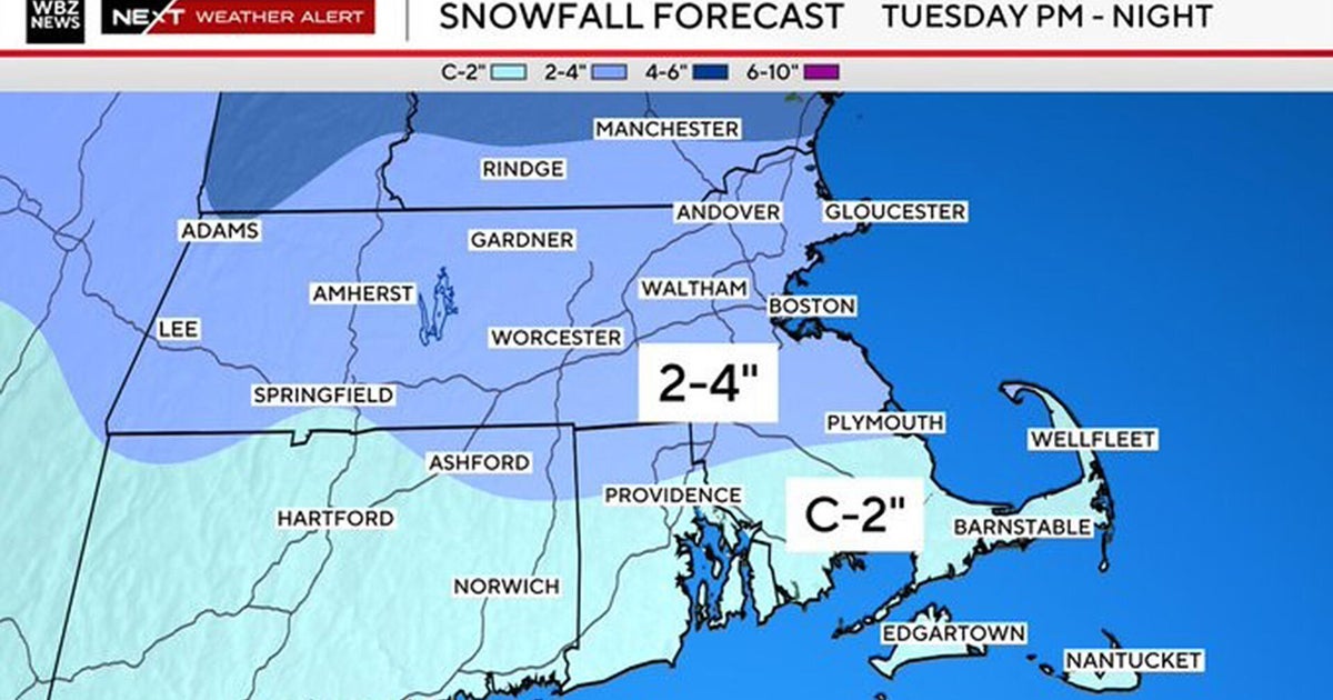
0-to 2 inches along the coast and in the Boston area
2-to-6 inches from 128 to 495 (NW)
6-to-12 inches in western Middlesex County, Worcester County and all of western Mass. as well as New Hampshire, Vermont, Maine away from the coastline.
But again, that 2-to-6 inch area is going be a real close call, so we have to watch it.
The snow will be a very heavy and wet consistency, hard to move around, will be tough to stick on the roads especially at first and some power outages or tree damage is possible due to the weight of the snow combined with gusty winds.
RAIN AMOUNTS
Rain will be heavy at times Thursday night and early Friday morning along the coast and in southeastern Mass, 1-to-1.5 inches possible with some thunder not out of the question.
Don't expect serious flooding considering how dry we have been lately.
WINDS
The winds are expected to be gusty NE 20-to-40 (along the coast especially) late tonight and early tomorrow.
TIDES
Due to the fast movement of the storm and relatively low astronomical tides, we are not expecting much more than a few pockets of minor coastal flooding.
High tides are at 10:30 tonight and 11 a.m. Friday.


