Skies clear Monday as unsettled pattern returns for rest of week

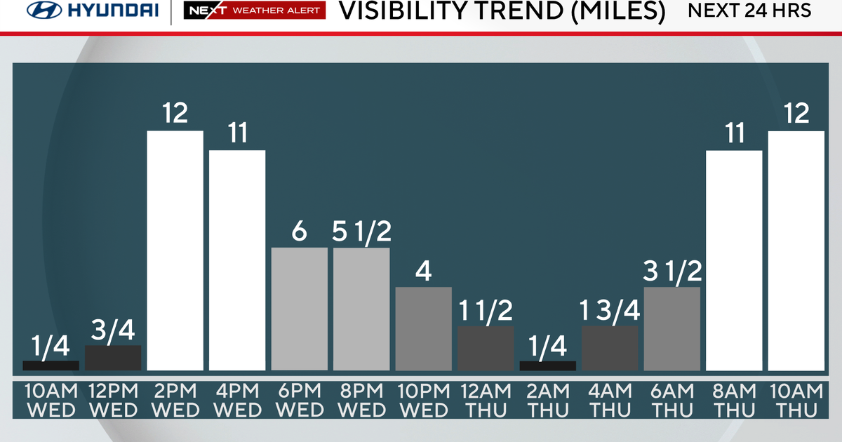
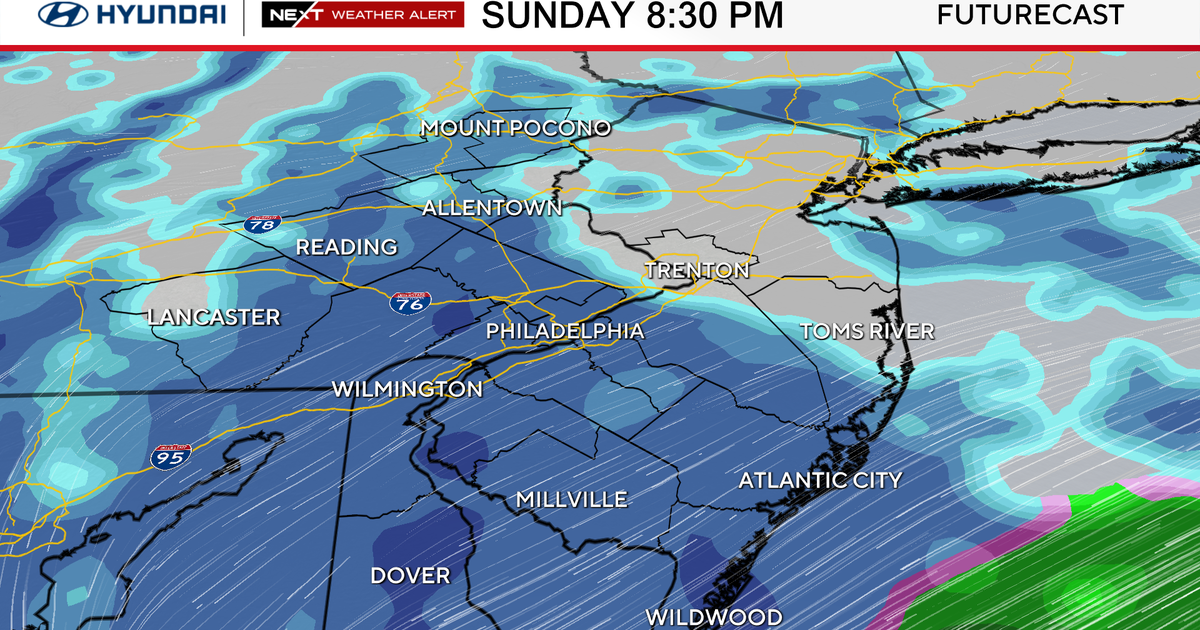
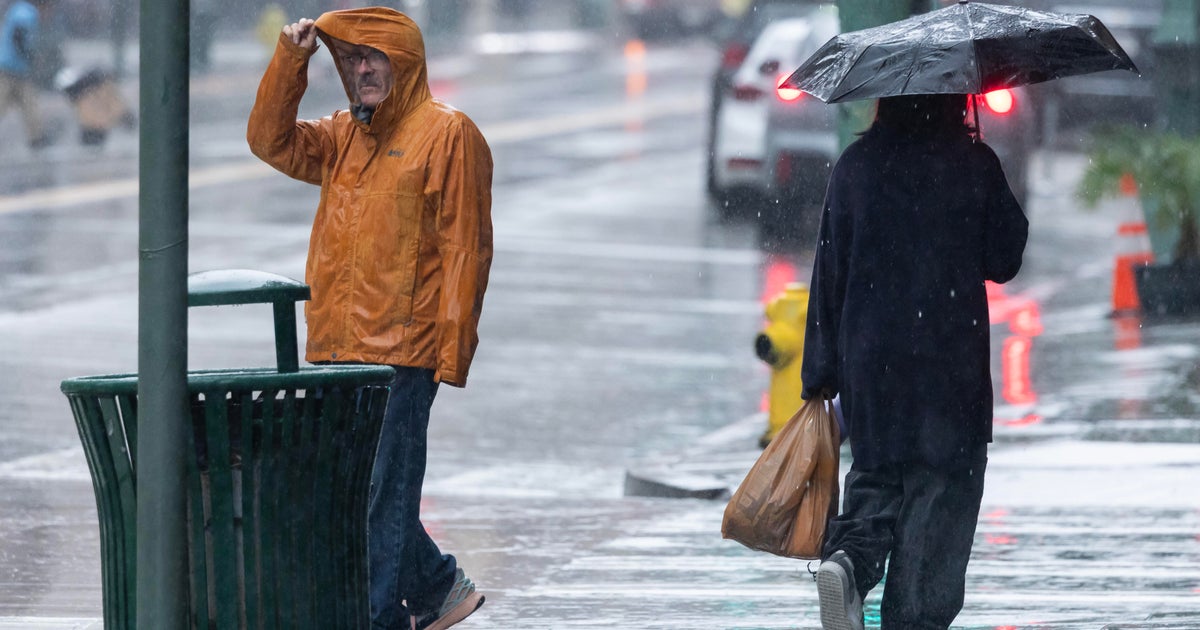
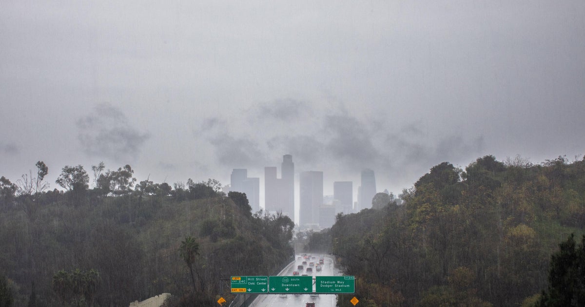
BOSTON - After a dreary start to Sunday, scattered showers and downpours became more numerous in the afternoon. Shower coverage and intensity will continue to increase Sunday night. There may even be an isolated rumble of thunder. Visibility will also be an issue if you are traveling with dense fog developing at times, especially along the coast.
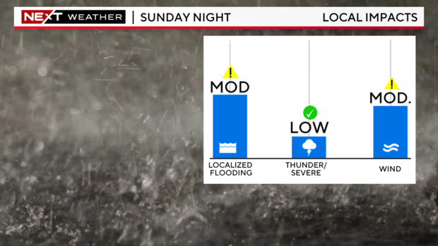
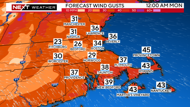
Wind will begin to pick up as well, gusting over 40+ mph at times along the south coast.
A few spotty reports of some tree damage may pop up, but nothing too widespread.
Rainfall totals will range from about 1-3" with locally higher amounts due to any developing thunderstorms. Isolated localized flooding is possible, especially in poor drainage areas and urban areas. There may be some big puddles and ponding on the roadways as well if traveling overnight.
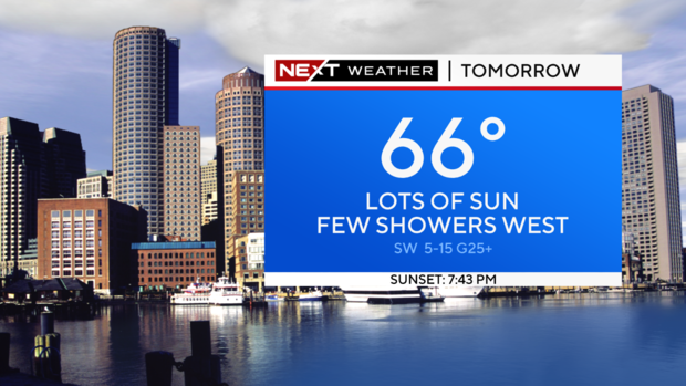
The good news is that the rain should start to taper off overnight, and we should see conditions improving by Monday morning.
Along with clearing skies and wind direction shift, highs on Monday will soar into the 60s.
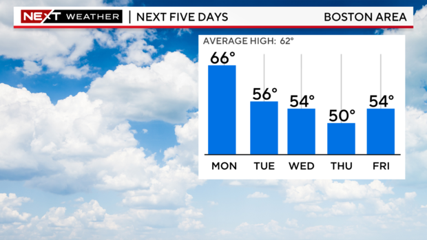
Enjoy it as the unsettled and cooler pattern returns the rest of the week as an upper level low continues to spin over the Northeast. Highs will likely range in the 50s, cooler than normal, with shower chances each day.