Returning Sun...
It's been a couple of days since we've seen the sun but a few towns actually saw it set this evening so we know it exists. That sunset is a good sign for tomorrow. A coldfront will sweep through tonight and winds will shift to the west bringing in drier air and nearly wall to wall sunshine. Temps will straddle 60 degrees in the afternoon but there will be a gusty wind and that may taint the otherwise fine day.
By Friday, with the evolving fast flow, another coldfront will be slicing through the region. This front will pass through at the warmest part of the day and will be supported by a midlevel vort max. These factors will lead to a brief but intense line of showers passing through early in the afternoon. The showers may have some gusty winds associated with them as well.
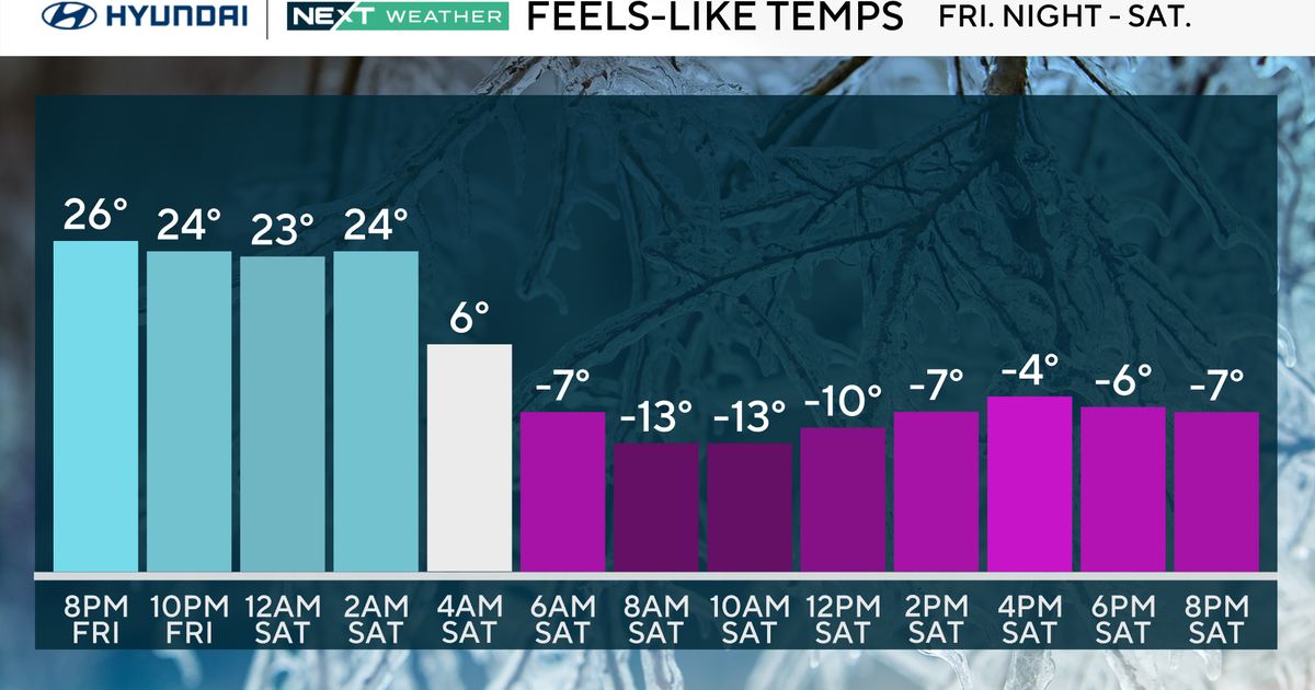
The showers with the front may get your attention but if they don't, the cold air that will follow them most certainly will. The coldest air of the season will descend on New England late Friday night and early Saturday morning...so cold that frost is now likely across the suburbs of Boston.
The same high that delivers the cold blast will warm us up for the end of the weekend and early next week. That high will slide offshore and return flow will commence sending temps through the 60s and close to 70 in a few spots. The trade off will be additional clouds and scattered showers however.


