Rainy July Continues With Flash Flood Watch For Monday
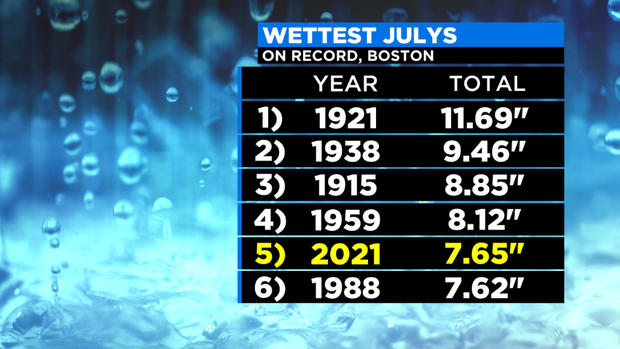
BOSTON (CBS) -- July is typically filled with BBQ's, beach days, and nights outside around a firepit or at a ballpark. However, this year… plans have been altered and many have had to run for cover as a record amount of rain has interrupted summer plans. One thing is for sure, mother nature has been in charge of watering the gardens and lawns have never looked. However, finding the time to cut the grass between rounds of rain has been a challenge. The city has recorded 7.65" of rain from July 1st through the 10th, making it the wettest start to July on record.
Even though we aren't even halfway through the month, we are already sitting in the 5th spot for the wettest July on record for Boston. There is a good chance we'll continue to move up the ladder as our current pattern is an unsettled one.
There has only been ONE day (July 5th) where we did not record measurable rain, even though a trace was recorded. There were also several days where the city picked up more than 1" of rain.
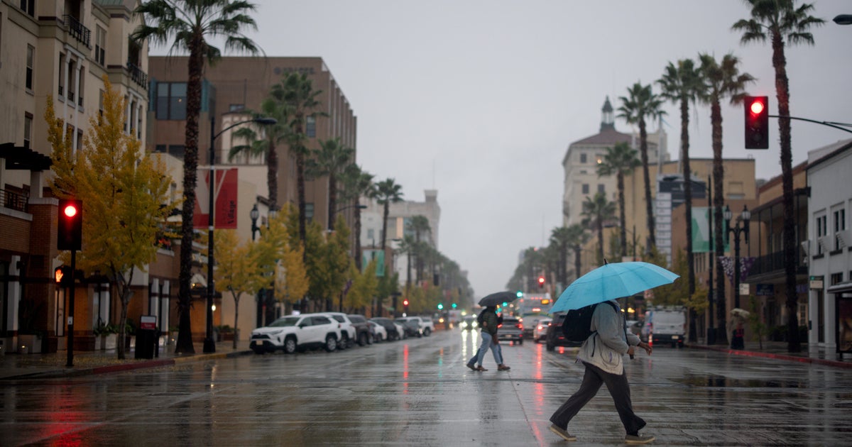
Most recently, Elsa brought heavy, flooding rain to the area with Boston picking up over 2" on the 9th. We saw a rapid rise in some of the areas small rivers and streams and several flash flood warnings as roadways and underpasses flooded. Basements were tested and sump pumps got a work out. You'd think we'd get a break from all the rain… but we've got more rain on the way, and flooding rain potentially. There just hasn't been enough time to let things dry out, so with a boundary setting up across the area Sunday night into Monday and low pressure passing through, a FLASH FLOOD WATCH has been issued for a majority of the area.
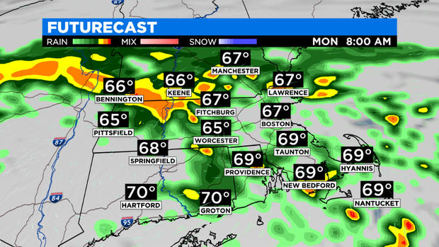
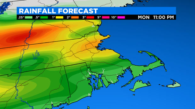
Heavy rain and downpours were in place overnight into Monday, leading to street flooding and ponding on the roadways. Some rivers and streams may quickly rise again. I don't expect as much rain to fall as Elsa produced, but some communities may receive 1-2" of rain, with the greatest risk along the MA/NH border.
Since the ground is completely saturated, there is really is no place for the rain to go besides low lying areas. This boundary along with downpours and steady rain shifted from southern VT and NH and along the MA border Sunday night southward through the area on Monday, bringing showers and downpours to start the day. It will be a cooler than normal too with highs in the upper 60s to low 70s.
In the afternoon, developing thunderstorms will be possible, especially south of the MA Pike. Some storms may be strong to severe with heavy rain and damaging winds as the main threat. The risk will diminish near or shortly after sunset.
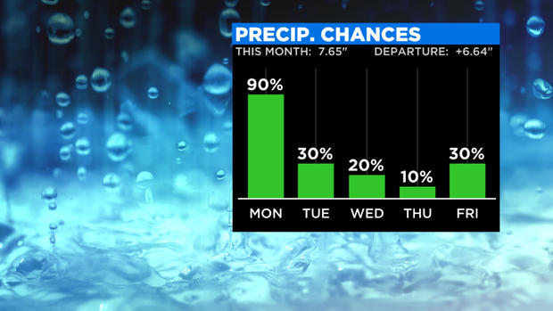
It will remain cool and cloudy on Tuesday with a few showers possible early in the day. Summer heat returns mid to late week, along with higher humidity. There will be some dry times mixed in, but this unsettled stretch continues through the week with the risk of daily showers and storms.
Stay with WBZ for updates and the latest weather information as it becomes available.
