See rain timeline, forecast maps for wet start to the weekend in Massachusetts
BOSTON - Thank goodness this isn't winter. A very large storm system has set up residence just off the Massachusetts coastline and the impacts from region to region are extremely variable.
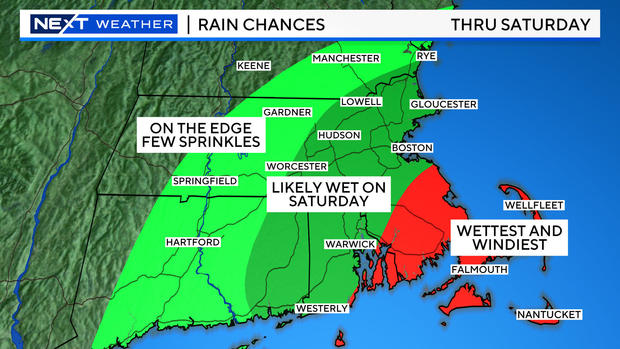
As of Friday afternoon, there was as much as 3-4" of rain on parts of the Outer Cape and Nantucket while Boston had received 0.01". If this were snow, that would be a stunning gradient.
Rain timeline for Massachusetts
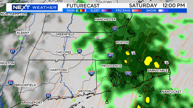
The rain remained nearly stationary during the day Friday, covering most of southeastern Mass. There is going to be a final push later Friday night and this is when Boston and areas father to the north and west will receive their share. Light to moderate rain is expected across most of eastern Mass. during Saturday morning and afternoon.
There will be a sharp cutoff to the west, somewhere close to Worcester County. Areas to the west of this line will remain mainly dry Saturday.
The rain will pivot out of southern New England Saturday evening, drying us out for the second half of the weekend. Sunday will be the pick of the weekend.
Look at this as sort of a warmup storm for the upcoming "storm season."
Folks at the coast will continue to deal with some wind and flooding throughout the remainder of the weekend.
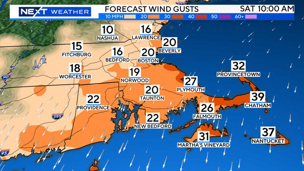
Strongest northeast winds will occur over extreme southeastern Mass. with gusts to 45 mph through Saturday, a bit less on Sunday but still gusty.
Coastal flooding concerns in Massachusetts
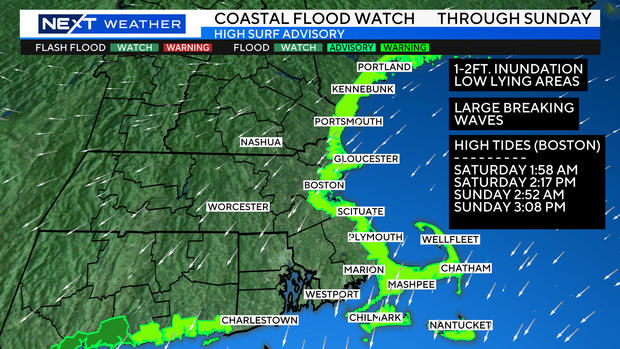
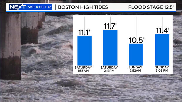
There is a coastal flood watch posted for all the upcoming high tide cycles through Sunday. Tides are astronomically quite high right now.
Combine that with the persistent, gusty northeast wind and we expect some inundation of coastal roadways and splashover during the next several high tide cycles. Of particular interest: Saturday high tide between 1 p.m. to 4 p.m. and Sunday high tide between 2 p.m. and 5 p.m.
