Our First Snow...
So surprisingly very little has changed with the Thursday / Thursday night storm...usually storms throw a few curveballs at us but this one is behaving very nicely...so far. Cold rain breaks out first thing tomorrow morning and lasts most of the day...but in the afternoon and evening rain will be flipping to wet snow from NW to SE across the area. First to change will be the higher elevations of Interior NE and last to change will be Boston and towns SE of the city. This means that a few inches will accumulate across the interior and especially in elevated areas.
But even around Boston there will be some coatings on the grass, car tops and decks. In the wake of the storm, gusty NW winds will clear us out but also keep us cold so sun and wind with highs in the upper 40s on Friday.
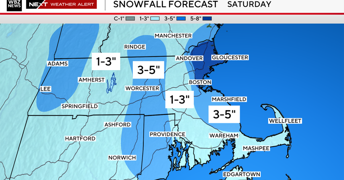
The weekend storm is looking more like a grazing at this point...a little cold rain and wet snow mixture Saturday afternoon and night. This will need to be monitored closely, a slight shift will mean a much more potent storm capable of several inches of snow and coastal flooding.
Watch Todd's forecast
As I talked about last night I wasn't buying the North American models regarding the weekend storm and keeping it so far out to sea...today they swung back west and are now pretty much grazing us. The EURO is showing a similar solution and not the whopper that it had earlier in the week.
So a grazing looks likely at this point and another round of mainly light cold rain and wet snow will occur in the afternoon on Saturday into Saturday night. Over this stretch, unfortunately, we are seeing some of the highest tides of the year and therefore at the very least, minor coastal flooding, splashover and beach erosion will occur. But if the weekend system jogs back to the west a bit, bigger problems will be seen.
