On to Round Two...
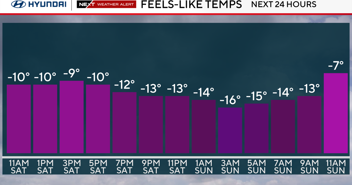
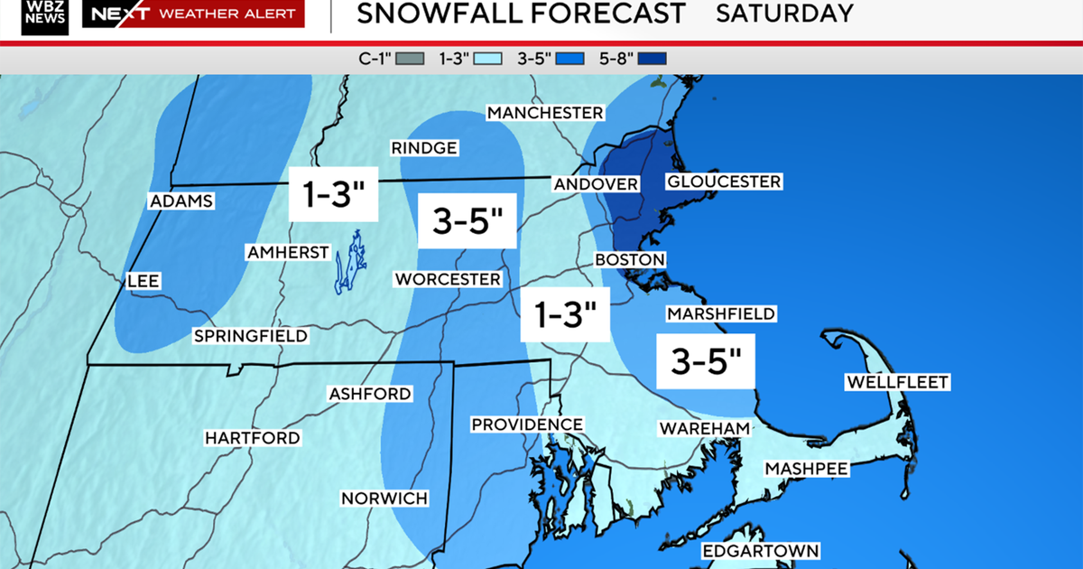
Round one is winding down with most picking up 6-9" of snow...for the next 6 hours there will be some very light mixed precip out there but it will basically be inconsequential. Storm two has a bunch more moisture as it has been tapping the Gulf of Mexico all day long...but it will also be incorporating warmer air into the storm...much more so than todays did. The high that locked the arctic air in today and is reestablishing it now (northerly winds in a lot of locals and temps will be dropping again tonight) will begin to move east toward the Gaspe Peninsula. That high and the low coming out of the Ohio Valley will produce an easterly wind component that will chip away at the cold in place along the coast and over SE Mass during the early morning hours. This will change snow to sleet, then freezing rain and rain. Regardless, the front end will be loaded with snow which will be arriving between 3-5AM (another awful morning commute). The snow will continue through early and mid morning then the transition happens. Around that time, cyclogenesis will be occurring south of New England as energy hits the coast and this is when it gets tricky. Obviously with the 850mb 0C line moving north of the Pike we will mix but I'm concerned at the surface with some low level drainage or damming...The formation of the surface low to our south will likely lead to some sort of northerly windshift (N or NE) and that should or could stop the warming at the surface in its tracks in most locals except along the immediate coast where a coastal front will likely set up. This presents a potential icing problem for interior Plymouth, Bristol and Norfolk Counties along with Northern RI and CT. North of that zone the cold should be deeper and sleet would be the predominate p-type along with snow. In the all snow zone north of the Route 2 corridor around a foot will likely fall in Northern Worcester County and SW NH and Southern VT. 6-9" will fall from just north of Worcester through the Merrimack Valley in MA. Then a 3-6" zone from Cape Ann to Boston out the Pike through Worcester. Towns south of the city are looking at 1-3" before the change. Aside from the risk of power outages, the snow will be heavy and wet (unlike today)...this will weigh down the rooftops...and for places that get rain, poor drainage flooding and rooftops could also be an issue. Finally as the storm is winding down in the late afternoon the mixed precip will be changing back to snow for the final burst.
Tomorrow will be fun to watch...don't underestimate the cold air...it will be tough to get out...soit wouldn't surprise me to see models come in with colder solutions sort of like the 18ZZ NAM did.


