Not Enough...
Temps this morning dropped into the 20s...the coldest it's been in three weeks! Word from farmers was good...not much crop loss last night. Driving around town however, I noticed that the Magnolias really took it on the chin and my favorite flowering tree saw many beautiful blooms brown. Tonight will be another very cold night but not as cold as last night thanks to some cloud cover advancing in after midnight. Those clouds represent milder air streaming into New England. It will first work in aloft then down to the surface tomorrow afternoon. The air is exceptionally dry right now but a few snowflakes may reach the surface tomorrow morning as the warmer air works in. By afternoon it will be much milder but some forcing in the afternoon will trigger some passing showers.
On Thursday, the parent low will work across the region...not much moisture will be present but as the system hits our coastal waters, it should wrap a few rain or snow showers back behind it along the coast especially. it will be a cold raw day with NE winds and temps in the 40s.
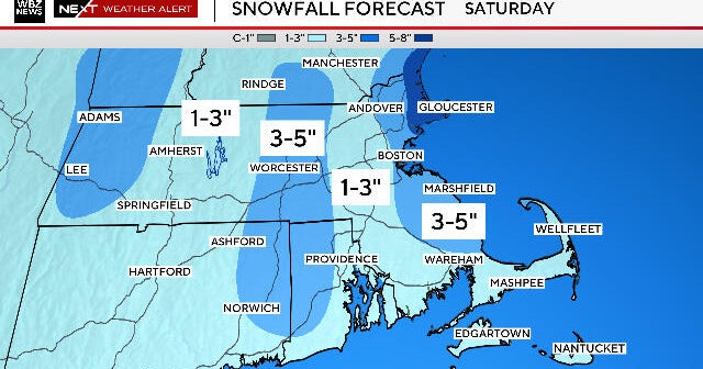
Sunshine returns on Friday but so does a gusty NW wind. The dry weather will continue on Saturday but clouds will increase during the afternoon as a storm system slides by to our south. There are some indications that the storm will come a little closer than expected and deliver us some rain to finish the weekend.
So clearly, there is no sure soaking rain in the forecast and we desperately need some.