Nor'Easter To Be A '3 Commute Nightmare'
BOSTON (CBS) - "Everything but the kitchen sink." That's a perfect way to describe what is headed our way.
This storm is going to be an absolute mess. Rain, sleet, snow, wind, flooding. You name it we will see it on Thursday. Some areas will be left with slop and giant puddles while others will be blanketed in copious amounts of heavy, wet snow.
There is a lot to this one, I will try to break it down as best I can.
Check: Current Conditions | Interactive Radar | WBZ Weather Blog | Nor'Easter Forecast Maps
This will be a long duration nor'easter, about 24 hours when all is said and done.
TIMELINE
Thursday morning:
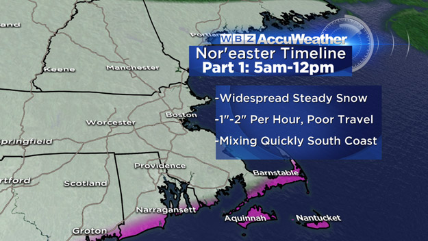
If you are an early commuter, you should get to work without much issue on Thursday. The real snow should arrive between 7 and 9 a.m. (just a few flurries may arrive earlier) and once it starts, it is going to ramp up quickly.
Much like the last storm, there is going to be an initial "thump" of moisture - steady, heavy snow for all of southern New England from about 8 a.m. through midday. Snowfall rates could reach 1-to-2 inches per hour and driving conditions will go downhill very quickly. Total snow accumulation during Thursday morning should be 3-to-6 inches and, by the way, this is just about all the snow that southeastern Massachusetts will see for the entire storm.
Thursday afternoon:
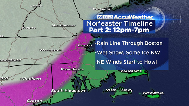
This is when the nor'easter goes from a snowstorm to a wintry mess. Snow will change to sleet and rain along the South Coast around midday. The rain/snow line will make steady progress to the north through the afternoon, likely reaching Boston between 1-to- 3 p.m. and reaching Routes 128 and 495 by the evening commute.
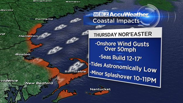
Rain on top of sleet on top of heavy, wet snow is going to put some serious stress on limbs and lines. Combine that with northeast winds gusting near 50 mph near the coastline and you have the perfect recipe for some scattered power outages.
Very heavy rain in eastern Massachusetts will likely lead to some poor drainage street flooding and some very large puddles for evening commuters. North and west of 495, the snow will continue to pour down all afternoon - several more inches are likely before the evening commute. By the rush hour on Thursday there may be 6-to-10 inches of snow in parts of northwest Middlesex County and into central Massachusetts and southern New Hampshire.
Thursday evening-night:
The actual low pressure area (storm) will cross near Cape Cod overnight and this is when the biggest thrust of warmth will push inland. I would expect mixing to AT LEAST 495 and perhaps some sleet as far west as Worcester to Fitchburg to Manchester, New Hampshire.
The heavy rain will continue in eastern Massachusetts, however there may be a "dry slot" working from south to north Thursday night which may shut off the precipitation in spots. Wind will continue to howl 25-to-50 mph+ out of the northeast and there may be some minor splash over during the high tide between 10-11 p.m. Thursday.
Friday Midnight-7 a.m:
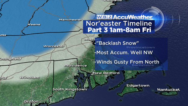
One final "wildcard" in the last moments of the storm. There may be a backlash of snow before it all ends. Winds will shift to the north, changing any sleet and rain back to snow everywhere and there could be a final snowburst.
If this happens, there could be an additional few inches of snow. The best chance for this backlash would be in central Massachusetts and in places that had the most snow early on. However, we cannot rule out some last minute snow accumulation closer to the Coast.
ACCUMULATION
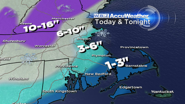
The final snow totals:
A few inches of slop, washed away by rain over the Cape and Islands
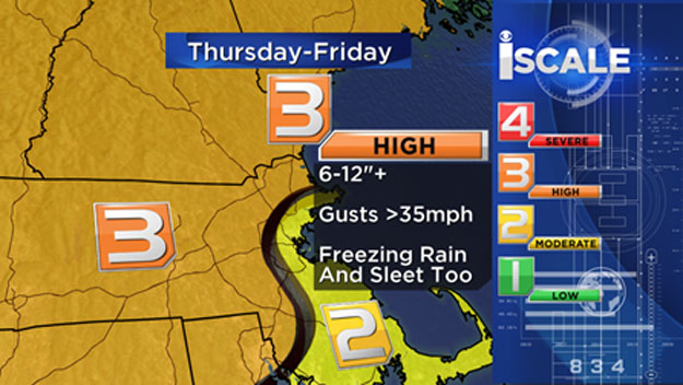
Three-to-6 inches of snow Thursday morning in southeastern Massachusetts, Boston and areas around 128, turned to slop by the rain later on.
Six-to-12 inches of heavy, wet snow around 495 and areas north and west, closer to 6 inches right on 495 and higher amounts the farther north and west you go. Near a foot in northern Worcester County and certainly a foot or more in the Monadnock region, the Berkshires and mountains of Vermont and New Hampshire.
So it looks like a 3-commute nightmare - beginning during the Thursday morning commute, peaking during the Thursday evening commute and ending just before the Friday morning drive, but leaving behind a big cleanup.
If you are lucky enough to have the option to stay home on Thursday, I would give it some serious thought.
Mother Nature is going "all-in" with this one, cleaning out her winter cupboards, hopefully in preparation of milder days ahead.
Follow Terry on Twitter @TerryWBZ
MORE LOCAL NEWS FROM CBS BOSTON
