NOAA predicts above normal 2022 Atlantic hurricane season
BOSTON -- The National Oceanic and Atmospheric Administration (NOAA) released their 2022 Atlantic Hurricane Season Outlook with a 65 percent chance of an above-average season.
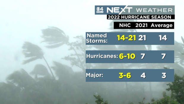
NOAA is predicting 14 to 21 named storms (winds of 39 mph or higher), of which 6-10 could become hurricanes (winds of 74 mph or higher), including 3 to 6 major hurricanes (category 3 or higher with wind speeds over 111 mph).
The Atlantic Basin has been active for the last six years, contributing to above-average hurricane seasons.
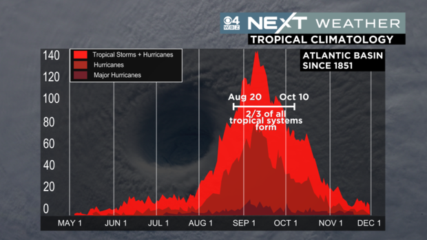
The official start of hurricane season begins June 1st. While tropical storms and even hurricanes have occurred in May and December, 97% of tropical activity occurs through the official season from June 1st through November 30th. According to climatology, the peak of hurricane activity typically occurs in late summer into early fall.
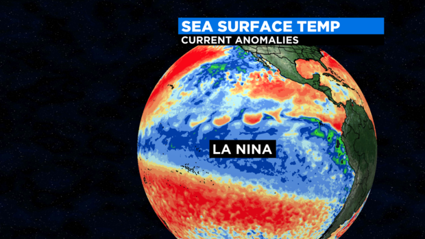
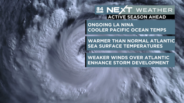
There are numerous factors meteorologists look at to predict how busy a season may be. One of the biggest indications is the presence of La Nina (the cooling of Pacific Ocean water near the equator). That tends to reduce the winds in the upper atmosphere, and allow for weaker winds near the surface in the Caribbean Sea, allowing storm development to blossom.
If La Nina continues to strengthen as forecasted going into the 2022 hurricane season, it would be the third straight year of La Nina. That has only happened two other times since 1950, (1998-2001 and 1973-1976). Typically La Nina will develop late summer or fall and peak in the winter, then weaken in the Spring, but it's already gaining strength. Every few years, water temperatures in this zone will switch from cooler (La Nina) to warmer (El Nino) periods, or stay average (Neutral). Right now, the water is unusually cool pushing forecasters to believe La Nina could strengthen going into the 2022 Hurricane Season. La Nina typically develops later in the Summer or early Fall and peaks in the winter before weakening again in the Spring.
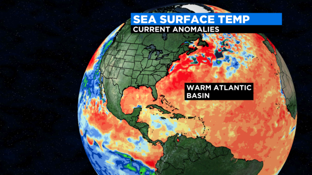
Another climate factor that is leading forecasters to expect an above-average hurricane season is the warmer than normal sea surface temperatures in the Atlantic Ocean and Caribbean Sea. Warm water fuels storm development. Also, an enhanced African monsoon present supports pieces of energy moving into the eastern Atlantic, which can ultimately develop into some of the strongest and longest thriving hurricanes during the season.
Over the weekend, the National Hurricane Center was watching a small area of low pressure in the Gulf of Mexico and issued its first outlook of the season. Before it could develop, the disturbance moved inland Sunday night with heavy rain and 40-to-60 mph wind gusts along the northern Gulf Coast. Currently, there are no other areas of the Atlantic Basin that the National Hurricane Center is watching for potential development.
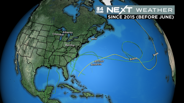
If it remains quiet with no tropical activity through the end of the month, it would be the first time in eight years the hurricane season would NOT produce a named storm before the "official" start of the season June 1st. If you recall, Tropical Storm Ana formed east of Bermuda last May, and in 2020, Tropical Storm Arthur and Bertha drenched the Carolinas.
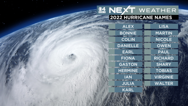
Having an early start to the season doesn't mean it will be less or more active. Being prepared and having a plan to protect life and property is your best plan of action. It only takes one storm to make an impact. The WBZ Next Weather Team will keep you updated throughout the season. Here is the list of storm names for 2022 Atlantic Hurricane Season:

