No Major Flooding Expected At This Point
BOSTON (CBS) - As we approach the one year anniversary of the March 2010 floods, certainly the devastation that occurred last year is still fresh in many people's minds.
Check: Current Conditions | Weather Map Center | Interactive Radar
It was called a "once in 50" or "once in a 100-year" event and with all the rain and lingering snow this March, a lot of folks are concerned that we could be in for a repeat.
Who could forget the 6-to-7 week stretch from Christmas to early February?
It was a relentless barrage of snowstorms, one after another, dropping 70 or more inches of snow to nearly our entire area.
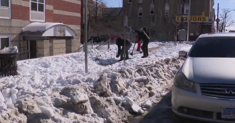
Most of that snow remained trapped in large snow banks during the month of February, sitting and waiting for milder days and warmer rain.
The big question - would we have a gradual melt or would it come all at once?
Thus far, we have been rather lucky.
Watch Melissa Mack's forecast
The quiet stretch in mid-February allowed for a slow eating away of some of the snowpack, a few mild days here and there took several inches away in just a few days.
The pattern got active again in late February and over the last four days of the month we received a combination of rain and snow totaling about 2-to-4 inches of liquid precipitation.
This is what started to swell the rivers and streams across the area and put us on alert, watching for any potential major rain events which could put our major rivers over the edge.
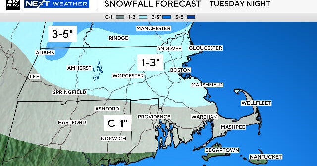
FIRST TEST
We got our first test Sunday night when most of eastern Massachusetts received between 1-to-2 inches of rainfall.
Parts of western Massachusetts and New York state got the jackpot of 2-to-4 inches.
This has put us on the brink, so to speak.
Many rivers are nearing their banks and some are going to be in what we call "minor" flood stage over the next 24 hours.
Some of these include the Shawsheen River, the Nashua River and the Assabet River. All of which are forecast to crest just above flood stage and rather quickly go back below within about 24 hours.
There is no major flooding expected except for some of the usual, flood prone areas.
WHAT'S NEXT?
So the big question is - what's next?
The worst case scenario right now would be for a 2-to-4 inch rain storm in the next few days, but that remains unlikely.
We will be dry through Wednesday and our next storm looks to hit on Thursday/Friday as rain. Right now, it appears as though the heaviest rainfall will once again be deposited in New York state and western Massachusetts, rising flood fears out there.
Most weather models are forecasting about another inch of rain for central and eastern Massachusetts, which would lead to another river rise, but nothing that would "break the bank" so to speak.
And following the end of the week storm, things look to be fairly quiet for a stretch with no big, heavy rain producers for a while.
So while we are not totally out of the woods for any more spring flooding, a repeat of last year does not look likely.