Nice Weekend...Unsettled Cooler Outlook
Building high pressure this weekend will wrap in drier air along with cooler NNE winds and return temperatures to more seasonal levels for this time of year. A weak front is pushing off the coast this morning. This came with a few light sprinkles or showers overnight and a deck of mid level clouds which is eroding away this morning.
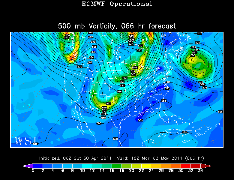
A trough is in place over the Northeast. An upper level low over the Canadian Maritimes will swing through Nova Scotia and help to keep a cyclonic flow, and cooler air aloft in place. So after seeing increasing morning sunshine, we will likely see clouds redeveloping this afternoon with the heating of the day. Partly sunny skies in the 60's inland with a afternoon seabreeze to cool temps down into the 50's this afternoon at the coast.
The Upper low with strengthen east of Nova Scotia tonight. This will reinforce NE winds at the ground and the potential for low clouds at the coast by dawn tomorrow. Plenty of stable air across the region Sunday, so expect plenty of sunshine...but a chilly NE wind off the water will mean temps in the Lwr-mid 50's at the beaches and Lwr-mid 60's farther inland away from any marine air.
The Upper level ridge kicks out this low and allows for a pleasant mostly dry Monday. Warm air advection into the northeast will mean Clouds increasing ahead of a front which weakens over the region. This will give us a chance of a late day shower Monday.
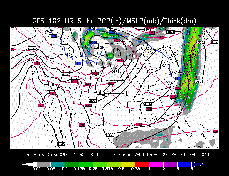
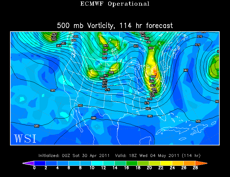
Clouds will be streaming into the Northeast by Tuesday with a front stalled over or just south of New England. A wave of low pressure will be gathering in the Southeast and likely ride up along this boundary through the midweek and track south of new England. Heaviest rain will be found on the NW side of the low..Our chances of seeing a few afternoon showers are better Tuesday afternoon with the main batch of rain waiting until Wednesday.
Upper level divergence along the east coast will help to deepen this low as it tracks southeast of Nantucket and eventually into the Gulf of Maine.
There are questions on how progressive this rain will be or if this will get caught up into a blocking pattern, but today it appears that this low will keep moving and allow for a gradual improvement to the weather by the end of the week. Cool onshore winds will keep in cool and raw at the coast the next several days until this storm passes.


