Moving From Mild to Cold This Week...Watching Unsettled Weather
Well, the weather ahead is certainly not boring. There is plenty of energy on the table, plenty of shortwavesto track with colder air definitely on the move. These are the ingredients for some unsettled and even unexpected weather to pop up...so let's give it our best go at it shall we?! The farther out the forecast goes...the less certain the timing and type of precipitation becomes. One thing is for sure...it is going to become much colder around here before this week is over.
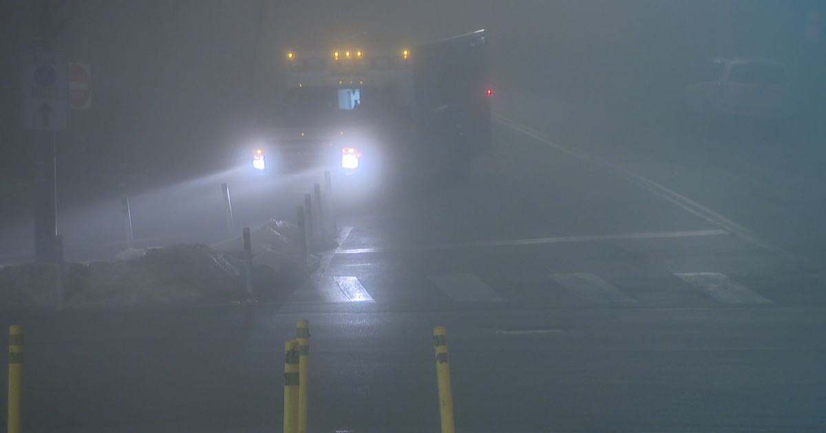
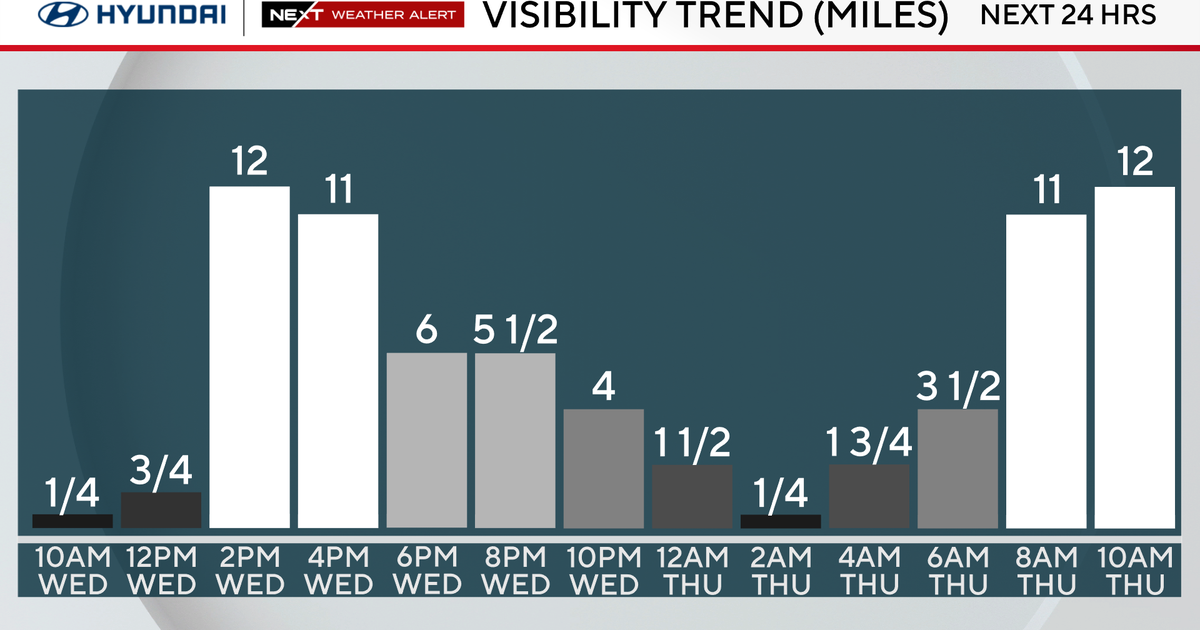
Light SW winds wrapping around our high in the Canadian Maritimes has wrapped in higher dewpoints in the 40's during the overnight hours helping to form dense fog for the early morning hours. Low visibility for many areas earl..but lifting.. Fog will linger longer in western valleys. Freezing fog in Concord & Nashua, NH around 7:00 AM. Fog will lift giving way to some partial sunshine and temps climbing into the 50's nearing 60. Nice day overall. But there are plenty of clouds...which will start to increase, lower and thicken during the afternoon.
Showers extend from Texas up through the Ohio Valley on a slow moving cold front. Several waves of low pressure we will have t0 track between Monday Night-Thursday morning. Some models make an easy transition to the cool...while others have a slower more unsettled look which will become a bit of a forecasting headache timing these batches of showers and the arrival of cold air with this moisture.
The first waves arrives late tonight with a cold front. This will be a slow moving front as it parallels the upper flow from the SW. Most of the evening will be dry, but showers may start to break out after midnight moving from NW to SE during the early morning hours. The front will lie right over us Tuesday with periodic light showers and drizzle pretty much at any point. We will still have SW winds ahead of the front so we will still be mild Tuesday with another day near 60.
How quickly and how far this front pushes off the coast is one of the many questions in this forecast. This front will likely stall over Cape Cod...with another wave to low pressure to track up the coast Wednesday. Some of the models keep this wave off the coast, others bring it in. At this point, I lean towards the slower wetter solution..but this can change. Plenty of uncertainty with how this will all eventually play out. Either way, Wednesday will be a colder day with cooler NNE winds behind the front. Going to keep showers in the forecast, especially south...with a somewhat drier afternoon with breaks of Sun possible. Highs will be in the 40's.
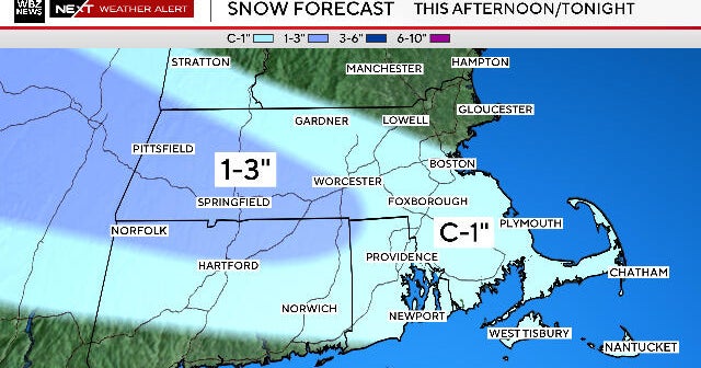
A third wave of low pressure along this stalled front off the coast is possible Wednesday night-Thursday morning. This has the potential to be the biggest of them all...or could stay out to sea. Simply going to have to give this a bit more time for more information. Still will lean towards the more pessimistic scenario until proven otherwise. Wednesday night colder air will still be pushing into New England. This "third" low will be tracking up from the Carolinas through the Mid-Atlantic and deepening off the coast, possibly tracking just south of the benchmark. Rain will change to snow overnight through the early morning hours Thursday before quickly pulling away. Cold Thursday with highs only in the Lwr-mid 40's. If this solution occurs there could be several inches of snow in eastern MA by dawn Thursday morning. We will keep you up to date on this as we get more info.
Building high pressure with sunshine Thursday into Friday with a more seasonal chilly airmass. An Arctic front will push through Friday night with the coldest air of the season so far for Saturday where highs will only be in the 30's. This air is literally coming from across the poles from Siberia and right into New England Saturday. Another wave of low pressure may ride along the front early Saturday for a few more rain or snow showers...before the sun returns in full Sunday with temps near 40. Chilly!
Despite all of this, this will be a very fast moving shot of cold air which will again be lifting out for temps to warm again heading into the week of December 12th. The cold just can not lock in. Still...there are signs of at least a few chances of snow. This time of year, snow can be very tricky and give very little warning in a pattern which is continuing to evolve before out eyes. Stay tuned!