Severe thunderstorms forecast for Massachusetts Monday afternoon. Map shows where the risk is highest.
BOSTON - Heavy rain and thunderstorms are expected across Massachusetts Monday afternoon and evening, so the WBZ-TV Weather Team has issued a Next Weather Alert.
We've got an unsettled pattern to start the week. There is an area of low pressure several hundred miles to our east and this will serve as the impetus for some storms which will rotate through New England from north to south during the day.
When does the rain start?
Most of the action is likely to occur between 2 p.m. and 6 p.m. Monday with a few storms present on either side of that window.
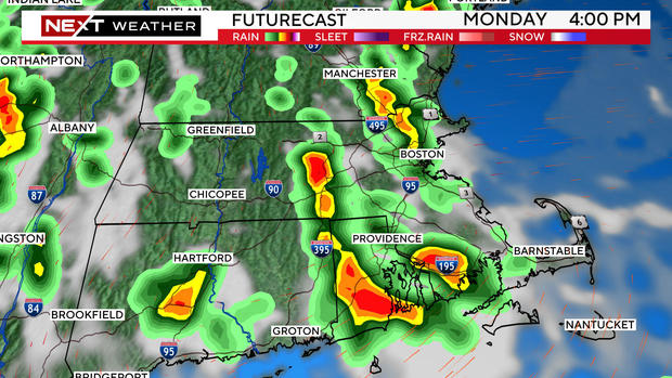
It is also likely that the main area of impact will be across central and eastern Massachusetts.
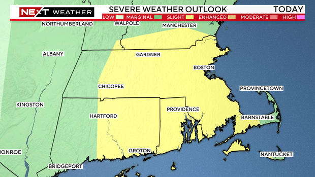
The Storms Prediction Center has placed much of central and eastern Massachusetts in a "slight" risk for severe weather, basically a 2 on a scale from 1-to-5.
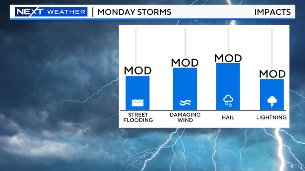
The main impacts from Monday's storms will be lightning, very heavy downpours, damaging winds and also the potential for some hail.
The storms will tend to die out around sunset and the rest of the evening will be quiet.
The next chance of impactful weather comes later on Wednesday as there is a possibility of another round of thunderstorms.
We will provide frequent updates throughout the day on WBZ-TV, WBZ.com and streaming on CBS News Boston.


