Model Mayhem On a Storm Several Days Away
I am not completely sure how this is all eventually is going to pan out, but my hat is definitely in the ring on this storm. Our computer models have about every possible solution on the table...and all options should be considered. Most importantly, the shift farther south and offshore shift with the European model in the morning OO Z run...has shifted back west and has a low SE of Nantucket Friday afternoon.
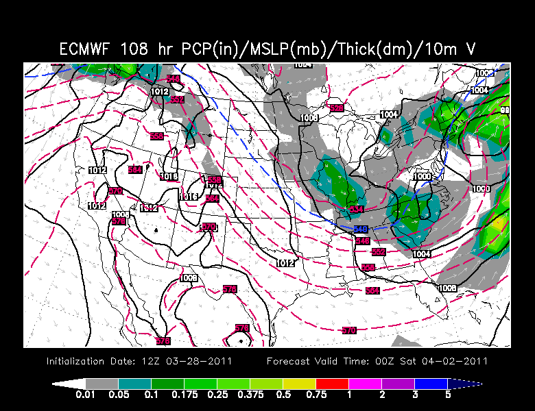
Below is a simple visual rundown to show you that there is something significant out there which is still very much on the table for the end of the week. I still feel this will be more wet than white for Boston Metro as some have a westward track...and there is not much real cold arctic air available. But at some point, snow could become involved depending on the track and strength of the system and timing of its arrival. ...especially in the North and West of New England. With a deepening storm and moving into the evening hours...snow could start to become mixed in...with more of an eastward track...like the Euro below.
12Z Euro 108 Hr
If this were to occur, it is mostly rain south, but a mix changes to snow Friday PM into the evening where we could see a significant snowfall across NH and ME. Still, there is still plenty of time here for more wiggles and corrections.
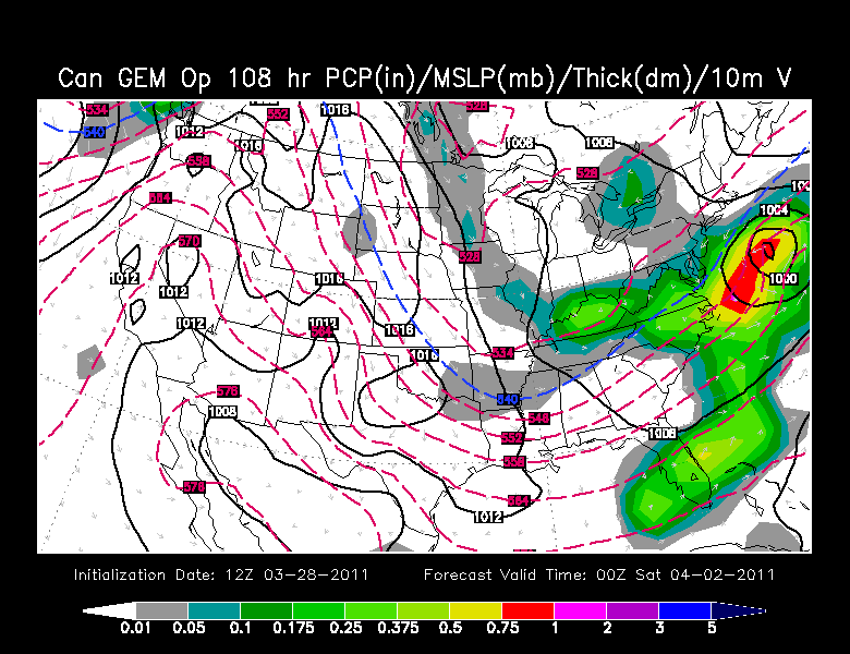
OOZ Canadian Friday Night (from this Morning)
Tightly wound low crossing southern New England with rain changing to snow with gusty winds at the coast. Look out!
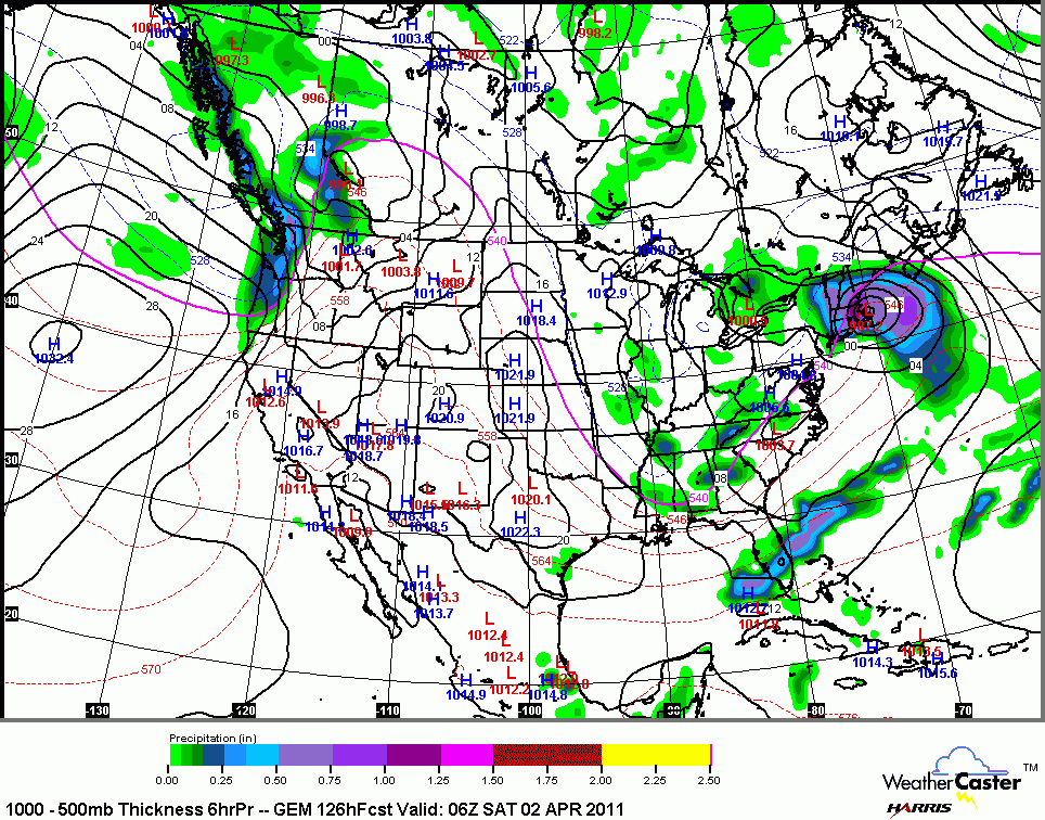
New 12 Z Canadian friday Afternoon...(Most recent run)
Much further south...mostly a MISS!
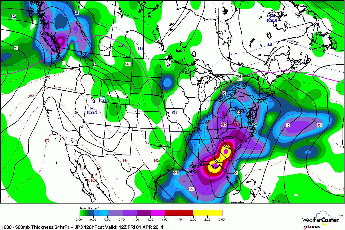
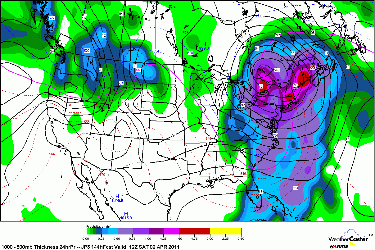
Check out the Japanese model below, an inside track with low tracking west of New England with a secondary up the coast producing inches of rain! very wet and windy
JMA early Friday Morning
12 Z early Saturday morning
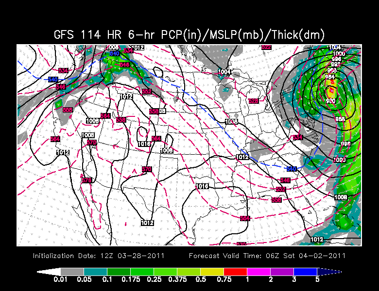
The new 12 Z GFS has a much stronger storm over Nantucket Friday night with rain and wind. Rain changing to a burst snow overnight and Early Saturday before pulling away with strong WNW on the backside . Quite a different look from it's ooZ weaker morning solution.
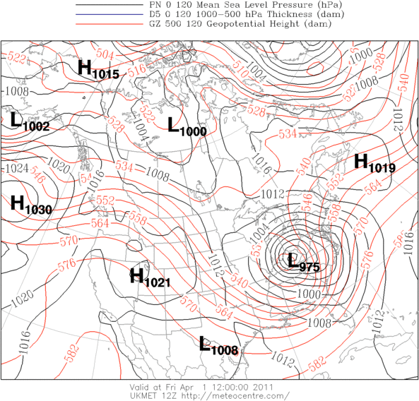
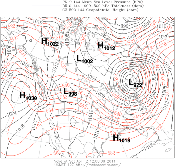
And finally the UKMET, which has a bear of a storm and is likely overdone...But still! A 972 mb low moving near New England. This is the western, warmer and wetter solution similar to the Japanese. This sort of set up has the potential to produce heavy and a brief period of flooding rains. Here the eastern trough takes on a more negative tilt and can really draw in warmer Atlantic moisture.
Friday Morning UKMET
Saturday Morning UKMET
So we are still very much in limbo in how this is all going to play out. There are many ways this could all go and we will keep you up to date. The point I wanted to show you with this blog...is there is something out there which has the potential to be a sizeable storm for New England...not necessarily a snow storm...but more of a mix...with snow either on the front or back ends.
The pattern has been for lows to be tracking south of us...and they will continue to do that through Thursday. We have seen some models hinting at this staying far enough offshore for a miss...but others show a lot of moisture coming up the coast with a deepeing storm. The ones with the farther south track I believe are not handling the energy or the merging of stream correctly in the long range outside of 96 hours.
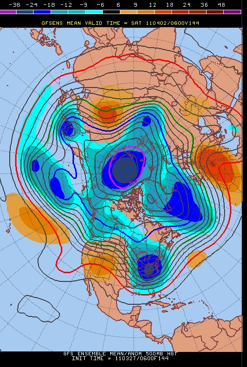
I leave you with GFS ensemble 500 mb for Friday April 1st. Look at the eastern trough in place, the merging of the polar and subtropical jetstreams. There is something out there...it is going to come with plenty of moisture. It will be an intesifying low up the coast. The question is the exact track right now. Impossible to say. I expect the models to start to find a consensus in the coming days once they start to figure out how to handle the multiple pieces of energy in play.
GFS ensemble 500 mb for Friday April 1st.
