Mile-By-Mile Guide To The Boston Marathon
It's a legendary course that stretches for 26.2 miles through beautiful suburban streets and right into the heart of downtown Boston. It's on many a bucket list and its uphills and downhills have broken many a runner.
If you are one of the 25,000+ people registered to run this year's Boston Marathon, keep reading! There are other course guides out there, but this one was written from years of experience, complete with visual cues, crowd cues, physical cues and strategy tips.
WBZ and Boston Marathon alumnus Peg Rusconi wrote this after her 12th marathon - 6 of them in Boston. Whether it's your first of fifteenth time running Boston, you're sure to find Peg's insight, which follows, valuable.
Start Line to Mile 1
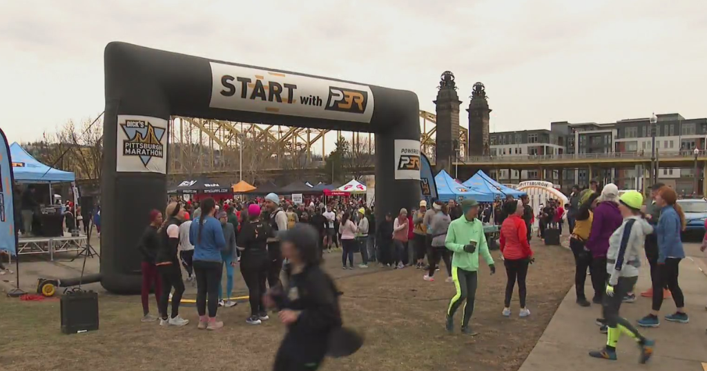
A possibly restless night and a long morning of waiting are finally in your rearview, as the starter's pistol sounds and you're bound for Boylston Street. Sort of. Honestly, the road between the Start line on the Hopkinton Green and the first mile marker might be lost in a haze of emotion, adrenalin, nerves - and bodies.
The surrounding pack of marathoners makes it hard to focus on much else, but this smothering situation will save you from yourself. It will keep you from barreling off on a jitter-fueled tear on the surprisingly steep drop that's just past the start. You'll hit a little uphill around the 1k mark, but this narrow stretch of rural road drops 130 feet - think a 13-story building - in that first mile.
Don't waste energy trying to zigzag around people; you can show off in the miles ahead.
Expect very big crowds of spectators here.
Mile 1 to Mile 2
Everything about that hyper-frenzied first mile moderates as you travel the second mile toward Ashland. The downhill pitch flattens out a little, the spectator crowds thin a little, the field of runners spreads out a little. Now you can get your head centered and find your running rhythm.
One thing that might surprise you is the rolling hills early in the race. There's little of real significance beyond that monster drop in the first mile, but if you've earned your marathon stripes running flat courses and arrive in Boston expecting the hills to start in Newton, you might be caught off guard. Newton is just where the REAL hills start.
If you're measuring your progress by checking off the course's 8 cities and towns, get ready to cross Hopkinton off your list.
Hello Ashland!
Mile 2 to Mile 3
If you ran the Boston Marathon between its inception in 1897 and 1923, Ashland is where you would have found the starting line.
Ashland, fittingly, starts out like a party. With any luck, your jitters are gone, you've found your rhythm and you're enjoying the beginning of your long journey to Boston. On your left, the crowd at TJ's Food and Spirits will keep the party rolling. Expect loud music and raucous support.
Again, some rolling hills through this mile on a stretch of two-lane blacktop with a guardrail and woods on much of one side, but a net descent.
Mile 3 to Mile 4
A couple of iconic Massachusetts logos accompany the third mile marker - Dunkin Donuts, and the circled "T" that marks the Ashland Commuter Rail station.
In this mile, rural gives way to commercial. If you need an ATM, a fast food fix, a national chain drugstore, you'll run right past it here.
Midway through this mile, you'll pass a course landmark - the clock tower at the intersection of Union and Chestnut Streets. Appropriate eye candy, as Ashland was home to Henry E. Warren, who invented the electric clock.
Speaking of time, remember to rein in your pace here and stick to your plan. Don't fool yourself by running on "feel." Everyone feels great here because it's early, and they're running downhill.
Mile 4 to Mile 5
This mile takes you out of Ashland and into Framingham. It's the first mile that actually GAINS elevation - 25 feet over the course of the mile.
A couple tenths of a mile past the Dairy Queen on Route 135, there's a decent half-mile climb that takes you past a building supply store and a big storage facility.
At the 4.8 mile mark, you'll enter Framingham: your third town of 8.
Mile 5 to Mile 6
Over the course of this mile, you'll hit about three little rolling hills, dropping more than you climb. The scenery begins to feel more industrial. By now the pack of runners has spread out significantly and you should be able to run comfortably.
You'll find the 6-mile marker at Bridge Street.
Mile 6 to Mile 7
You'll wind downhill at the start of this mile.
A significant landmark at the 6.2 mile mark is the Framingham Train Station. A significant inconvenience in 1907 for all but the lead pack, when a train switched tracks, stopping runners in theirs.
You should be aware you'll be crossing tracks here. Watch your step.
A now-closed restaurant on the right called the Chicken Bone marks the halfway point of this nice, flat mile.
As the course flattens out, resist the urge to run faster than you planned. Remember, the idea that you can "bank" minutes here for the second half of the race will bite you in the backside in the late miles. It's what the experts say, and it's what I've learned from experience.
Mile 7 to Mile 8
Get ready to say goodbye to Framingham. At about the 7.3 mile mark, you'll enter Natick.
You'll pass a colorfully-signed taco joint on the right called the Aztec. You'll take on a little climb that passes a Wendy's restaurant on your left. Then you'll pass the West Natick train station and hit the 8-mile mark.
Mile 8 to Mile 9
This mile starts with a slight climb past some office buildings, a very large Planet Fitness gym and a car dealership. There's another incline past Speen Street, but we're talking minor uphills here. Overall it's a pretty flat mile.
You'll see a sign for the Natick VFW on your left, right around the 9-mile marker.
Mile 9 to Mile 10
This mile starts quietly. You've got train tracks on your left and Lake Cochichuate on your right, so not a whole lot of space for spectators.
It's flat.
You'll hit the 15k mark as you come to the end of the lake, and you'll enter a historic district, which is a nice switch from the commercial and industrial landscapes of previous miles.
Think pretty, quaint Victorians as you climb at the half-mile mark toward the town center.
Mile 10 to Mile 11
Time for some big crowds. This mile takes you through Natick Center, past the fire department and municipal buildings. You'll pass the First Congregational Church with its tall steeple on your left.
There's a big green with a gazebo on your right - lots of room for adoring fans and kids with outstretched hands for a high five.
You should feel fresh here. If you don't, dial down the pace a notch.
Mile 11 to Mile 12
This mile starts uphill, and after the first quarter-mile, rolls downhill until almost the 12-mile mark.
In the last half, it's pretty quiet, with thick woods on your right side. For a quick spell, you're left to your thoughts. But soon, you won't be able to hear yourself think.
Mile 12 to Mile 13
As you come upon the main gate of Wellesley College, get ready for a sharp gain in decibels. You'll hear it as you approach, and before you know it, you're running through a screaming gauntlet of college co-eds.
The women of Wellesley are loud and proud... but here, they are mostly loud. Impossible to ignore. I remember American elite Ryan Hall playing to this crowd, putting a hand to his ear as he charged past. I actually think some men who are not trying to win the race slow down here. It's a nice boost.
You'll pass the 20k mark with a little drop, and then you'll climb to Wellesley Center.
Mile 13 to Mile 14
This is a fun mile through downtown Wellesley, which offers enthusiastic crowds, nice surroundings, and even nicer psychological ammo: the all-important halfway point. From here on in, you can just keep telling yourself that you're closer to Boston than to Hopkinton.
But also keep in mind the old adage about a marathon having two halves - the first 20 miles and the last 6.2. Definitely true of this course.
So enjoy this fast, mostly flat mile. You're closing in on the rough stuff.
Mile 14 to Mile 15
At 14 miles you'll see tennis courts and athletic fields on your right. It's flat and pretty. You'll come to another quaint commercial district along the way. Look for Marathon Sports on the left, mile marker 14.7 if you're wondering. You'll cross Route 9.
At this point, you're just a mile away from the start of the roller coaster section of the course - about 9 miles of sharp drops and steep climbs that demand more effort and focus. So this is a good place to gauge what you've got in the tank.
If you don't feel fresh here, slow down and regroup.
Mile 15 to Mile 16
Mile 15 starts with a little climb that tops out quickly. You're in a lovely residential area; you'll see some nice stone buildings. It's flat for about a quarter of a mile. And then… two words, people: IT'S ON!!
Halfway through this mile the road plunges, barreling more than a hundred feet down into Newton Lower Falls, where the mile ends.
Many insist this is where the real race begins. Racing or not, it's where the storied course will begin to test you. You're going to be climbing and dropping for about the next nine miles. None of these hills, up or down, is a killer on its own. It's the cumulative effect and the fact that when the uphills start, your legs already have 16 miles on them. If you're whipped at 16, you've got some rough miles ahead.
Mile 16 to Mile 17
When that half-mile spill into Newton Lower Falls bottoms out, the road flattens for the blink of an eye. You'll see the Entering Newton sign on your left (you'll feel much different by the time you leave Newton, guaranteed) and the lovely Lower Falls Wine Company on your right. If you're a wine lover, make a mental note to stop in sometime. They appreciate our sport here: one of the proprietors ran for Georgetown.
It's entirely appropriate that almost as soon as you enter Newton, you start to climb. This is a big one, folks, a tough, grinding hill notable less for its steepness than its length - more than a half-mile. For first timers, it may also be a little unexpected, because talk of the famous Newton hills tends to focus on the series that begins a mile from here, at the firehouse.
Truth is, for my money (and that of many Boston vets and experts) THIS MIGHT BE THE TOUGHEST HILL ON THE COURSE. You're still 10 miles out, in the middle third of the course. This climb takes you along a long not-at-all-scenic overpass that crosses I-95/Route 128 and you're exposed to whatever weather elements the day hands you. Whatever it is, hot, windy, rainy - it's magnified here. Crosswinds can be nasty.
You'll pass Newton Wellesley Hospital. The road drops a little and flattens out as you approach the Woodland Golf Club and mile 17.
Mile 17 to Mile 18
Mile 17 starts out nice and flat. You'll pass the Woodland Green Line T station on the right. It's a nice residential stretch. At 17.3 miles, you'll make one of the two famous turns on this course, known as "the turn by the firehouse." The right turn onto Commonwealth Avenue, at the firehouse on your right, brings huge crowds, lots of noise and encouragement, and a lot of energy.
I always feel like I've arrived when I get here. A little past the firehouse is what people refer to as the Firehouse Hill; another big one. This one is much steeper than the 128 hill, but not nearly as long, not even a half-mile. There's a refreshing little drop at the top, which brings you to the 18-mile mark.
Mile 18 to Mile 19
After the 18-mile mark, the road tilts up again, but in the scheme of things this is a speed bump. This mile is mostly flat or gently downhill. You'll cross Chestnut Street about three tenths of a mile in. You should be able to cruise past the 30k mark and ride a short drop to the 19-mile mark.
Mile 19 to Mile 20
At the 19-mile mark, you'll see Newton City Hall. As you cross Walnut Street, way over on the left, far enough that you might not see it, there's a fabulous tribute to the legendary Johnny Kelley: twice a winner, 61 times a finisher. The "Forever Young" statues depict a young Kelley running alongside an elder Kelley.
About a quarter-mile in, you'll need to focus on the road ahead, which - surprise! - is rising to taunt you yet again.
I cannot tell you how many runners asked me, during the 2010 marathon, if this was Heartbreak Hill. Generally, it wasn't a question but a statement: "So, this must be Heartbreak."
It is not.
I'm not aware that this hill has a nickname, although I've heard people call it "the second hill" (after the firehouse). I think of it mostly as a nuisance. It's sort of a two stager. The first part is steep but short - maybe half the length of the firehouse hill. Then it flattens and climbs again, but briefly. You notice it mostly because you have almost 20 miles on your body.
You'll cross Centre Street at the .9 mark. There's a ski shop on the corner, and right now, you're participating in what feels like a mountain sport.
Mile 20 to Mile 21
As you cross the 20-mile mark, you can see the base of Heartbreak Hill where the road winds ahead. Get ready. You'll run past some little shops and then, there's no mistaking it. Heartbreak is a steep half-mile uphill. It will likely not be the longest or the steepest hill you'll ever run but, again, at this point, you're probably not running on fresh legs.
What I try to do here is to not let myself get out of breath, usually by shortening my strides. I also never look at the top, just at the road immediately ahead.
I love Heartbreak. The crowds are great, and on a long, meandering course, it represents a short (relatively) and attainable goal. There's a huge sense of accomplishment as you reach the top, some much needed psychological firepower.
So here's the thing. You'll crest Heartbreak, and see another hill. I call this the "you must be kidding me hill."
Don't worry about it. It's minor.
Mile 21 to Mile 22
As you close out Mile 21, you enter Boston College territory. The road plummets here, in steep fashion, for a full half-mile. This might sound like a nice break from the Newton ups, but farther down the road, a lot of runners realize the upcoming series of downhill stretches just punishes tired legs. At this phase, though, it's enjoyable.
Expect a lot of noise from the screaming Eagles of BC. They were so loud in 2010 that I couldn't hear the Green Line trains that run along the left side of the road. Seriously.
There's a little climb of about a tenth, then you'll roll downhill again past a cemetery.
Mile 22 to Mile 23
I call this the Meat Grinder Mile, because it's an apt description of its effect on spent quads. The road starts flat, then bottoms out for more than a half-mile, steep first, then more gradually. Somewhere in there, you may reach an epiphany about downhill running not being all it's cracked up to be. The pounding is just punishing, and a lot of quads lock up here. Moving forward just seems harder than it was a mile ago.
As you spill into Cleveland Circle, beware of the Green Line trolley tracks. You'll cross a few sets, so watch your step. Wheelchair athletes need to pay particular attention here.
This mile concludes with a gradual quarter-mile climb. You'll enter Brookline.
Mile 23 to Mile 24
At the 23-mile mark, you'll find yourself looking downhill again. You'll descend along Beacon Street through Brookline's Washington Square neighborhood, past some restaurants and shops. About a quarter-mile in, the road spikes upward, but this is a short uphill, and about the only climb in a mostly downhill mile. And it's noticeably downhill.
As you approach Coolidge Corner, and the well-known Tudor-style building on the left, you'll catch your first glimpse of Boston's iconic Citgo sign in the distance. It's a very quick glimpse; from here the sign is about a mile and a half away.
Mile 24 to Mile 25
You'll reach the 24-mile mark just past Coolidge Corner, near the intersection of Beacon and Charles Streets in Brookline. You're nearing the end of a long (more than a half-mile) downhill, passing shops and restaurants and a sea of four story brick and stone condo buildings. The road undulates slightly as the mile progresses, but in the wake of that downhill, even the flat can feel like running in wet cement.
Just know you're getting closer with every step.
You'll cross Park Drive and enter Boston at the 40k (24.8 mile) mark.
At this point, the glorious Citgo sign is right in front of you. And it's at the top of a hill. Seriously.
This hill takes you along the overpass atop the Massachusetts Turnpike. It's short, but just long enough and just steep enough to seem tough as you approach the 25-mile mark. Several of my runner friends dread this hill more than any other on the course.
Mile 25 to Mile 26
The final full mile starts with a little drop. You'll see the green walls and light stanchions of Fenway Park on your right. Full disclosure: I'm actually getting chills as I write this, thinking about that sight and what it feels like to be there, closing in on the finish.
You'll enter Kenmore Square. Big crowds. The Hotel Commonwealth is on your right, a big bus shelter on your left, and somewhere here, you'll notice "1 mile to go" painted on the pavement. Again, more chills here.
As you exit the square, you'll run under some overpasses and then drop down underneath Mass Ave, so a quick down-in and up-out before you make this course's other iconic turn, "the turn on Hereford." This is a right turn, and it's slightly uphill. It's another scream tunnel. You'll pass Newbury Street and then turn left onto Boylston Street.
What you see up ahead is no mirage. It's the finish line.
Mile 26 to Mile 26.2
With the finish line ahead, you might not even notice the 26-mile mark. Between here and the finish, you'll pass the Prudential Center, Gloucester, Fairfield and Exeter Streets. It's pancake flat. You'll cross the finish line before you get to Dartmouth Street, next to the Boston Public Library, joining the space blanketed warriors in Copley Square.
