Mid-Winter Cold...
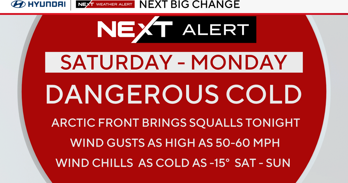
A brief shot of Mid-Winter cold will move in tonight ushered in by gusty NW Winds...some serious cold air advection will take place with a near 40 degree temp drop from the high today (48) to the low tomorrow morning! The frigid start will be tough to rebound from, in fact both the GFS and NAM MOS data spit out highs of 21 and 22 respectively! This seems a little low for my liking and we had this problem last week with the models short-changing us with temps. We'll have full sunshine and a downsloping NW wind so I'm thinking upper 20s for Boston...28. This thinking is supported by the 850mb temp of -13 degrees C. If we can get through tomorrow, we are pretty much set for a week or so...a warming trend begins on Friday with Spring-like temps and conditions for the weekend and beyond. Highs in the 50s over the weekend with a slow-moving rainmaker for the end of the weekend and early next week could deposit well over an inch of rain! Behind the system, a trough will be digging in the West...so we'll see rising heights and mild air...no prolonged Winter weather for the first two weeks of March!