Thunderstorms, tornadoes possible in Massachusetts Sunday. Map shows timing and path of storm


BOSTON - The WBZ NEXT Weather Team has issued a NEXT Weather Alert for the risk of severe storms Sunday afternoon and evening.
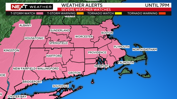
Severe thunderstorm watch issued
A Severe Thunderstorm Watch has been posted for posted for nearly all of southern New England, except for the Cape and Islands. Strong to possibly severe storms are likely throughout the mid-afternoon.
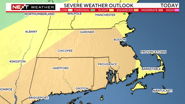
The Storm Prediction Center has parts of the area in an 'enhanced' risk for severe storms where elements are lining up for a busy afternoon.
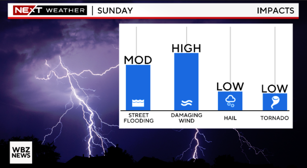
Any storms have the potential to bring damaging winds, hail, and torrential downpours. There is also a low but not zero risk for a tornado (about 2% as of now).
What time will storms start?
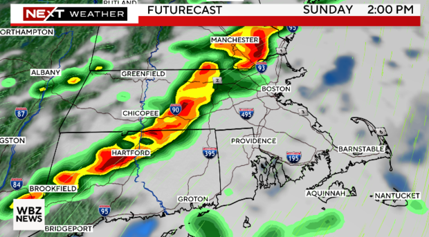
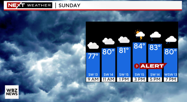
After the region started the day with some early morning showers, much of New England will get a lull before a round of scattered showers, and storms move in early to mid-afternoon. The line of showers and storms will then move east into the evening.
The time to watch for potential storms is 2 p.m. to 9 p.m.
It will be much warmer and more humid on Sunday as well, with highs climbing near 90° and dew points into the 70s, providing the juice and instability for storms.
Lingering showers on Monday
We'll have a slight chance for a few lingering showers on Monday, but overall, we are looking at a much drier and nicer day followed by increasing temperatures mid-week as we approach the 4th of July holiday! Sunday will be a day to watch the radar.
The NEXT Weather Team will be following the storms all day long on WBZ.com, WBZ-TV, and CBS News Boston.