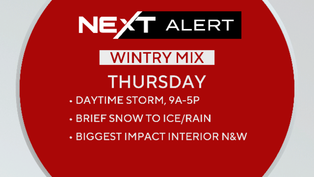
"Kitchen sink" storm on Thursday will bring rain, snow and ice to Massachusetts
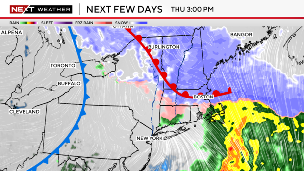
BOSTON - A train of storms looks to be headed to the Boston area, with the first set to bring rain, snow and ice to Massachusetts on Thursday.
Click here for an updated forecast with the latest weather maps showing how much snow Massachusetts could get and when it will start.
The month of February is going to be very different than the prior two winter months. It will not be as cold, so there's that... But it is looking very active with several messy storms in the next 1-2 weeks.
Storm set to arrive on Thursday
For now, we focus on storm #1, set to arrive in New England on Thursday.
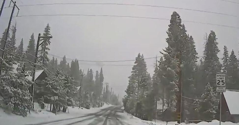
The WBZ Weather Team has issued a NEXT Weather Alert for what looks to be a "kitchen sink" type storm on Thursday. You have likely heard the phrase, "everything but the kitchen sink" ... well, our area is likely to see all the precipitation types with this next storm.
Believe it or not, the storm is still thousands of miles away, off the West Coast.
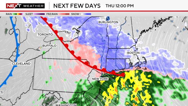
Over the next 48 hours, it will trek across the entire country, leaving behind various amounts of rain, snow and ice.
With regards to impacts here in New England, we will be working out the finer details in the next 24 hours.
Fast moving storm
Right now, we know a few things for sure.
-It will be a fast mover, in and out of here in about 6-8 hours (approximately between 10a-5p Thursday).
-We also know that this will NOT be a major storm for our area...no wind or coastal concerns and snow amounts will be on the lighter side.
In the end, this one comes down to figuring out what types of precipitation are falling and for how long.
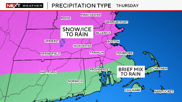
What type of precipitation?
It will be cold enough at the start for some snow to fall in most of our area, except perhaps extreme southeastern Massachusetts.
Warmer air will be moving in several thousand feet above the ground during the day Thursday which will change the snow over to ice and, eventually, rain.
The tricky part right now is timing the arrival of the milder air...how much snow/ice can fall before it arrives?
That answer will come with more data in the next 24-36 hours.
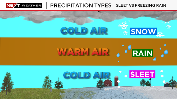
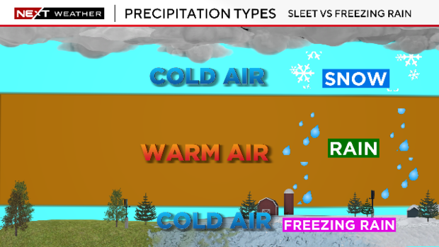
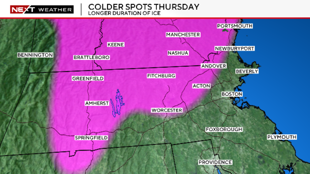
Sleet vs. freezing rain
A reminder that sleet are those small ice pellets that ping off of everything. Freezing rain is precipitation that falls as water and freezes on contact with the ground, a much more hazardous event. The change to "ice" on Thursday will largely be in the form of sleet, not freezing rain.
As is typical, areas farther north and west will be slightly colder and therefore more apt to hang on to the ice a bit longer.
A bunch of slop
As for snow amounts, expect that forecast map to come out Tuesday.
It is safe to say that there will not be a lot of snow with this one. For most, this will be a bunch of slop. An inch or two of snow, topped by some icy pellets, turned to mush by rain.
Looking for good news? The temperatures get milder with time Thursday and will not be falling immediately after the storm. That will certainly help cleanup efforts and make the roads a bit less hazardous Thursday night.