Tornado risk elevated in Massachusetts with strong to severe storms likely
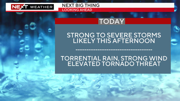
BOSTON - The WBZ Weather Team is continuing the NEXT Weather Alert on Sunday amid an elevated tornado threat in Massachusetts and New Hampshire. This time, instead of heat, we are tracking several rounds of thunderstorms.
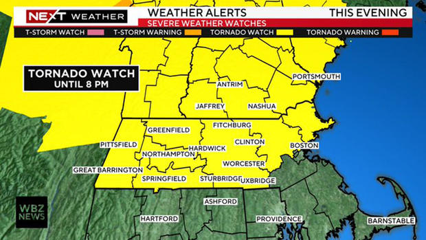
After the hottest week in a few years, now the pattern becomes unsettled and stormy. A tornado watch was issued through 8 p.m. Sunday for parts of Massachusetts and New Hampshire.
Sunday
There will be two rounds of storms on Sunday. The first pushed through Sunday morning, dropping a quick .25" or so in sports with a few claps of thunder.
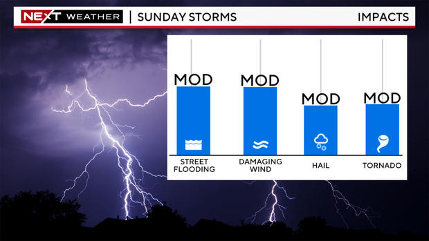
The second and most volatile round will be in parts of central and northern New England between noon and 5 p.m. and in southern New England between 4 and 8 p.m.
The Storms Prediction Center has placed a much larger area in the "marginal" risk (yellow shading) for severe weather on Sunday extending from Boston all the way through northern New England.
In addition, they added an "enhanced" area (orange shading), level 3 of 5, in parts of the Berkshires, southern and central Vermont and through the Lakes Region in New Hampshire. New England rarely sees this level of severe thunderstorms risk, perhaps a few times per year if that.
Tornado risk
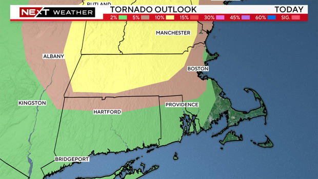
Even more unusual is the center's tornado risk assessment. The biggest risk for a tornado will be through central and northern New England, where the center has issued a 10% risk for a tornado (yellow shading) - including much of central/western from the Berkshires into Middlesex County. Additionally, Boston into Metrowest and south into Norfolk County was given a 5% tornado risk (brown shading).
This is incredibly rare and concerning for this area. A few quotes from the center's Sunday morning discussion:
"Scattered damaging winds and a few tornadoes are likely across parts of the Northeast and New England, with additional severe storms expected across the Ohio Valley, Mid-Atlantic region, as well as the Northern High Plains."
"A corridor of locally greater severe risk remains apparent across portions of southern Maine, VT, NH and west-central Massachusetts ... With the potential for a mix of supercells and line segments, the risk for tornadoes will exist."
What does a 10% tornado risk mean?
Reaching the 10% threshold indicates a notable increase in the tornado threat. These forecasts are often associated with enhanced or moderate risk days when several tornadoes are possible and the potential for a stronger tornado, (EF2 or greater) increases.
A 10% tornado probability means that within 25 miles of any point in the highlighted area, there is a 10% chance of a tornado occurring. This is extremely significant and again, very rare for this area.
Clearly, Sunday will be a day to keep an eye on radar. We urge that you stay tuned to WBZ-TV, WBZ.com and CBS News Boston as we will have you covered all weekend long.