Icy Cold Winds Will Ease
For the second weekend we have had bombogenesis off the coast, luckily this time we were spared
by just a couple miles. Here are a few Nemo vs. Plato stats: Minimum central pressure ~971mb vs ~954mb, peak Boston gust 76mph vs 47mph, Boston snow total 24.9" vs 5.1".
Our weekend storm is heading now to Newfoundland and weakening a bit. Building high pressure to our southwest. Air is flowing from high to low pressure, so this funneling effect of air will continue over New England for much of the day. Air is being discharged right out of Canada, so the Arctic air remains for one more day. Temps this morning in the teens are feeling below zero as winds continue to gust between 30-40 mph. It will be a harsh cold out there even with the sunshine. Highs will climb into the upper 20's and lwr 30's by afternoon. wind chills will still be in the teens. As the storm continue to pull away, I expect the winds to really begin to die down by evening with mostly clear skies.
Tuesday will get off to a great start with sunshine and a developing SW wind ahead of an approaching cold front. Highs will climb into the mid 40's with increasing afternoon clouds. Rain and Showers will be spreading from west to east and should be arriving around sunset or just after. Temps will be cold enough across northern New England that the northern mountains could see several inches of snow. The showers will last through the evening, but wind down after midnight.
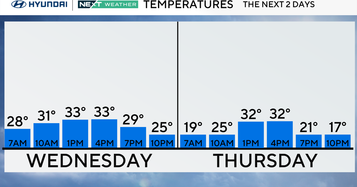
Gusty NW winds will filter back in for Wednesday and Thursday. Midweek temps will be in the mid 30's with the coldest air likely waiting for Wednesday night and Thursday where highs will only be in the 20 & lwr 30's with again the gusty winds making it feel colder despite the sunshine. Friday will have a light variable wind with mostly sunny skies and highs climbing back to near 40.
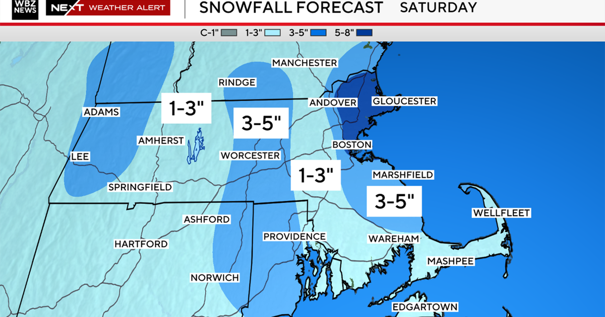
We will have to watch the weekend. There is plenty of uncertainty this far out on timing, ptype, track, ect....but it appears a low will be tracking through the mid-Atlantic and may come close enough to SNE to clip us with a period of rain and snow later Saturday into Sunday. Then we could see another low track south of us somewhere in the 27-28th timeframe to give us another chance of accumulating snow. It is an active storm track which will take us into March...where I think a more typical trough pattern should become reestablished.

