Hurricane Maria's Final Path? Tropical Storm Jose To Play Major Role
BOSTON (CBS) -- As Maria re-emerges over the ocean after battering Puerto Rico, Jose seems like an afterthought here in New England.
While we still have a good deal of rain, wind and coastal erosion on the way, none of it will compare with the devastation happening now in the Caribbean. That region has taken blow after blow this season, from some of the most intense hurricanes on record in the Atlantic.
Could Maria affect the East Coast or even New England next week?
Yes--but it all depends on Jose, more on that below.
First, here is the latest on Jose.
It is going nowhere fast. Jose will slowly drift northeast Wednesday, staying more than 100 miles off our shoreline. While that is farther out than a typical nor'easter, Jose's circulation is large enough to still envelope parts of southern New England in its shield of wind and rain.
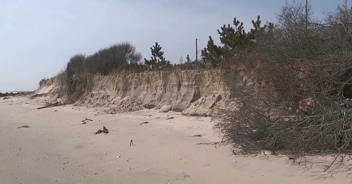
It's greatest effect on New England will come from the ocean. We are already seeing 10-to-20 foot swells just offshore of Nantucket. With Jose forecast to linger in our waters for the next several days, our coastline is going to take a severe beating.
COASTAL THREAT
Coastal flooding is forecast to mainly be minor with pockets of moderate for the South Shore, South Coast, Cape Cod and Martha's Vineyard. Nantucket Harbor will likely bear the brunt of the flooding, with widespread moderate flooding there.
With Jose going nowhere fast, our coastline will be at risk for flooding and severe erosion for the next several days, likely right through Saturday.
Tides are high (astronomically) and with a continued strong northeast wind, the water will pile up cycle after cycle.
Beach erosion will be severe. Many east/northeast facing shorelines will be eaten alive by the days of high surf.
WINDS
The strongest winds (35-55 mph gusts) will largely be confined to Nantucket, Cape Cod and the immediate South Shore.
Interior eastern Massachusetts will see gusts 20-35 mph at times.
It now appears that these gusty winds will continue through Thursday and perhaps even well into Friday. With 2-3 days of persistent winds, tree damage and power outages are likely to pile up.
RAIN
The vast majority of the rain will fall over Nantucket and over the open waters to our east.
Some showers and downpours will rotate farther west into eastern Mass. at times, but rainfall totals inland will be light (under 1 inch). Nantucket and the extreme outer Cape will likely receive several inches of rain over the next 48 hours.
Jose will be a factor in our weather here well into next week!
It is forecast to loop around and slowly weaken off our coast during the next several days. This will keep our seas rough and winds gusty over the Cape and Islands through part of the upcoming weekend.
WHERE DOES MARIA GO?
So with Jose going nowhere fast, how does that affect Maria's ultimate path?
Early next week, what's left of Jose will be spinning around in the waters to our south. At the same time, Hurricane Maria will be headed north from the Caribbean, paralleling the East Coast.
This is a very complex setup with many possible solutions. The interaction of these two circulations will be key in determining Maria's final path.
Long story short, it is just too early to tell where Maria is ultimately headed.
Solutions range from a hit anywhere along the East Coast from North Carolina-northward to a recurve out to sea. Timeframe to watch for a potential landfall would be mid to late week (next week). It will certainly be several days before any significant increase in forecast confidence occurs.
As always, we urge you to stay tuned to updated forecasts on CBSBoston.com, WBZ-TV and WBZ NewsRadio 1030 on both Jose and Maria.
Follow Terry on Twitter @TerryWBZ


