Remnants Of Hurricane Laura Could Bring Heavy Downpours, Thunderstorms
BOSTON (CBS) - After a beautiful end to the week, stormier weather will make a return to New England to kick off the weekend. While a shell of its former self, the remnants of what was once Hurricane Laura will add some extra tropical moisture to the atmosphere. Saturday doesn't look like a total washout, but it'll be an unsettled day in the area.
There are two fronts to watch - a warm front passing through during the early morning and a cold front in the afternoon/evening. The first will bring a round of scattered showers and maybe some rumbles of thunder to start the day. Once passing through, we'll hold on to a good amount of cloud cover but it will still be warm and humid with dew points climbing into the low 70s. Temperatures will be held in check by the clouds but should reach the upper 70s to near 80 in the afternoon.
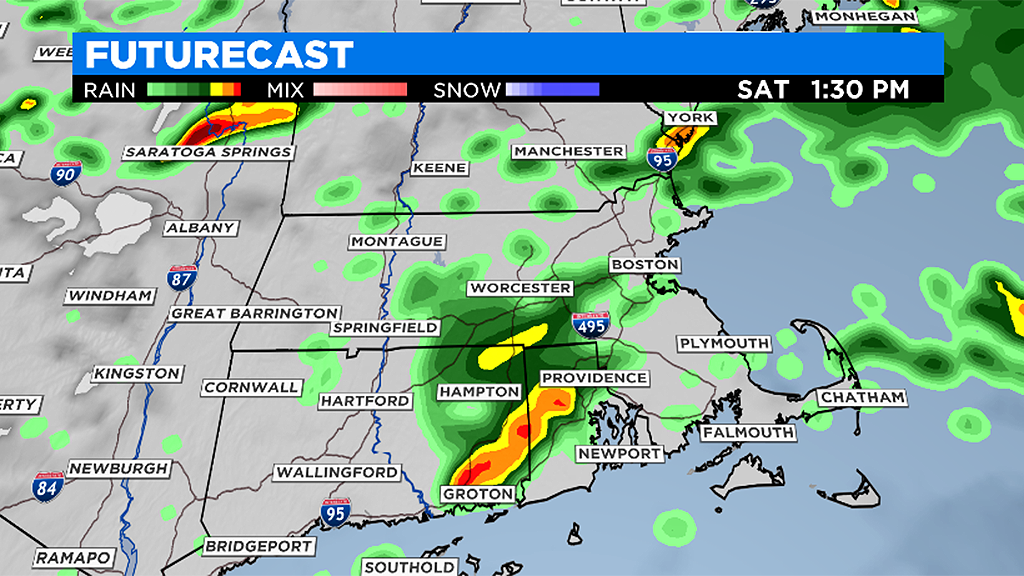
As the cold front approaches, it'll tap some of this warm and humid air and spark more showers and thunderstorms during the afternoon and evening. It won't be raining all the time, but if you have outdoor plans you're going to have to dodge rainfall and keep an eye on the skies. This risk will linger past sunset before diminishing overnight.
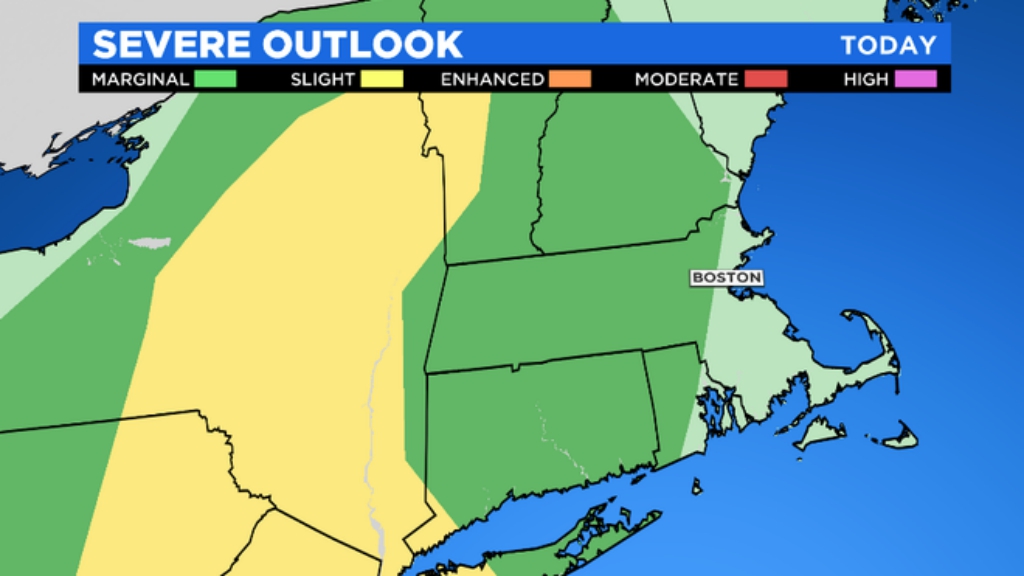
Since the atmosphere will be pretty juicy for the time of year, any downpours could quickly drop some heavy rain amounts. As for severe weather...the risk doesn't look too high but a couple strong to severe storms could organize if there's enough sunshine. The main risks would be for torrential rain and damaging winds in any storms that pop.
It's a quick moving system, so we'll dry out nicely for Sunday with a mix of sun and clouds and highs 75-80.