Tropical Storm Debby's path will determine how much rain Massachusetts gets
BOSTON - Before the remnants of Tropical Storm Debby approach Massachusetts, the WBZ Weather Team is continuing the NEXT Weather Alert for downpours that should end late Wednesday morning.
The heaviest rain fell overnight. During the Wednesday morning commute, the intensity of the rain will be lessening, and we will gradually dry out throughout the morning.
The second half of Wednesday will be much better with sunshine emerging and very comfy air in place.
Projected Debby path
After a very brief break Wednesday evening through part of Thursday, our attention then turns to the remnants of Tropical Storm Debby.
Debby is forecast to remain a weak tropical storm for the next few days as it slowly moves through the Carolinas and Virginia.
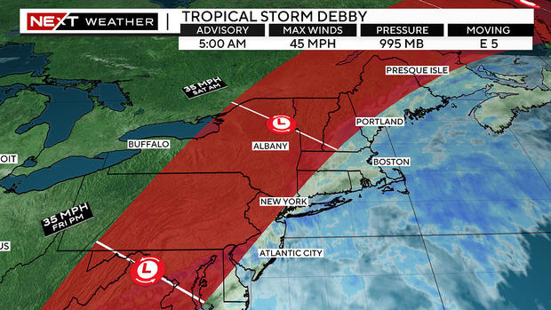
Some of the outermost rain bands from Debby will reach our south coast as early as Thursday late afternoon and evening.
There will be periods of showers with some embedded downpours Thursday night through the day on Friday. This will be an off-and-on rain and not all that impactful.
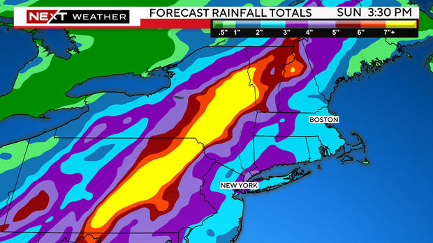
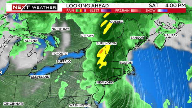
The heaviest band of rain will come as the center of what was Tropical Storm Debby (it will have lost its tropical characteristics by the time it gets here) makes its pass through the northeast.
The most intense rainfall in a system like this is typically located just to the west of the center's track.
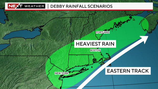
The big change in the last 24 hours has been a shift to the west. With the center passing through central and northern New England, the heaviest rain would be located through parts of New York state and northern New Hampshire and Vermont.
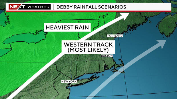
This western track would mean a shorter window with heavy rain in southern New England and much lower rainfall totals.
While it is still too early to forecast an exact track and rainfall numbers, this scenario would produce an inch or two of water (or less) in southern New England while as much as 3-6" of rain could fall in far northern New England.
Bottom line, there will certainly be periods of rain from Thursday night through at least part of Saturday, but odds are increasing that we may avoid any serious and significant flooding in our local area.
We will have much more detail to come later Wednesday.
The second half of the weekend looks fantastic! Great news for the annual Perseid meteor shower which peaks late Sunday night.


