Beryl maps show path and landfall forecast of storm as it reaches Texas
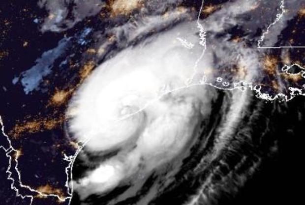
After hitting Mexico's Yucatan Peninsula, Beryl churned across the Gulf of Mexico and made landfall over the middle Texas Gulf Coast as a Category 1 hurricane early Monday, the U.S. National Hurricane Center said. Beryl began weakening after making landfall and was downgraded to a tropical depression later Monday.
The storm blew past the Cayman Islands and Jamaica last week, initially making landfall over the island of Carriacou in Grenada while tearing through the Caribbean, strengthening at times to a Category 5 hurricane — the strongest rating.
What is Beryl's projected path?
The hurricane center issued an update Monday evening saying Beryl was bringing flooding and the risk of tornadoes across portions of eastern Texas, western Louisiana and Arkansas.
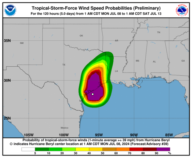
As of 8 p.m. EDT, all tropical storm warnings and storm surge warnings for Texas had been lifted.
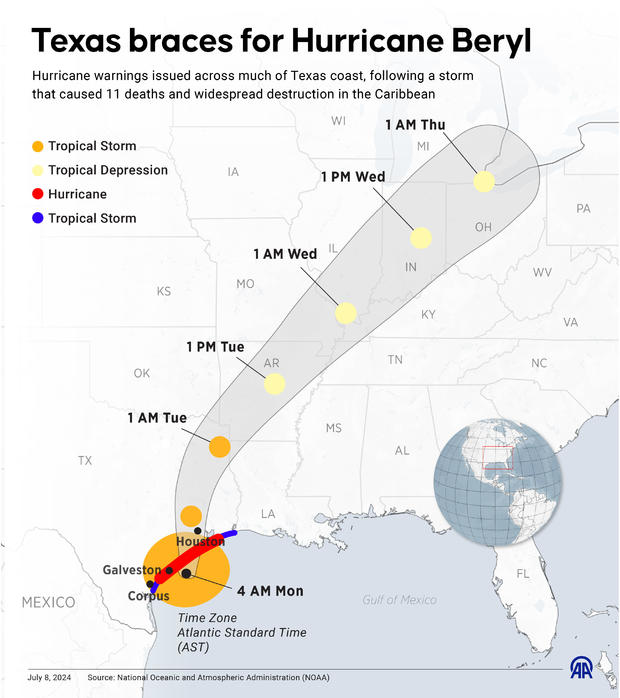
Beryl's eye "will move over eastern Texas today, then move through the Lower Mississippi Valley into the Ohio Valley on Tuesday and Wednesday," the hurricane center said. "Steady weakening is forecast, and Beryl is expected to become a post-tropical cyclone on Tuesday."
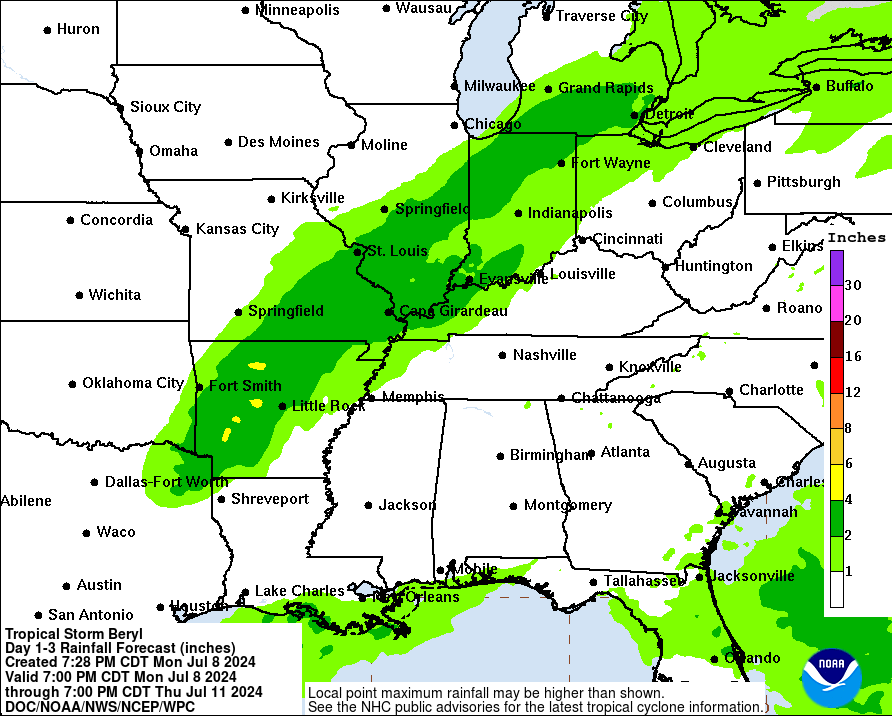
"An additional 4 to 8 inches of rainfall with localized amounts of 12 inches is expected across portions of eastern Texas through tonight," the hurricane center said Monday evening. "Considerable flash and urban flooding as well as minor to isolated major river flooding is expected. Heavy rainfall of 3 to 5 inches, with locally higher amounts, is expected across portions of far southeastern Oklahoma, Arkansas, and southern Missouri through Tuesday."
Before reaching the U.S., Beryl made landfall in Mexico's Yucatan Peninsula on Friday as a Category 2 hurricane, just northeast of the resort town of Tulum, before weakening to a tropical storm and moving back into the Gulf.
Beryl became the first hurricane of the 2024 Atlantic hurricane season at the end of June and rapidly strengthened. It was the first major hurricane east of the Lesser Antilles on record for June, according to Philip Klotzbach, Colorado State University hurricane researcher.
Brian McNoldy, a tropical meteorology researcher for the University of Miami, told the AP that warm waters fueled Beryl, with ocean heat content in the deep Atlantic the highest on record for this time of year.
Beryl also set records as the first June hurricane ever to hit Category 4, the farthest east a storm has ever hit Category 4, and the first storm before September to go from tropical depression to major hurricane in under 48 hours, CBS News weather producer David Parkinson reported.
Beryl was also the earliest Category 5 hurricane ever recorded in the Atlantic basin and was only the second Category 5 storm recorded in July since 2005, according to the hurricane center.
Brian Dakss, Alex Sundby and The Associated Press contributed to this report.