Winter Storm Warning, High Wind Warning, Coastal Flood Warning...the Warnings are out for a major winter storm for late October. We will be a witness to history in the making today as there has never been a storm of this magnitude, delivering this much wind and snow, this early in the season. It is only late October and we will be seeing one of the more powerful storms in the next 24 hours than we will see all Winter! Really, this thing is going to be a bomb...and from a meteorological perspective...it there anything more exciting than Bombogenesis?
Check: Current Conditions | Interactive Radar | Maps | Weather Blog
Bombogenesis is defined as rapid or extreme cyclogenesis of a mid-latitude
cyclone that drops in surface barometric pressure by 24 or more millibars in a 24 hour period. That is exactly where we are heading. High pressure over us this morning with 1024 mb. This time tomorrow, Our storm will be bombing off the coast with pressure falling to 984 mb! Blizzard Conditions will be felt in the interior overnight. Blizzard- Includes winter storm conditions of sustained winds or frequent gusts of 35 mph or more that cause major blowing and drifting of snow, reducing visibility to less than one-quarter mile for 3 or more hours. Extremely cold temperatures often are associated with dangerous blizzard conditions.
Close to Hurricane force gusts will be found on the Cape early Sunday morning as the storm pulls away..with peak gusts possibly reaching 70 mph out of the Northwest.
There is plenty of model consensus so we feel confident of it's potential, track and intensity. The one remaining question remains the warm ocean water of 50-55 degrees and how this will eventually play out for the coast line...especially with the rapid deepening drawing in the cold air tonight into the center of the low...Any shift from the NE to the North could mean higher accumulations at the coast...so there is the potential to be underdone at the coast if the cold air eventually wins out. Still expect no more than a slushy inch or two at the beach. Let's get to the details as the concerns and impacts of this storm will be far reaching.
The most significant threat remains tree and power line damage from heavy, wet snow and strong winds. A secondary threat would be the potential for minor to moderate coastal flooding, particularly during the high tide overnight around 2AM.
The precipitation arrive late this morning south of the Pike, and push into NH by the mid afternoon hours. Temps will start off mild enough for mainly rain for all of Eastern Massachusetts, a wet snowy mix in higher elevations to the west. High pressure to our north will drain the cool air into New England through the day. Rain and snow will become heavy by late in the afternoon. The rain/snow line will collapse to the south and east as colder air is drawn into the deepening storm on shifting winds to the north. By midnight it will be snowing just about everywhere with the exception of southeastern MA where it will continue to rain very heavily. The rain/snow line will collapse further southeast to around the Cape Cod Canal in the pre-dawn hours of Sunday morning before the storm system pulls away and the precipitation shuts off just after dawn.
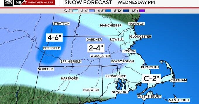
Snow: Water temps will be a huge factor here where at the beaches perhaps an inch or two of wet slush...but just a mile or two inland in Cambridge or Brighton, Newton totals will ramp up quickly to 3-5" to 128. Heading to 495 totals should range from 6-12" is likely in a wide area of Southern New England including most of Western Middlesex County, all of Worcester County and all of Western MA and SW New Hampshire with the Higher amounts outside of 495. The jackpot for snow amounts will be in the higher elevations (1,000ft and up) where a foot or more is possible
The wildcard with this storm is the timing of the change from rain to snow along the coast and in the nearby suburbs...if it occurs just a few hours early, amounts could easily increase in the Boston Metro area..especially with the power of this storm. Snow will be a very heavy and wet consistency, compacting quickly keeping accumulations lower...but also weighing down on tree limbs and wires . Would not be shocked to see 1-2" per hour snow, some thundersnow and even blizzard conditions for a time tonight. Wow.
Rain: Areas southeast of Boston and Providence will receive very heavy rainfall, many towns exceeding 2". This will result in urban and poor drainage flooding and cause many rivers and streams to rise near bankful.
Wind: Winds will be out of the NE early in the storm gusting 25-50mph+ along the coastline and 25-35mph inland by late afternoon. Winds will shift to a more northerly direction later in the evening and at night and continue very strong, especially over Cape Cod and The Islands and the coast. Gusts to 50-60 mph at the coast by Midnight. This will pose a significant problem coupled with the heavy, wet snow and lots of foliage still on the trees. Tree and limb damage is almost certain and numerous power outages are expected.
With wet saturated soil, winds will blow the trees back & forth with the potential for trees to topple. Winds aloft by dawn Sunday will be rip roaring behind our storm as it heads into the Gulf of Maine. 75 kt winds will be mixing down with the departing storm for a second round of wind for the coast in the early morning from the NW with gusts over 60 mph for the Cape & islands. Wind damage and impact form this storm could exceed that from Tropical storm Irene.
Coastal Flooding: The storm is coming during a new moon phase and very high astronomical tides. The good news the worst of the storm will not be happening on the highest of tides. One of the highest tides of the year is High tides is at 1:30PM today...minor flooding is possible at this time.
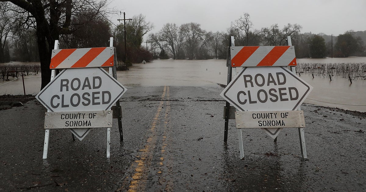
But the High tide 2:00AM Sunday morning will be no slouch and is the one we have to watch out for…While this tide is a bit lower astronomically speaking, 10-20 foot seas just offshore and powerful winds will cause pockets of moderate flooding at the coast. Moderate coastal flooding is likely from Revere to Scituate, to Sandwich and Chatham in flood prone areas. Significant beach erosion, road closures and flooded basements. This tide will come with a 2-3 foot surge. Coastal Flood warning for 11pm and 5am.
Clouds, wind and snow will hang around at the coast through Sunday morning. High pressure builds in for the afternoon with clearing skies. Strong NW in place all day with gust to 40-45...winds will slowly slacken by afternoon.
Kids will be trick or treating under a partly cloudy sky with snow on the ground this year adding to the chill. The Kids may want to wear boots this year to keep their feet dry. Temps will start in the Lwr 40's at sunset and fall into the 30's
