High Winds & Heavy Rain Tonight-Early Thursday
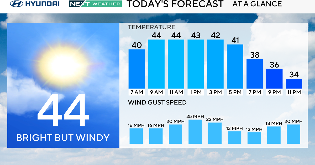
A warm front is slowly sliding through New England this morning. Ahead of this front temps have been near freezing which made for any icy commute across SNH and Central and western New England. School delays because of a freezing fog and mist which developed with the milder air riding over the colder snow cover. Temps will be slowly moderating with the passage of this warm front with low clouds and fog. Once the front passes through by midday, the warm up will be on! SW breezes will pick up, clouds will begin to lift and even break! Highs will be climbing well into the 50's in SNE for a pretty nice afternoon despite the abundant cloud cover in place. A few scattered showers may try to peel off and start to move through during the early evening hours. Temps will continue to warm with breezy SW flow right through the evening where temps will likely reach 60 degrees and hold there until the cold front passes.
This cold front is not your regular cold front. This one is energized to the max! Cold arctic air sliding off the Rockies is pushing east and colliding with the unseasonal warmth surging out of the Gulf with moisture laden air. A strong jetstream putting tilt to thunderstorms making for strong updrafts, rotation and a severe line of Thunderstorms which is producing damaging winds and scattered tornadoes as it moves west to east across the nation. This line of storms will be approaching New England tonight in a weakened state....but it will come with the potential for damaging winds.
Showers will be turning into to steadier rains during the evening hours...with the heaviest still in western New England through 9 PM. The heaviest rain and wind will shift east and happen from Midnight-7 AM Thursday. Heavy rain could produce some localized street flooding in downpours as about .50-1.5" of rain will fall in a short amount of time. Some of these thunderstorms may try to hold together as they cross the region...so we can not rule out the potential for embedded thunderstorms in the heavy rain. There will be a strong low level jet racing above our heads with winds from the SW at 70-90 kts. Any heavy rain from convection could easily transfer these strong winds to the surface. A high wind warning is in place for SE MA including the Cape & Islands through Thursday morning. Winds will gust between 50-65 mph here...with the strongest winds happening around 2-6 AM. There is the potential for these winds to be damaging toppling trees and power lines and producing scattered power outages.
Thursday's morning commute will start very wet and windy which could make for some early delays. Temps will be in the 50's at dawn. Breezy WNW winds will shift in behind the front as it pulls off the coast and quickly takes the rain and mild air away. Temps will fall through the day with increasing sunshine by afternoon. By sunset, temps will likely be right around 40-45. Still above normal! The cold air advection will continue right into friday with a mix of sun and clouds with temps in the Lwr-mid 30's. While we will cool down, the real Arctic air will not be plunging in or be nearly as cold as the teens we had last week.
Instead with a trough in place across the northeast, numerous shortwaves will be pushing into the trough, with weak lows track south of New England. It will be come somewhat of a "Clipper" pattern with these lows starved of moisture or energy. Still there is a chance of some light accumulating snow as each of these lows pass. The best chance of light snow will be Sunday & Tuesday, with the potential for another low riding south of us by next Thursday. None of these look very impressive at this point. All they will do is help to reinforce an over all cool pattern through the middle part of February.
Make sure to enjoy the next 24 hours! This is going to be some pretty exciting weather...if you like this kind of stuff...which I am sure you do if you are reading this! Thank you so much for taking the time and the interest!
