Heat advisory in Massachusetts extended before storms linked to Beryl arrive late in the week
BOSTON - The excessive heat and humidity in Massachusetts and most of southern New England has led to a NEXT Weather Alert from the WBZ-TV Weather Team.
Heat index values are set to climb near 100 degrees for many communities Tuesday. Then, we will transition to an unsettled and stormy pattern, partly due to the remnants of Tropical Depression Beryl.
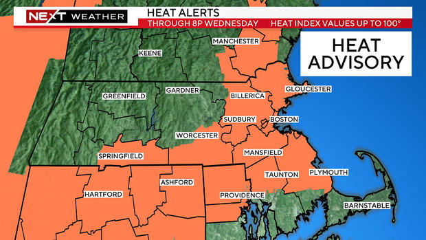
Heat advisory Massachusetts
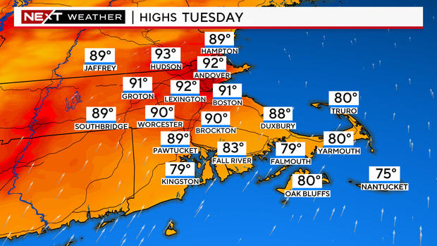
Temperatures will peak Tuesday with highs between 90 and 95 degrees away from the immediate coastline. The National Weather Service has extended a Heat Advisory issued Monday to go 8 p.m. Wednesday for most of eastern Massachusetts.
Areas outside the orange shading in the map above could very well experience the same conditions with feels-like temperatures between 95 and 100. The highlighting is simply to mark the areas most at risk.
Given the stagnant air mass, there will also be a chance of heat issues continuing into Thursday after being expanded through Wednesday evening.
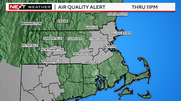
Air quality advisory Massachusetts
The Massachusetts Department of Environmental Protection has issued an air quality advisory from 11 a.m. Tuesday to 11 p.m. because of extra ozone pollution
Heat wave potential but no record heat
Our last heat wave brought several days of temperatures in the upper 90s. This week will not be as hot (technically) with highs peaking in the low to mid 90s on Tuesday. A heat wave is three consecutive days above 90 degrees.
However, the air will be excessively humid each and every day right through this weekend, making it feel hotter than the readings on the thermometer.
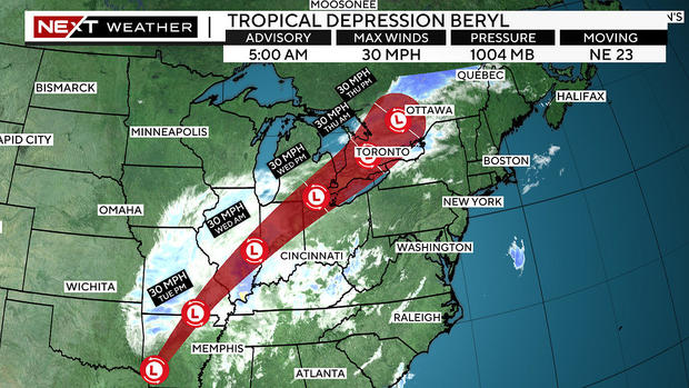
Tropical Storm Beryl path
Beryl made landfall Monday morning as a category 1 hurricane southwest of Houston, Texas. It quickly weakened to a tropical storm and continues to erode and weaken. Its remnants will track through the Ohio Valley and head well to our northwest, into Canada, later this week.
Just because it will not be passing directly over Massachusetts does NOT mean the Boston area won't feel some of its lingering impacts.
Heavy rain next
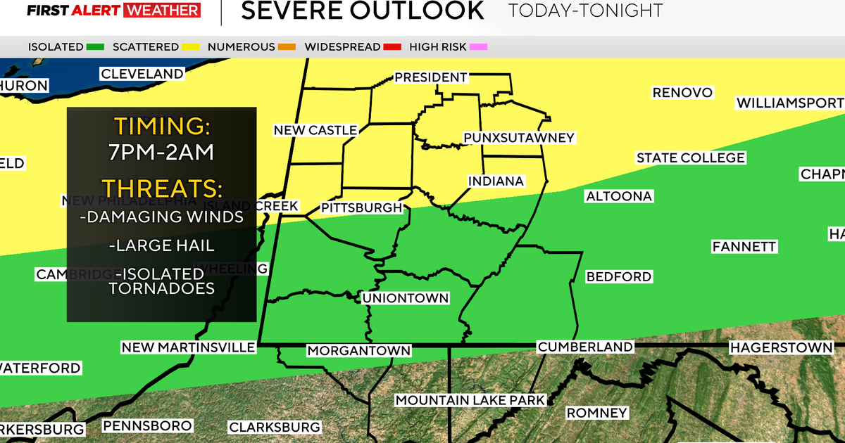
As Beryl loses its tropical storm status, rain and wind will continue as the system moves north and eventually near New England. The expectancy is that showers and isolated thunderstorms could affect some areas in the north with gusty winds likely towards the end of the work week.
This band of activity will carry the risks of localized damaging wind gusts with the greatest risk of them north of the Massachusetts Turnpike and especially near the New Hampshire border. Torrential rainfall and very localized flooding will be possible with any thunderstorm.
As the first half of the weekend concludes with showers Saturday, conditions will improve remarkably for Sunday into early next week as more heat is to be expected.
As always, we will provide frequent updates on WBZ-TV, WBZ.com and streaming on CBS News Boston all week long.
