Frosty Friday for some in New England
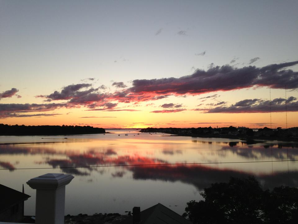
What a day! Once the clouds cleared, it was an absolutely stunning evening. With temps in the 60s and a breeze, I think just about everyone had fall on the mind. And there were just enough clouds around when the sun headed toward the horizon to create a fantastic sunset. This photo was sent in by Carolyn in Hull. Can't ask for a much better way to end a day.
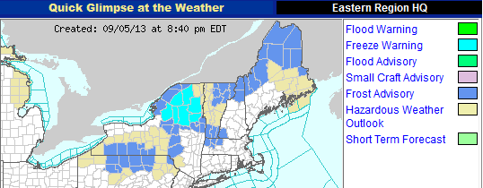
However, when light blue starts showing up on the National Weather Service website, you know times are changing.
Frost Advisories and Freeze Warnings are up for parts of 6 Northeastern states tonight, especially in the sheltered valleys amongst higher terrain. The cool, more dense air settles in those low spots, leading to colder temperatures by first light. Even parts of Franklin, Hampshire, and Berkshire Counties in MA have Frost Advisories up! But the good news for plants in eastern New England is that we should stay in the 40s, and the coastal plain will linger around 50 for overnight lows. So a chilly Friday morning heading off to work or school for sure, but none of the icy stuff just yet (and none in the foreseeable future).
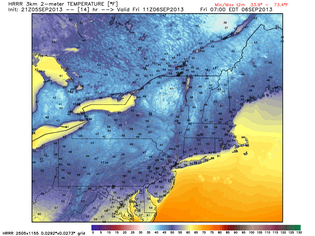 <--a model projection of temps at 7am Friday
Good news is that high pressure will sit right on top of us tomorrow, leading to widespread sunshine and a truly nice day to be outdoors. We'll warm well up into the 60s, just a few degrees below the average high (which is 76). With generally light winds, a gentle sea breeze should develop at the coast, but won't factor much into overall highs since the water temperature is about the same as the projected air temperatures.
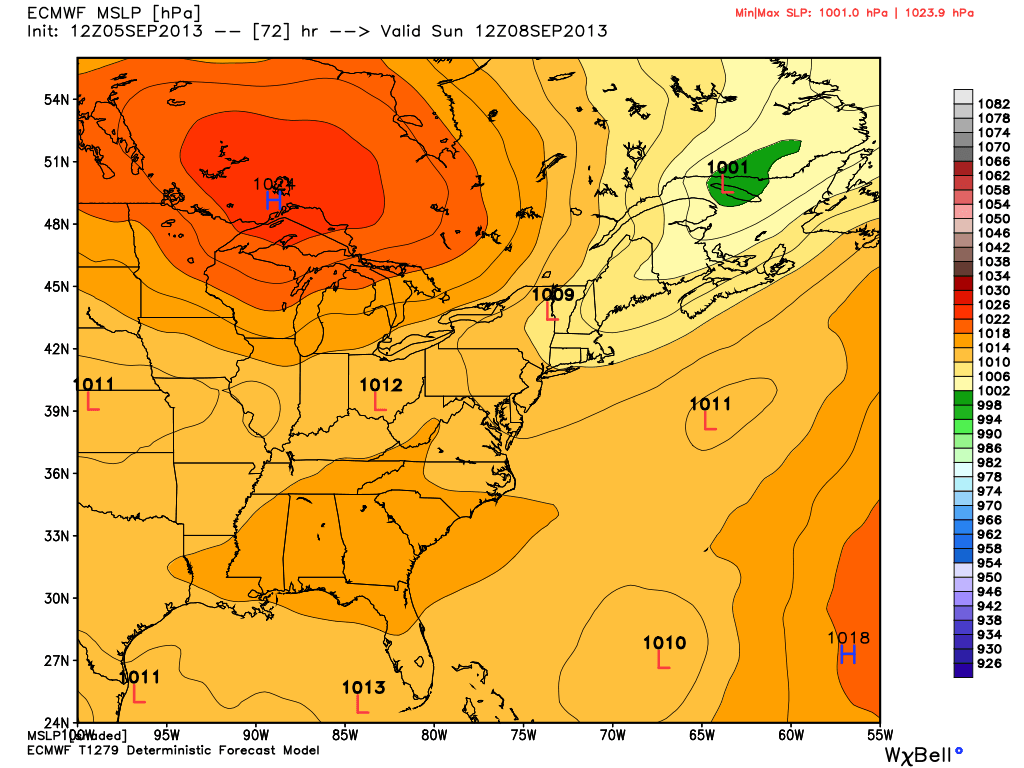
For the weekend, an active jet stream will keep systems shooting in our direction out of Canada. I think most of the clouds that roll overhead on Saturday will be of the wispy cirrus variety way up in the atmosphere, so overall we'll enjoy a great start to the weekend. With winds turning southwesterly again our temperatures will rebound back into the 70s. So for those who aren't ready to jump into fall yet, no worries. The map below is for Sunday, when a cold front will move through. At the moment it seems the front will arrive in the morning, which means a few showers and early clouds, but probably no big thunderstorms. It also may clear through here early enough to salvage a pleasant afternoon. Stay tuned for updates on the exact timing, but for now I'm thinking we'll end up with a nice end to the day.
After that the big huge 'H' on this map will move in, which means a great Monday and probably pleasant weather for Tuesday, too. Then yet another front will approach for the mid-week. Right now details are too fuzzy to give exact timing, but it looks like warmth and storms will return to the region for Wednesday/Thursday.
In the tropics, we're still watching what is now Tropical Depression Gabrielle. The storm weakened and become more disorganized on Thursday, and is expected to stay in a weakened state as it drifts slowly through the northern Caribbean. It will still pose a locally heavy rain threat to Puerto Rico and the Domincan Republic, but will not feature damaging winds.
 Water Vapor Loop of Gabrielle
