Foot Of Snow Likely Monday In Massachusetts
BOSTON (CBS) – Boston averages 43.8" of snowfall in an entire season. This average climbs to near 60" for a good portion of our area to the north and west including Worcester.
Check: Weather Blog | Current Conditions | Share Photos
Just seven days ago we were nowhere near attaining these averages. It now appears as though we will be eclipsing our entire seasonal averages by the end of the day on Monday.
A widespread 35-50" will have fallen in just under 10 days.
As the Patriots are set to take top stage on Super Bowl Sunday, Mother Nature is right on their heels, back at it with another significant winter storm Sunday night and Monday.
Timeline
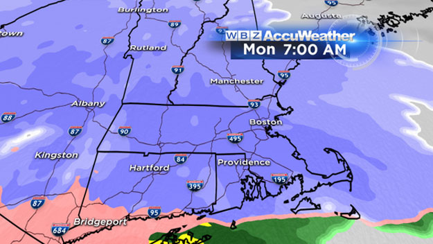
The first flakes should begin to fly shortly after the Patriots hoist the Lombardi Trophy. The snow will overspread the area from west to east after midnight Sunday Night. It will be snowing steadily well before the morning commute on Monday in all of Southern New England.
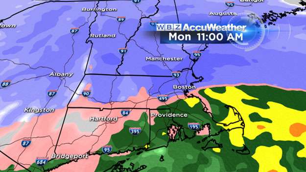
The heaviest snow will fall between 7 a.m. and 4 p.m. on Monday. Nearly 90% of the total snow accumulation will be done by 5 p.m. and the snow will shut off from west to east after 7 p.m. on Monday.
On The Ground Estimates
By 7 a.m.: 1-3"
By Noon: 3-6"
By 5 p.m.: 6-12"
By 9 p.m. (the end): 8-14"
Snow Totals
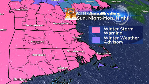
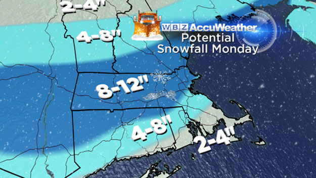
This is going to be a widespread 8-12" snow storm with some areas reaching as high as 14-15". This includes a large area from Southern New Hampshire all the way down to the South Coast and Cape Cod. There is still a chance that some milder air will work in during Monday morning in extreme southern areas (Cape/Islands) and briefly mix the snow with rain, knocking snow totals down a bit.
Outside of the South Coast and Cape, temperatures will be in the teens during Monday's storm. This will make for another light and fluffy snow, and allow it to pile up very easily.
This will not be another blizzard. Snowfall rates will top out around 1" per hour and winds will not be nearly as strong. Peak gusts will be between 20-40 MPH, mainly over the South Shore, Cape Cod and the Islands. Winds will be fairly quiet elsewhere. Coastal flooding is not expected as the peak of the storm arrives during low tide.
We will have updates throughout the Weekend, but this is a fairly high confidence forecast. Big changes are not expected and no, there is not a chance of a miss.
One final thought. Monday is Groundhog Day.
Not to take the big stage away from Phil and Ms. G but this may be one of their easiest forecasts in recent memory. Plenty of snow and cold are in the pipeline over the next few weeks.
Six more weeks of winter? At this point that seems like an optimistic forecast.
Follow Terry on Twitter @TerryWBZ
