Flakes On The Way
Find Eric Fisher on Twitter and Facebook
Hopefully you opened a few boxes full of scarves, gloves, and jackets this Christmas. It was the coldest one in Boston that we've seen in years, with a high of 28º at Logan but only 21º in Worcester. Ocean-effect snow showers put down a festive coating on the Cape, and now we settle in for a mild food coma with the chill outside tonight. Temperatures will hold pretty steady in the 10s to low 20s throughout the overnight, even rising a bit into mainly the 20s by tomorrow morning. The core of the Arctic air is heading out and a new storm system is moving in, albeit a weak one.
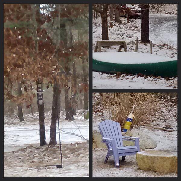
Scenes from Ocean-effect snow on Cape Cod Christmas Day. These photos courtesy Annie and Paul in Eastham
Tomorrow this system will spread clouds and a period of rain and snow showers from late morning through the evening. Milder air intruding from the south will change most of the Cape, South Coast, & Islands over to rain showers, perhaps as far north as the South Shore. For the interior there will be bouts of generally light snow. A coating is expected, but parts of Worcester County, northern Middlesex, and southern New Hampshire may see 1 or 2" add up. Nothing major, and with temps mainly at or above freezing roads should be fine. The only area that may get a little slippery is north-central MA and southern NH, where highs may stay just below freezing. So if you're heading to return that sweater for one that fits better, travel with caution!
That storm will ramp up Thursday evening but it will be too late for us. Most of the strengthening happens off into the Gulf of Maine, bringing a plowable snow to coastal Maine during the overnight. It's all gone by Friday, and bright/breezy conditions will be the rule in its wake. Saturday is looking a-okay, with highs reaching into the 40s and a good amount of sunshine. A perfect way to kick off the weekend!
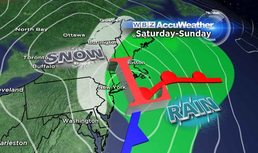
Next up - a coastal storm moving up the East Coast Saturday into Sunday night. It's a quick mover, but will emerge from the Gulf of Mexico and so will bring a good slug of moisture along for the ride. The track looks close to the coast right now, which without any true Arctic air in place would lead to a rain event. If it comes down heavily enough and colder air manages to work in from the west, I wouldn't be surprised to see this trend to a little more snow over the next couple of days, particularly for the higher elevations. Certainly something to keep an eye on! Precip should start to move in Sunday afternoon...the morning looks fine as it stands now.
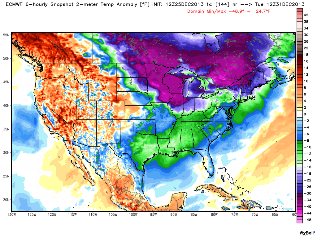
12z ECMWF surface temperature anomalies for NYE. Yikes! Models have been very consistent in advertising this cold outbreak, so it seems like a very solid bet now that we're only 6 days out. Courtesy: WeatherBell
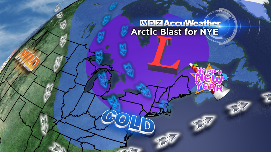
The final days of 2013 and first days of 2014 will be all about COLD. The polar vortex will send a couple lobes of bitterly cold air our way as it noses south. The first salvo arrives in time for New Year's Eve. If your plans take you outdoors, it may end up being a pretty brutal evening. Still a ways out, but this sign has been in place for a long time. Even colder air may dive into New England New Year's Day and for the end of the week. We may be talking subzero lows across all of New England and highs in the single digits to 10s. Regardless of the exact numbers, expect 2014 to start on a frigid note!
There have also been hints of a strong coastal storm in the 2nd-5th time frame. The biggest and baddest storms need things to be just right, so it's all preliminary for now. But certainly with plenty of cold in place and most models hinting for Nor'Easter potential, it will be part of the discussion in the days to come.
Merry Christmas to all! Hope your holiday was full of fun, laughter, good food, and even better company.
