Finally Some Snow...
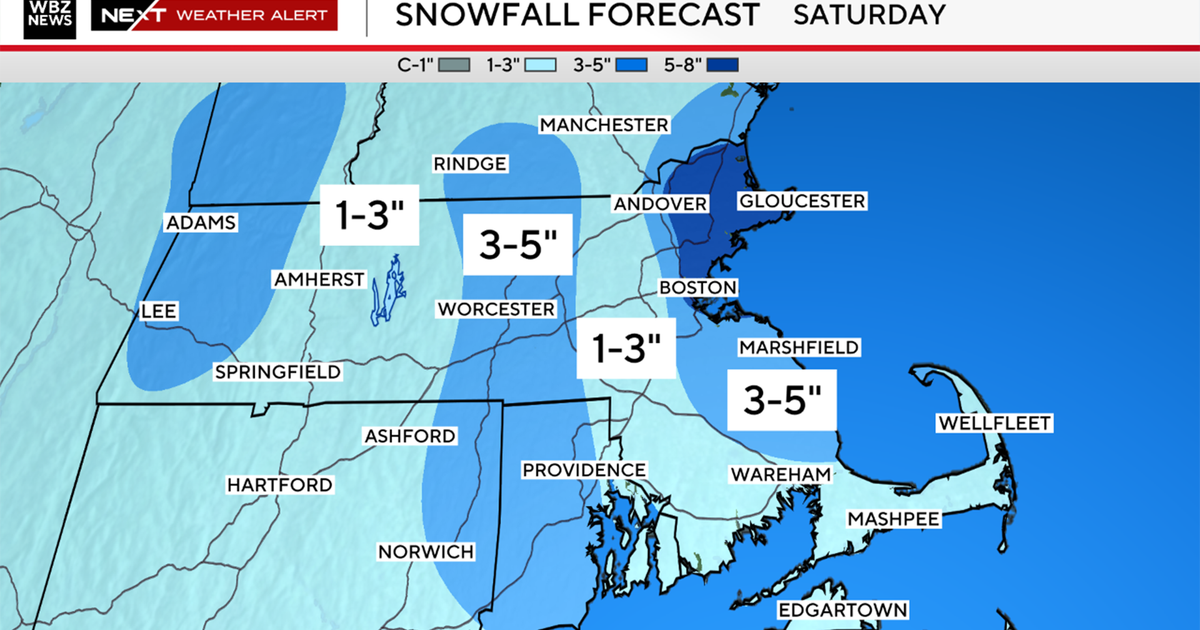
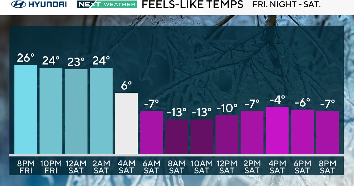
Congrats, you made it into the 50 degree club again...the 14th time this Winter! The high was 53 degrees in Boston set just after 1PM this afternoon. We are now going to be cooling off for the next few days as our winds have shifted to the NW and are now tapping a chillier airmass. With that said, tomorrow will be another mild day with highs in the mid 40s and clouds will advance in during he afternoon. Those clouds are in response to an upper level disturbance that if it had slowed down a bit would have merged with a huge storm to our south and we'd be talking about a nor'easter this weekend instead of a few snow showers. That storm will be a miss but the upper level disturbance will produce some briefly intense snow showers Saturday night and many towns will wake up to a coating of snow on the car tops Sunday morning. That front / disturbance will merge with the ocean storm blowing it up into a large low. The winds behind it will pick up Monday drawing even colder air into New England...highs in the upper 30s with sun for Monday. As usual, the cold won't last long...another moderating trend for much of school vacation week...highs well into the 40s with occasional rain showers middle of the week.
FYI, we are currently tied with 1937 and 1925 for least snowy Februarys with just a trace of snow seen at Logan...that could change tomorrow night but not by much.


