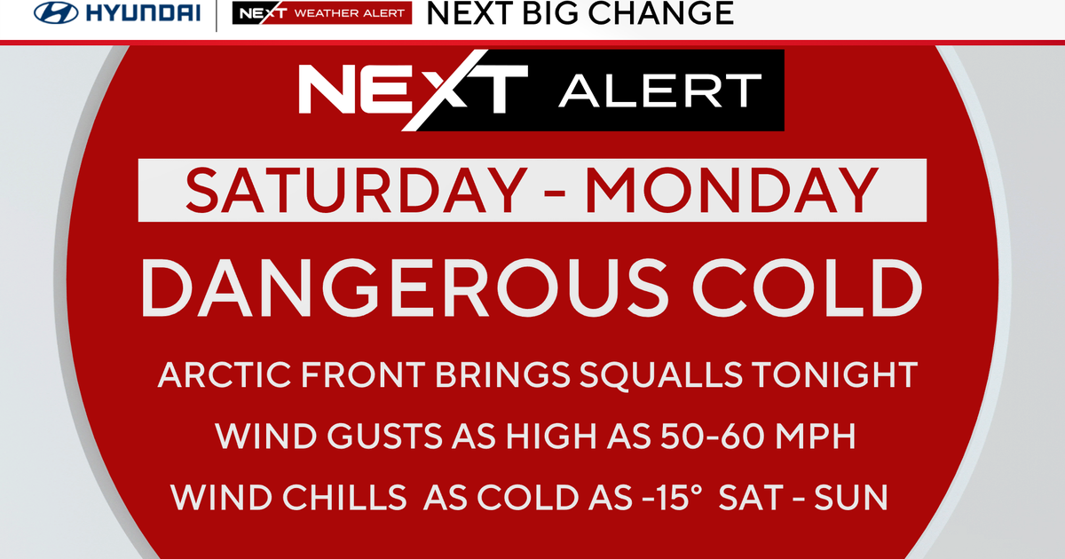
Final Burst...
Temps are falling...nothing drastic but enough to change rain to snow as the atmospheric structure is cooling from above to the surface. This final burst of snow will be briefly heavy so roads will slush up and become snow covered even in Boston through the evening. The snow will vary in intensity through about 11PM and we are looking at coatings in SE Mass to 3" in the higher elevations.
The next storm will fly in tomorrow night...there isn't much to look at with it as the mid level support is lacking but the 300mb jet structure looks good for as a departing jet max and an approaching one will create enough lift for surface low pressure to develop. There is still some question with the track this weak low will ultimately take but it appears that it will squeeze out around .25" of liquid precip which should translate to a 2-4" range...light and fluffy, not the slop from today.
The third storm in the stretch will arrive on Monday...this one will take a similar path to today's storm...but slightly farther west...meaning even warmer air will work in so another wet and windy day with potential t-storms Monday night. We are likely looking at close to an inch of rain coupled with melting...again flooding will be a concern. I'll throw this out there too...as we transition out of the colder airmass and into the warmer one Sunday night, high pressure will be departing to our north and east...damming a bit of cold in here and a little overrunning precip may break out...perhaps some flurries or maybe a little freezing drizzle. No guarantee but something to monitor.
Have a great weekend everybody...