Feel of Summer for a Little Longer...
It took a while but Boston finally broke 70 and touched 79 briefly earlier this afternoon. Since then, stronger southerly winds coming have been coming up from the cooler coastal waters south of New England which has both cooled us down but also added moisture to the air and low clouds and fog are filling back in. Tomorrow will be a very muggy day with dew points over 60 in spots...sun will be limited and ultimately will likely save us from the severe storms that have been firing to our west the last few days. There will be some very strong storms to our west developing in the afternoon but will likely weaken some as they encounter the slightly more stable air here in Eastern New England...not only that but the timing of the front appears later in the evening...I still expect some heavy downpours to survive and maybe a few stronger storms as well.
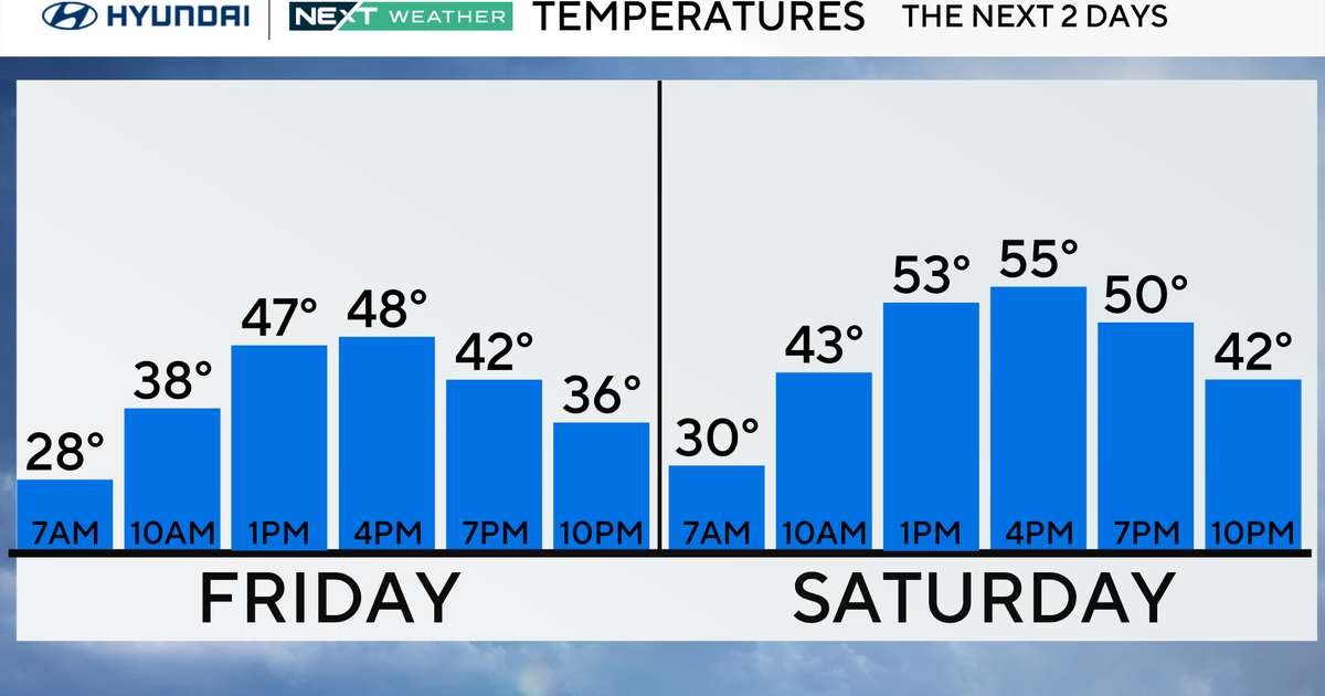
Following the front, the air will gradually dry out tomorrow night leaving us with very comfortable conditions for Friday when dew points will drop into the 40s. An upper-air disturbance will generate cumulus clouds in the afternoon but highs should still reach the upper 60s. The weekend is looking great still with plenty of sun and high in the 60s on Saturday and near 70 on Sunday.