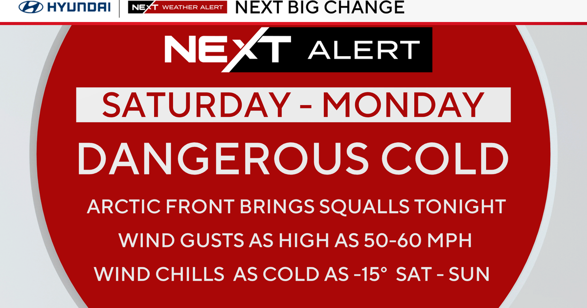
Easter Weekend...
A cold pool of air responsible for all the clouds and scattered downpours the last few days is beginning to drift away and before the next storm system moves in we will take advantage of some fine weather. The instability will wane later this evening and any showers will dry up...clouds will thin as well during the overnight. With less instability tomorrow, fewer clouds will form leaving us with even more sunshine. There still will be some cumulus development and there will be some depth to the clouds making sprinkles possible in the afternoon but they will be few and far between. Temps will reach the middle 50s but may be cooled some at the coast in the afternoon with localized seabreezes.
Easter Sunday will start out sunny and chilly but will warm quickly with the morning sun and a southerly breeze. Temps will max out in the mid 50s as clouds advance in and drown out the sun in the afternoon. A developing wave of low pressure will spread rain into the Northeast by the end of the day but drops should hold off until around or shortly after dark. Rain will be steady and briefly heavy Sunday night...probably picking up .25-.50" before shutting off by dawn on Monday.
Sunshine will break through the clouds and temps will pop up to around 60 degrees before a potent coldfront sweeps through Monday evening with a rain shower followed by much colder air for the middle of the week. The front will be hanging around just offshore early Tuesday and a little moisture may get squeezed out as some drops or flakes early Tuesday morning before benign weather takes over for the rest of the week.