Dry Heat For Holiday Weekend...And A Heat Wave For Some
Friday's clouds and seabreeze at the coast kept much of eastern MA in the upper 80's to near 90, but will help prevent that official heat wave for many areas. Yet still, there are places like Fitchburg, Lawrence, Nashua, Manchester & Concord who reached the Lwr 90's Friday...who will have the best chance of stringing three consecutive days at or above 90 through Sunday. A bit muggy Friday, but a dewpoint front has pushed off the coast with a drier, more comfortable airmass sitting over us this weekend.
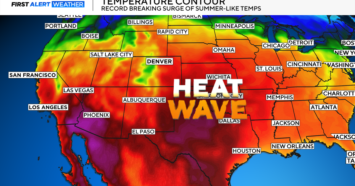
Millions of people are without power this morning because of a powerful Derecho which moved from Chicago to DC last night with straightline winds of 60-90 mph knocking down hundreds of trees and powerlines. Over 500 reports of damaging winds from the Severe Storms Prediction Center. These areas are seeing temps near 100-105 degrees with a heat index over 100 degrees. A serious situation for many many people because of the lack of air conditioning and refridgeration. Heat waves can be one of the leading killers of all natural disasters.
We will get a piece of this of this heat this weekend, but it will be a dry heat as the front separating the steamy from the dry will remain south of New England this holiday weekend. Highs will warm to near records with WSW winds to near 90-95 degrees today with sunshine. Increasing high clouds this afternoon from a weakening T'storm complex to our west. Highs will be nearing 90 on the Cape, and even climb into the Lwr 90's for our eastern facing beaches today. A stellar beach day, but by all means bring the sun protection!
Plenty of fireworks tonight and the weather will be ideal. A summery evening with temps in the Lwr 80's for the festivities. Falling back into the 70's towards midnight, and 60's by dawn under clear to partly cloudy skies. Sunday will see a few more clouds with skies becoming partly sunny. A cold front will approach from the NW during the afternoon which could trigger a hit or miss thunderstorm during the afternoon. It will be hot again, but not as hot as Saturday with highs climbing inot the lwr 90's, but a sea breeze may try to shift in during the afternoon to keep it in the 80's right at the beaches.
A NW flow aloft with a weak trough over New England will go a long way in suppressing the high heat and humidity away from New England this week. Sure, it will be warm and a bit sticky, but nothing compared to what the rest of the nation is experiencing, so we should be very thankful. With this flow aloft, there will not be much instabilty or lift or moisture to work with from Monday into Tuesday with seasonal warmth with highs in the mid 80's. A passing short wave in the flow may sometimes be just enough to trigger a brief shower or thunderstorm. By July 4th, the humidity/dewpoints will start to climb and with an approaching front..that July 4th may actually be the most active weather day with our best chance of seeing a few scattered showers and storms...especially during the afternoon. I expect the weather to be quieting down for the evening fireworks.
Once this front passes, the heat ridge will become established once again for the heat to come roaring back to end the week heading into next weekend with temps climbing back into the 90's. Again, I think a trough will return back to New England to push that next hot spell away and bring back the comfortable air again, while the rest of the nation continues to bake in the peak of summer. Make the best of this weekend with your friends and family! Happy Birthday America!