Dry Breezy Weekend..Wet Start Next Week
There are no big storms in the immediate future, so I am going to take a look at the jetstream and look at the big picture for what is coming down the weather highway for the next several days.
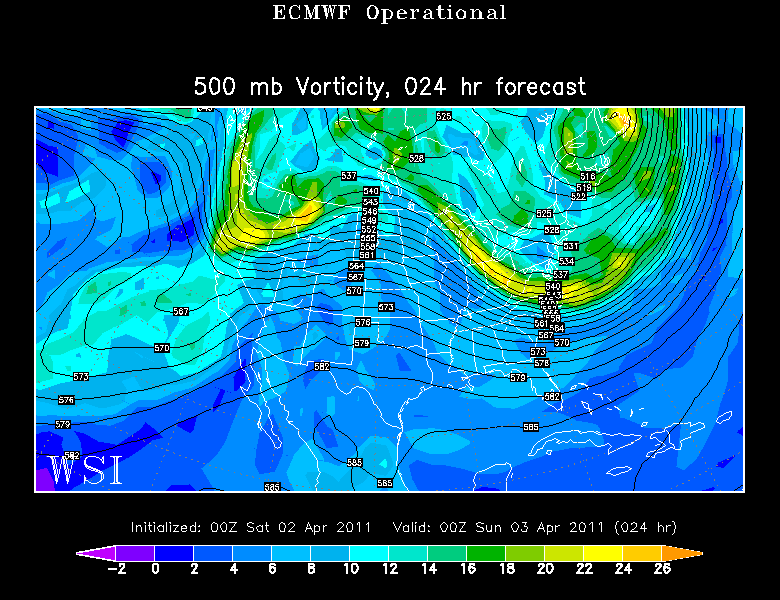
Our departing April Fool's day storm continues to pull away, but lingering effects are still in play to start off the weekend. Drying, windy down sloping winds off the hills and mountains is providing a sunny Saturday morning along the coastal plain. Upsloping winds are making for scattered mountain snow showers for North and West facing slopes. Awesome powder day for many ski areas with most locations picking up 6-12" yesterday.
There is still a trough in place this weekend...even with the March sunshine which will be strong enough to melt a good portion of the snow which fell yesterday. Cooler air is moving in aloft with the WNW winds...so with the heating of the day...the steep lapse rate should ensure building PM clouds. Tracking a weak short wave late today which could trigger a passing sprinkle of brief shower. Sinking air and upper level ridging starts to shift towards New England tomorrow for brighter sunshine and a more stable air mass. Breezy WNW will stick around this weekend with seasonal highs in the 40's and Lwr 50's
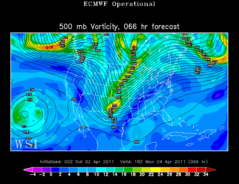
Upper level ridging continues to shift towards the eastern seaboard on Monday. Warmer air from the south will be overriding the cooler air in place across the Northeast for a potent slow-moving Warm front Monday which will produce widespread showers. We will spend most of the day Monday on the cooler side of the front which will mean spending the day in the 30's & Lwr 40's. Any rain may briefly start as a burst of snow or sleet upon it's arrival at daybreak Monday before the change over to showers.
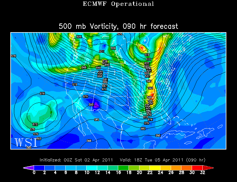
Showers will be winding down by the late afternoon with mild SW winds mixing down to the ground Monday Night into Tuesday. We get into the warm sector ahead of a cold front Tuesday. Strong upper level winds will direct the mild balmy air into the Northeast...but the timing of the shortwave and the arrival of the front will make a big difference on how warm we get. A quicker frontal passage will mean a cooler more stable solution with morning rain Tuesday with temps in the 50's. If the front slows just a bit, we bask in the warm sector Tuesday morning with temps climbing into the 60's, afternoon showers with the chance for thunderstorms. I am hedging my bets with a middle ground solution calling for Lwr 60's in the South for now.
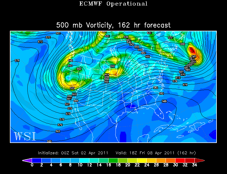
A cooler drier seasonal middle to end of the week is likely with a gradual warming trend heading towards opening day on Friday as another upper level ridge begins to shift into the Northeast. The Euro paints a more optimistic solution while the GFS has a few more showers to watch by the end of the week...so there is some uncertainty with how the end of the week plays out. I am leaning towards a nice opening day Friday until further information proves otherwise. It looks like an awesome warming trend next weekend shifting to the east coast...but our warmth may get cut off at the pass by any passing shortwave of front.
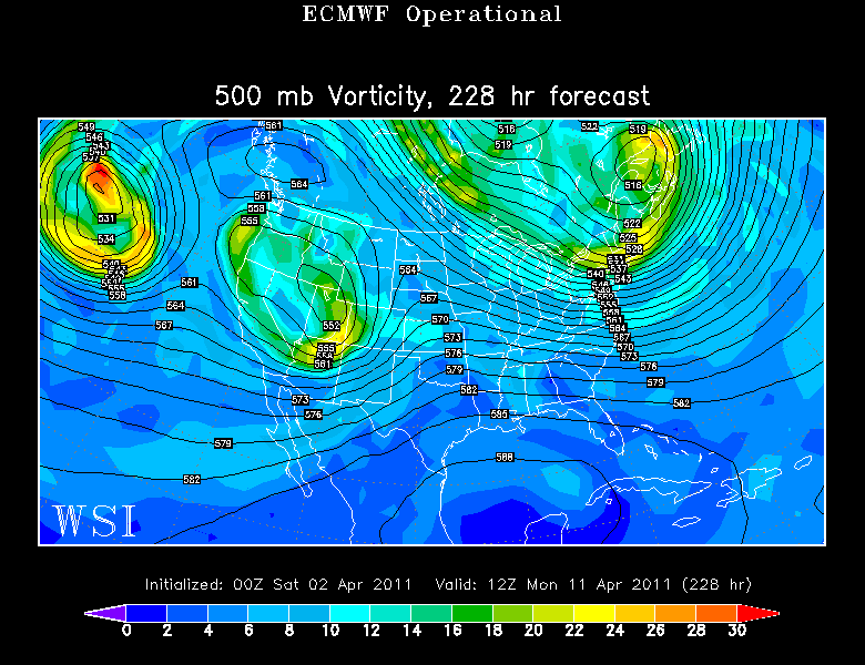
Further down the road the trough does return back to the Northeast by the 11th to return a blast of cooler than normal air which will likely remain in place through the 14th...after this...We will be tracking our next ridge. So as you can see...there is plenty of ups and downs, troughs and ridges to track...but no Nor'easters in our immediate future. If anything, as the April warmth starts to build...this could make for Thunderstorms and severe weather through the midwest and Ohio valley and the potential for tornadoes. Here in the Northeast...nothing quite so severe, but the potenial for a few rumbles of thunder with each frontal passage depending upon how much warmth we can get into the Northeast ahead of the next front. This time of year...cold water temperatures in the 30's along our coast can mean back door fronts and NE wind shifts which can quickly put dampers on upcoming warm ups.
