Delightful Start To Meteorological Summer
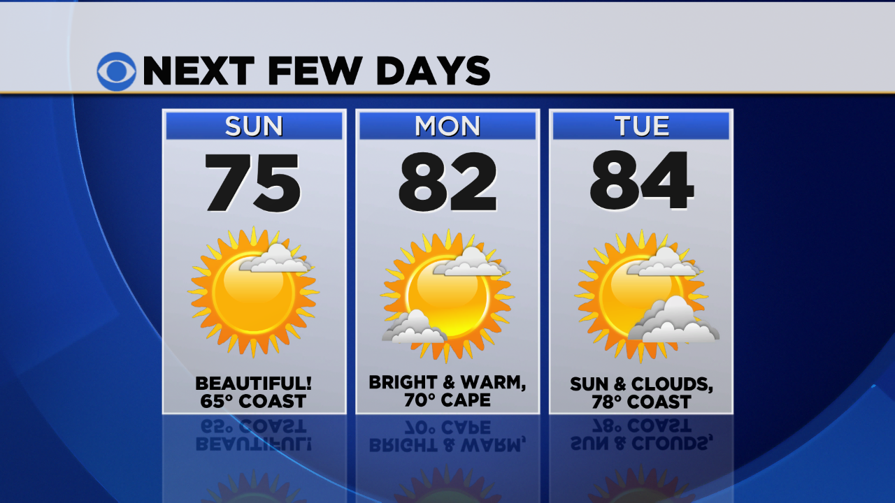
Happy first day of meteorological summer! After a cool start this morning (upper 30s in the coldest suburbs), our temperatures will rebound considerably this afternoon, coming into the mid 70s! There's always an exception, and this time of year it's often the coastline; a seabreeze at the shore will keep coastal communities in the 60s.
If you're looking for a beach day, Monday or Tuesday may be your best bet. Temperatures will climb into the low to mid 80s, but a slight component of wind off the water may hold the coast in the upper 70s. Our UV index is very high these next few days, so be sure to put on the sunblock if you'll be enjoying the great outdoors! Water temperatures are in the low to mid 50s so there probably won't be many brave enough to go for a swim, but it is worth noting that the rip current risk is moderate to high today, especially on the outer Cape and east side of Nantucket.
A slow moving cold front will approach late Tuesday, but aside from an isolated storm well outside of 495, any wet weather should hold off until Tuesday overnight and Wednesday.
Meanwhile, today is the start of hurricane season, which lasts through the end of November. While early predictions are calling for a near to below average season, all it takes is one landfalling storm to cause devastation. I had the opportunity to speak with experts from the National Hurricane Center and National Weather Service about their thoughts and a new product coming out this year: click here to watch.
I also want to note that three years ago today, the greater Springfield tornado touched down in the western part of the state. It was the strongest of the four tornadoes that developed that day in Massachusetts. The twister will be remembered not only for its intensity, an EF3 with estimated wind speeds of 160 mph and its width, one-half mile at times, but for the continuous path of damage it left behind. From its initial touchdown in the Munger Hill section of Westfield, the tornado strengthened as it moved through West Springfield, crossing the Connecticut River into Springfield itself, continuing east through Wilbraham and directly into Monson, Brimfield, Southbridge and eventually Charlton before lifting off the ground. The scars are still visible on our landscape today and I'm sure memories of that day are fresh in the minds of many. My thoughts go out to those impacted by this deadly twister 3 years ago.
-Danielle


