Debby's storm path is now west of Massachusetts. Here's the latest timeline and rainfall forecast.
UPDATE 8/9: Debby has turned "post-tropical," but it could still bring severe storms to Massachusetts. Click here for the latest forecast.
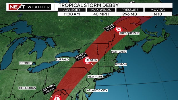
BOSTON - Tropical Storm Debby is accelerating northward and will be carving a path through Pennsylvania, New York and northern New England.
If this news has you canceling plans for the weekend... stop now! The impacts here in southern New England will largely be minor and, in fact, we have one of the best stretches of the summer on the way.
Tropical Storm Debby timeline
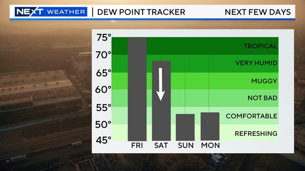
A tropical-like airmass will overspread our area through Friday. Southerly winds will usher in very high dewpoints and an environment capable of producing pop-up showers and quick downpours at any time. Having said that, it certainly won't be raining all of the time, so, once again, you probably don't want to cancel any outdoor plans you may have in the next 24 hours.
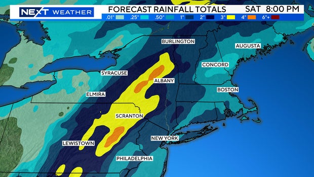
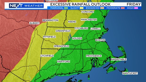
With the track of Debby's remnants being so far west, the heaviest rain and best chance for flooding will remain in New York state, Pennsylvania and perhaps just scrape parts of northern New England.
The National Weather Service has issued an enhanced risk for excessive rainfall in those areas. Farther to the east those chances are much lower.
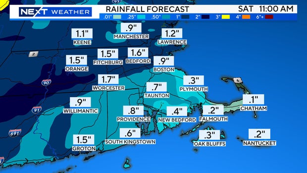
Rainfall amounts in central and eastern Mass. will range from very little (southeast Mass., Cape Cod) to about .5"-1.5" north and west of Boston. Certainly not enough for any serious flooding concerns.
When will Debby impact Massachusetts?
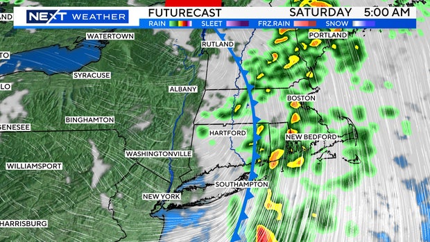
The heaviest rain in New England will come after midnight Friday night and taper off during Saturday morning.
Estimated arrival-departure times:
Western Mass: 9 p.m. - 2 a.m.
Central Mass: 2 a.m. - 7 a.m.
Eastern Mass: 4 a.m. - 9 a.m.
Weekend forecast for Massachusetts
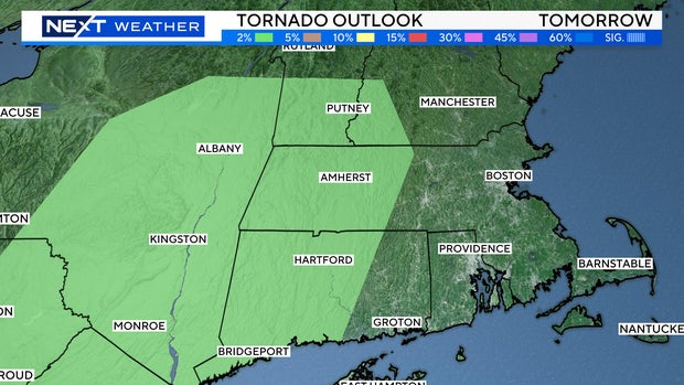
Along with some downpours, there is a slight risk for some severe thunderstorms within this final line of storms. The Storms Prediction Center has highlighted an area in western MA and western CT with a 2% tornado risk.
Tornadoes are not unusual here when the remnants of tropical systems pass through. Overall, the risk in our area is low but, something we will be closely watching in the early morning hours on Saturday.
After these final downpours exit the area Saturday morning, we will be home free for the remainder of the weekend!
Refreshingly dry air will pour in Saturday afternoon and evening. Got Saturday afternoon or evening plans? You're good to go!
In fact, we may be in for one of the nicest stretches of the entire summer Saturday afternoon through much of next week. No big storms, no scorching heat, and no oppressive humidity!
Perseid meteor shower forecast
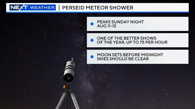
A final bonus for the weekend: One of the best meteor showers of the year is coming Sunday night. The Perseids often produce dozens of shooting stars per hour. And this year, with clear skies and no moonlight, we could be in for a real treat!
If you are heading out to stargaze, the later the better Sunday night. We expect the number of meteors to increase hour by hour overnight.
