Debby turns "post-tropical," but Massachusetts could still see severe storms
BOSTON - The WBZ Weather Team has issued a NEXT Weather Alert for the remnants of Tropical Storm Debby, which will pass through Massachusetts Friday night.
Debby storm update
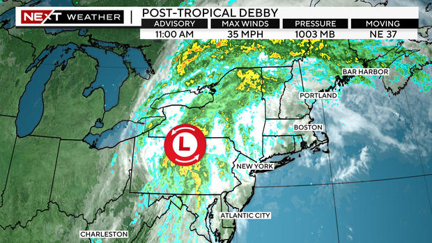
Debby has transitioned to "post-tropical," essentially meaning it now resembles more of a typical low-pressure area than a tropical system.
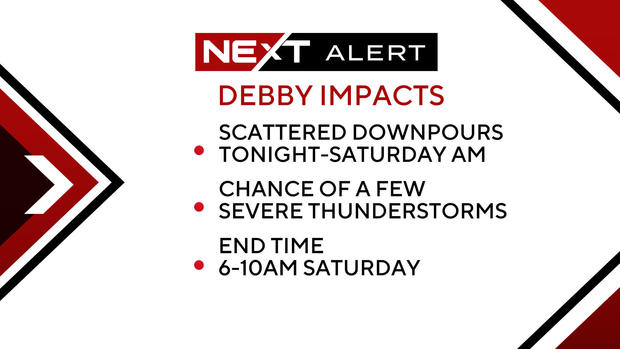
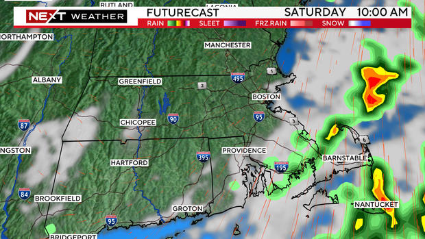
What's left of Debby is still packing a decent punch and will bring periods of heavy downpours and pockets of severe thunderstorms to New England through early Saturday.
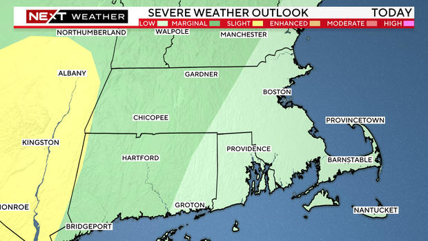
The Storms Predictions Center has placed central and western portions of Massachusetts in a "slight" risk of severe weather and a 2% risk of a tornado.
Farther to the east, closer to Boston, the atmospheric parameters are not as primed for severe weather Friday night. Although, we cannot rule out a few severe storms in eastern Mass.
When will Massachusetts see Debby's effects?
The timing has moved up a bit in the last 24 hours.
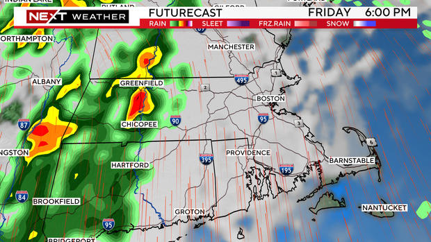
In western Mass., storms could arrive as early as 5-6 p.m. and exit that region between midnight and 2 a.m.
In central Mass., the main threat is between 8 p.m. to 5 a.m.
In eastern Mass., prime time is between 8 p.m. and 6 a.m.
Finally, the last of the showers will exit far southeastern Mass. (Cape Cod area) by 9 a.m. to 10 a.m. Saturday.
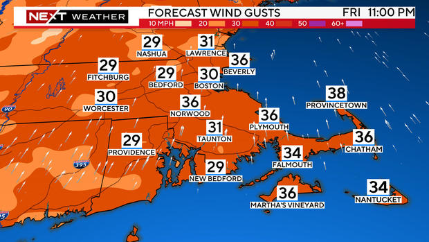
Southerly winds will gust as high as 25-35 mph Friday night, ushering in a very tropical-like airmass over the region.
Weekend forecast for Boston area
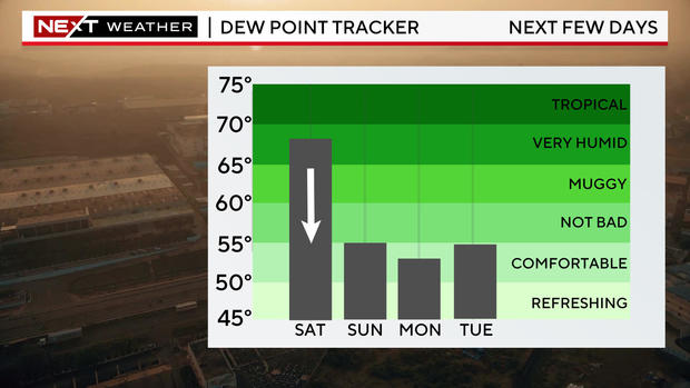
Big changes arrive during the day on Saturday. Dewpoints will begin the day in the 70s and drop into the 60s and 50s by Saturday evening.
That will begin a stretch of several days with very comfy, refreshing air in place.
All outdoor plans for Saturday afternoon and evening as well as Sunday are looking great!
