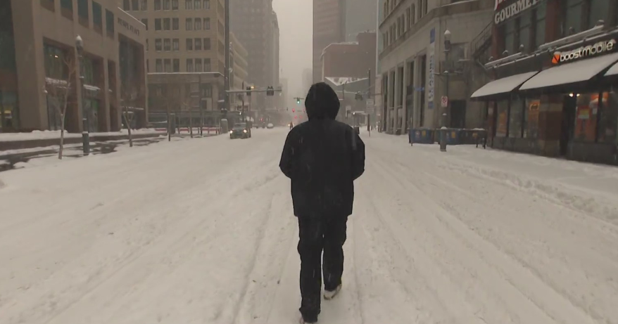
Colder Pattern Here to Stay for A While
It is hard to elaborate much more on what has already been said without stating the obvious which is already known. So I will do what I can here in providing some insight into a developing prolonged cool pattern for the beginning weeks of Spring.
I am not one to complain about the weather. I love it all. Still, like many of you, I am looking forward to some warming temperatures. Unfortunately, I see very little of that in the future, at least through the 10th of April.
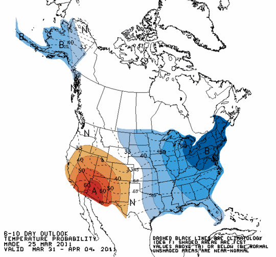
Canadian High pressure is providing cool brisk breezy conditions into the Northeast with plenty of sunshine this weekend and an overall fair weather pattern through midweek. Temps will run below normal for the next week. the Climate Prediction Center has the northeast running well below normal for the next 6-10 days.
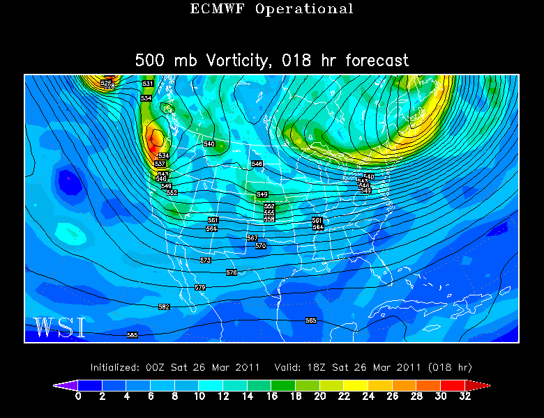
Though High pressure is providing the sunshine...Upper level winds are steering in the cold...which is especially cold aloft with temps at 850 mb running -12 to -14 C. With the heating of the day, this steep lapse rate along vortmax moving through, and midlevel moisture at 800 mb....I would expect some diurnal cumulus to start to pop around midday into the afternoon. Still plenty of sunshine. Highs are stuck in the 30's today with Lwr 40's tomorrow with brisk NW winds.
An upper low will sit over Newfoundland through Tuesday before finally lifting out. This in combination with the High over the Canadian Plains will guarantee the persistent cool NW flow with periodic pieces of energy wrapping around the low which will help to give some cloudiness across the North Monday...as well as the chance for upsloping snow showers for North facing slopes in Northern New England.
After Wednesday, the pattern becomes more interesting with still plenty to watch once the upper low finally pulls out of the picture. Will we be tracking energy slamming into the NW US which will then move into the Great Plains. This will likely be the cause of more thunderstorms or even tornadoes through the midwest. Just enough ridging will be in place to likely keep Wednesday mostly dry....but the exact timing of this disturbance is still in question this far out.
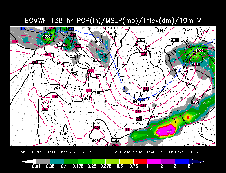
If you go on the European model above, it shows low tracking just south of New England bringing with it a wet mix of snow and rain...mainly for Thursday. As the low pulls away...any rain may briefly mix over to snow by Thursday night...before ending. Again, the timing, placement, ptype is all speculation right now...so we will just have to watch that...but I would not be surprised to see the Berks to the Worcester Hills get a few inches of snow from that.
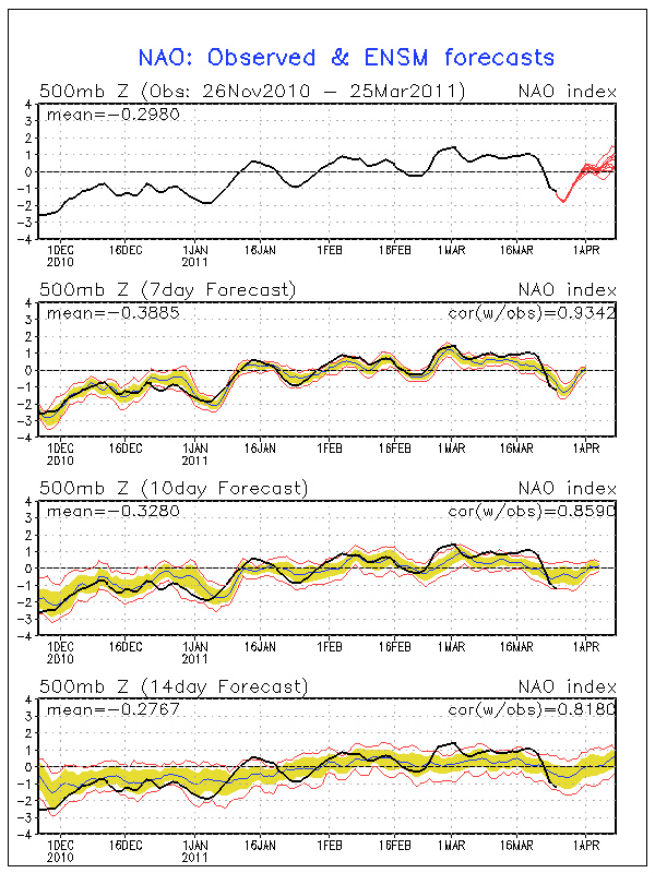
As we know, we have moved back into this blocking pattern with building high pressure over Greenland. So far this is helping to take the main storm track south of New England and keep it cold. That will remain the trend for now as the North Atlantic Oscillation has gone into negative territory. When negative, blocking highs over Greenland and cold weather with a trough in the Northeast is very typical. But looking at the chart which is kind of hard to see...(my apologies) The NAO starts to work back towards the neutral or positive phase further into April which could mean a gradual easement of the cold pattern
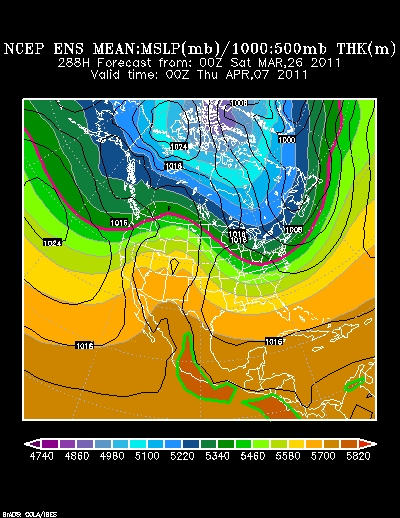
That may be...but our long range ensembles are still showing a trough in place across the northeast right thought the 7th...which will likely still be having some sort of impact on our weather through the 12th of April
Timing the shortwaves of energy which will come over the western ridge and into the base of the trough in the east will create some nashing of the teeth for forecasters as there is still the potential for a more sizable storm to form and come up the coast before we finally break out of this. Our models are everywhere looking further down the road. Sometimes there is a storm, sometimes there is not...but there certainly is potential through this time period. This is the time of year where surprise heavy snows can come out of nowhere. So for now...let's enjoy the quiet weather as chilly as it may be.
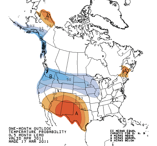
The Climate Prediction Center has fine tuned their April Outlook with Northern New England above normal. Hmm. Once this troughy pattern finally lifts out...could we be in for a marvelously mild second half of spring to make up for the early chill? Could be!
