Cold Air Moving In...Then Impending Snow?
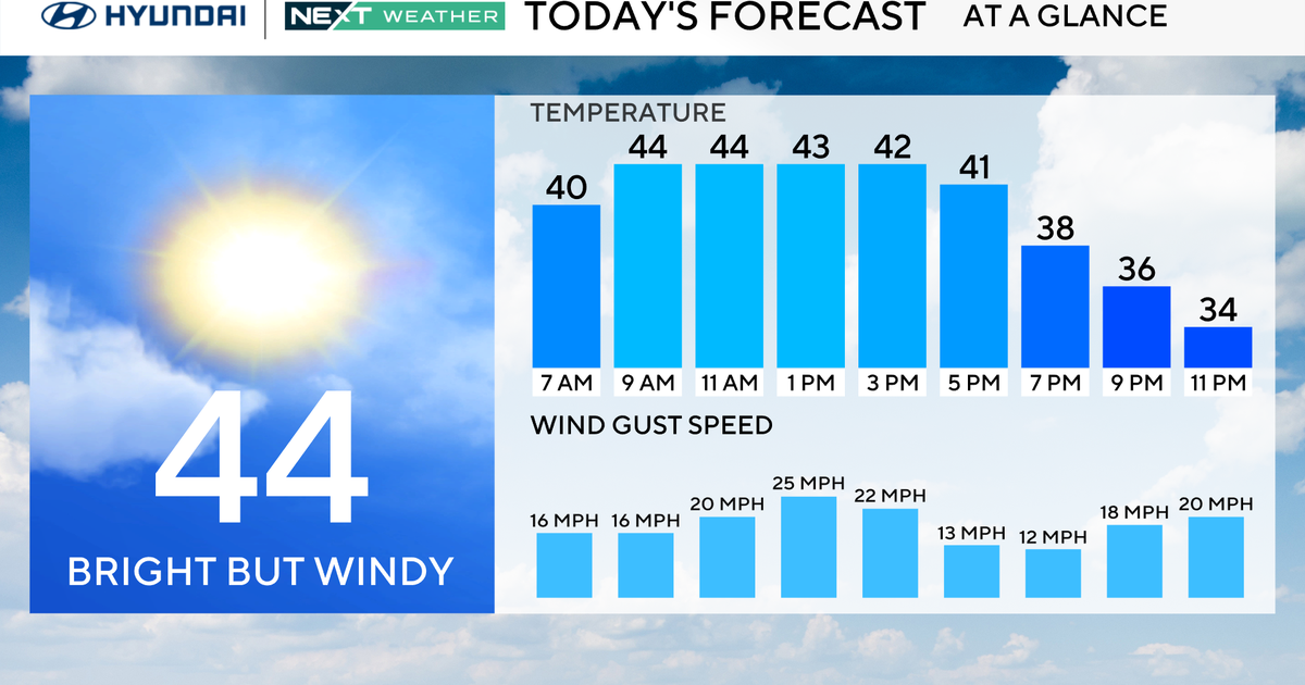
I must say the most noticeable thing this morning was the warm temperatures. Thanks to southerly flow and overnight cloud cover associated with a cold front now pushing off the coast, temperatures were steady overnight, and in fact the warmest temperatures we will see today were already met early this morning. Despite the cold front being offshore, there are still lots of clouds around amidst cold, cyclonic flow aloft. These clouds will gradually break for some afternoon sunshine under a blend of sun and clouds. Winds will be quite gusty out of the west at 15-30mph, and despite temperatures in the middle 40's the wind chill will make it feel more like the 30's.
This evening and into the overnight hours temperatures will tumble as skies clear. Many locations outside of the city will drop into the middle 20's as crisp clear skies allow the atmosphere to radiatively cool rather effectively. It would be wise to bundle up if you're going to be out and about early tomorrow morning. Gusty winds in addition to cold morning temperatures will create wind chills in the teens!
Sunday we have lots of sun to start, although it appears some mid-level energy in the form of a "vorticity maximum" will rotate through the area on the base of a nearly zonal trough. This will create a mid-level cloud deck which will block out the sun from time to time. It will be noticeably cold out there as highs will struggle to get above 40 degrees with continued blustery winds and wind chills in the 30's.
Monday looks to be the sunniest, warmest day of the week. A surface high pressure center will move over New England, acting to suppress most cloud cover and also slackening the pressure gradient. This will allow temperatures to warm into the lower to middle 40's with light westerly winds. Things look much more interesting as we head into Tuesday...
Now, over the last few days you may have heard some talk about a potential storm Tuesday-Wednesday. Unfortunately, the computer models have been all over the place, to say the least. Run to run and model to model continue to show a variety of solutions, although this morning there does appear to be a little better consensus regarding the track of the storm. It appears an area of low pressure will be slow to develop as it moves off the mid-Atlantic coast. Then as it turns toward New England, likely staying just south and east of the coast, when it intensifies, and how much it intensifies are all questions to be answered. The ECMWF, which is typcially most accurate, has a weak progressive low which would generate only a few snowshowers and at most 1-2 inches of snow across the interior. The GFS on the otherhand, especially this mornings 06z run, shows this low rapidly intenisfying as it passes south and east of the coast. This scenario would drop several inches of snow inland along with gusty NE coastal winds. This GFS run has up to a foot or more of snow in the NW mountains. Any farther track south could spell the potentila for a heavy snow inland.
This uncertainty will hopefully be mitigated over the next 24-48 hours as we come closer to the storm and the computer models hopefully come into agreement as to the evolution of this storm. At this point it does seem likely that at least some locations will see accumulating snowfall, with the potential for substantial snowfall if the low intensifies more than currently forecast. There are many variables in play as always...from available moisture, to track, to temperature of the air...all of this needs to be figured out. We hope to have better answers for you very soon.
As we head into the rest of next week, we should see some late sun Wednesday afternoon behind the departing low. As this low exits the region some artic air will pour down from Canada on bone-chilling northwest winds. As a result, highs Thursday and Friday will likely be in the 30's! Morning lows will also be frigid with readings in the teens possible in many locations, especially if we have a snowpack. Even farther into the future there lies much uncertainty as to the strength of the NAO and the position of the jet stream, which inevitably will impact our day to day weather. However, we may be in for a brief warmup towards the end of next week as a ridge tries to build in against the cold air entrenched in the region.
Have a great weekend and enjoy the sun. If you like winter sports, hit the slopes and enjoy the snow that the resorts have been pumping out over the last several days. We already have several resorts open with more and more terrain available every day!
