Clash of the Seasons...
Spring surging up from the south Winter hanging around to the north...the two will be doing a nice little dance over the next several days...
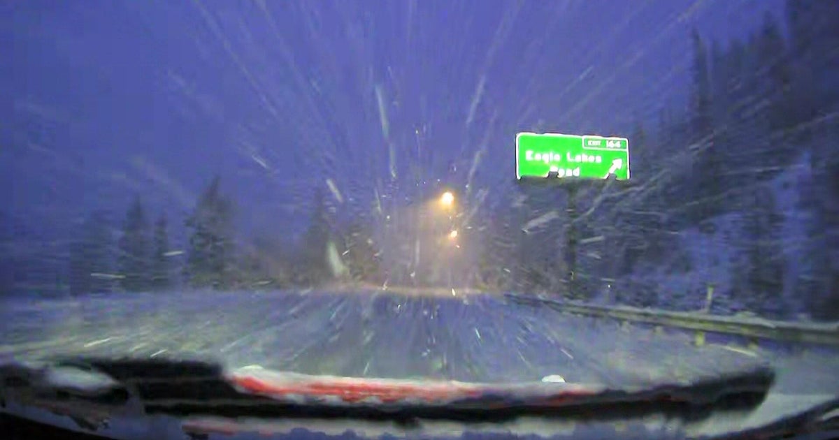
At first, Spring will win out with ta storm track likely to cut right through Massachusetts, most of us will see a soaking rain storm tomorrow but just over the border into northern New England it will be a different story with much of VT,NH and ME picking 6+ inches of snow...great news for the ski resorts as they finish up school vacation week. The rain will be the big story around here and we are still looking at embedded convective rains (a few thunderstorms) as parts of the area slip into the warm sector and the potent shortwave at 500mb (cold pool of air) create a rather unstable environment for this time of year. The rain will continue into the early evening and 1-2" is likely and so is poor drainage and some street flooding. I'm not so concerned about the rivers and streams in the immediate future as flash flood guidance shows 3-6" of rain / snowmelt needed to send rivers into flood stage.
The storms structure is pretty sprawled out...you can clearly see that by looking at a radar of the system right now. This along with the fact that the storm goes negative as it is going by tomorrow evening means the precip will hang on deeper into the evening...while the cold is returning...this means a flip from rain to snow at the tail end with a possible inch or so in Boston and 1-3" to the north and west.
Temps will be pretty wild to look at tomorrow in the afternoon across New England...they will likely range from the Mid 50s in SE Mass to the 20s in Northern NH and ME! Potentially damaging wind will gust to 60+mph over the Cape and Islands during the days as the storm approaches and then everybody will see strong gusts out of the NW as high as 45mph in the evening as the storm goes by and the cold comes crashing down! Lot's to monitor and follow tomorrow!
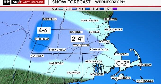
In the wake of the storm for the weekend we will be back in the Winter cold...highs near 30 both days. At the same time a departing 300mb jet streak and another streak approaching from the west will spin up a little surface low on Sunday that along with onshore overrunning will start a little light snow machine maker for the day...1 to maybe 3" looks likely...there you go snow lovers, should be a pretty snow.
But, then the pendulum swings back...another wet, warm and windy storm to knockdown the snowpack even more!!!