Catching A Break At Winter's End
What a great way to end the weekend as highs were in the mid-upper 40's in the late March sunshine. We even reached 50 degrees at TF Green airport and at Taunton. That 50 degree number will become more in reach in the coming days as the sun gets higher in the sky. Normal high for this time of year is 48...so we are just where we need to be!
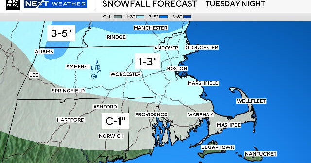
Of course all eyes are focused on this storm which will be staying south of New England and sparing us the worse wintry effects. This storm will be providing DC to Philly produce about a half foot of slushy snow Monday. Thanks to a blocking pattern in the upper levels of the atmosphere, this storm will get steered just south of us but it will be close. One low currently sits in the Ohio Valley, but a secondary low will be strengthening off the coast of new Jersey Monday and tracking south of New England Monday night.
Enough dry air will be in place that Monday will be dry, but cloudy for the morning hours. By afternoon clouds will be thick enough that they may start to spit a few sprinkles or flurries. It will be a cool raw day with a stiffening NE wind which will help to keep temps in the 30's and lwr 40's. The northern fringe of this storm will track awfully close to the south coast by later in the afternoon into the evening. Any wet mix should be changing to snow with by 4 or 5 PM. The latest runs of Nam, GFS and Euro all bring in a steadier batch of precip into the south coast for the late afternoon and evening. A general 1-2" is possible for the south coast to Buzzards Bay to the Cape. There may even be a few pockets of 3-4" of snow reserved for the Vineyard and Nantucket and maybe even Chatham. The strongest NE winds will happen Monday night where winds will gust to 30-40 with a few gusts to 45 for the Islands. This storm will quickly pull away with drier air wrapping in with a persistent NW flow which should last for most of the rest of the week as temperatures will slowly moderate. SAo after this storm, it will be a quite week of weather as end out the month of March and look forward to warmer times in April, where this cool stormy blocking pattern should ultimately break.


