Boston weather back to "normal" this week; Watching a weekend storm threat
BOSTON - This week is a week of milestones in the weather world - and we're also keeping an eye on a potential storm for Massachusetts this weekend.
First up, this weekend marked the earliest ice-out at Lake Winnipesaukee on record!
We beat out 2016 by a day. It was a very warm winter up that way ... frankly they barely even had an ice-in!
First day of spring and 7 p.m. sunsets
The spring (vernal) equinox arrives just before midnight on Tuesday, making Monday the final, full day of astronomical winter!
A reminder: The vernal equinox is the moment when the sun is directly over the equator and making its way northward.
Later this week, Saturday to be exact, our sunsets will cross the 7 p.m. threshold!
We are making fast progress in the length-of-day department, picking up more than two minutes each day right now.
Back to "normal" March weather
As for the weather this week, we get back to "normal." It has been so warm for so long; it is hard to remember what a normal mid-March day feels like. Well, this week, will be very close to average with highs generally in the upper 40s. Normal high for today's date in Boston is 46 degrees.
You can see the highs for Tuesday are pretty much right on target.
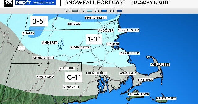
We have two shots at precipitation this week. The first comes on Wednesday and looks to be quite minor. Only expecting a few scattered rain and snow showers, mainly later in the day. Best chance of seeing a few flakes would be in central and western Mass.
Possible weekend storm?
There is a much greater storm threat coming this weekend, however, at the moment, models are all over the place.
We will have to wait and see how this develops in the next 48 hours. Potential solutions range from a complete miss to a fairly impactful storm with rain and snow in the area.
We'll keep you updated!


