Mild weather in the forecast for Massachusetts before a brief return to winter
BOSTON - The weather headlines this week feature several days in the 50s, a one-day return to winter, and yet another warmup to follow.
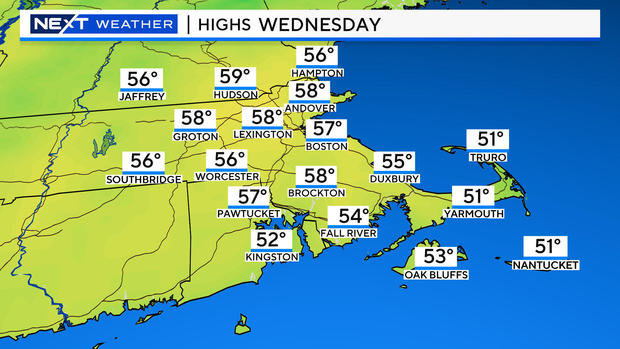
Check out the forecast high temperatures on Wednesday, the warmest of the next few days.
Keep in mind that average highs in late February are in the low 40s.
What's the reason for this stretch of mild days? There will be a powerful area of low pressure headed well to our west, carving a path through the Great Lakes Region on Wednesday. Out ahead of this storm, a long fetch of southerly winds will draw up an unseasonably mild airmass into the northeast.
Cold front brings heavy rain and maybe some snow
Along with the mild temperatures, will come quite a bit of cloudiness and some precipitation.
Clouds will be thickening during the day on Tuesday. The first batch of rain showers will arrive Tuesday night and continue through Wednesday morning.
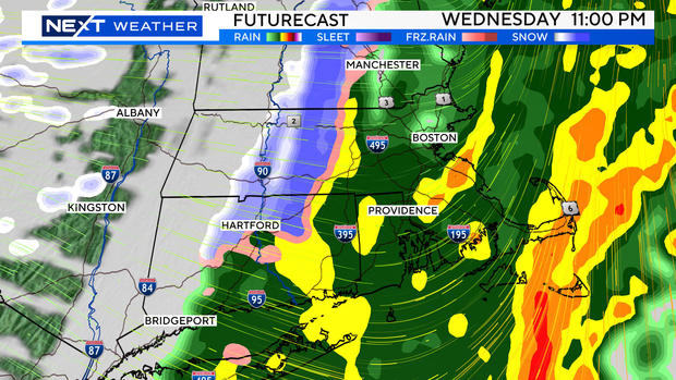
We should get some drier weather during the day Wednesday before a potent cold front arrives Wednesday night, around midnight.
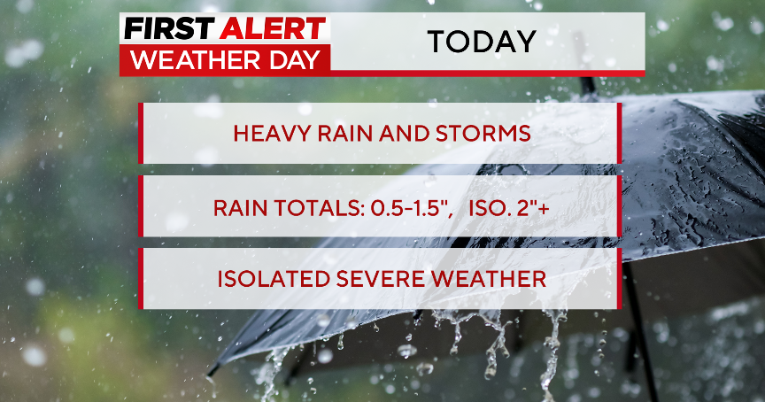
The heaviest rain this week will fall in this time frame, between about 7 p.m. and 2 a.m. It may even end as a brief period of snow as much colder air rushes in.
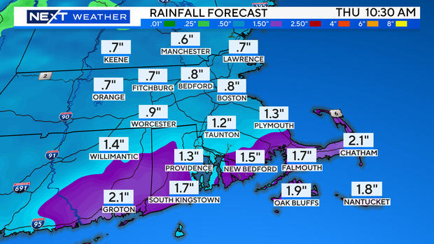
All in all, we expect about an inch of rain over the coming few days, perhaps as much as 2" well to the south of Boston.
Turning colder with gusty winds Thursday
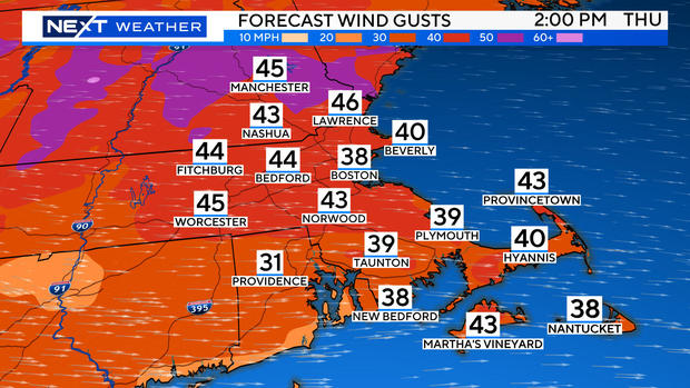
Perhaps the most notable weather story this week will be the harsh temperature drop and powerful winds on Thursday.
Highs will drop some 20 degrees between Wednesday and Thursday and winds will gust 40-50 mph during the day on Thursday.
Thankfully, the brisk/chilly airmass will only be here for a brief stay. Temperatures will warm up again in time for the weekend.
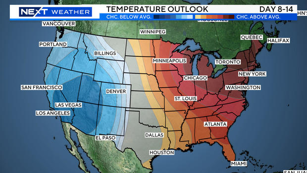
Looking in the longer range, the first 1-2 weeks of March also look quite mild across much of the eastern United States.
