After wet Saturday morning, more snow expected in afternoon
BOSTON – Happy Saturday!
No big surprises or changes this morning. Here is the latest on our winter storm:
- As expected, most of the snow accumulation has occurred north of the Mass Pike.
- Highest snow totals (locally) with this event will be across northern Massachusetts and southern New Hampshire.
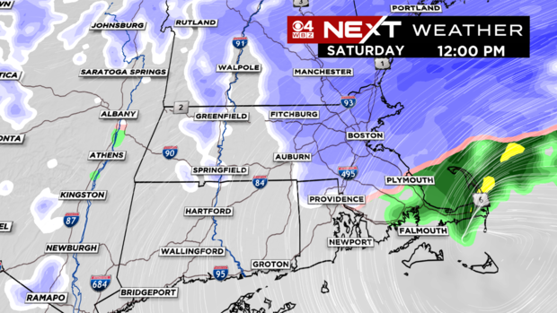
- During the morning hours on Saturday, we will see a mix of sleet and wet snow in northern areas and sleet and rain along the coast and areas south of the Pike.
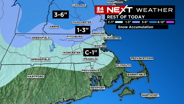
- By midday and afternoon, the precipitation will change back to mainly snow, but we are not expecting any significant additional accumulation.
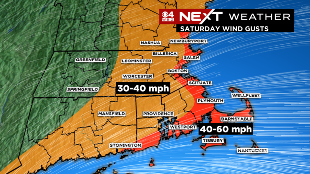
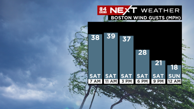
- Winds will remain very gusty through the afternoon, peaking along the coast and Cape.
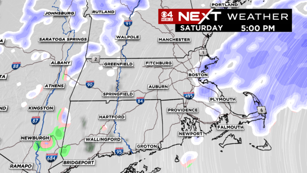
You can see around midday, the rain/sleet is changing back to snow as winds veer more northerly.
By this evening, the snow is tapering off to just a few flurries leftover at the coastline.
Here is what you can expect for additional snow accumulation after 6 a.m. Saturday.
The winds will be very gusty all day today. Some scattered wind damage or power outages are possible, especially at the coast.
The winds will gradually decrease later today and tonight.
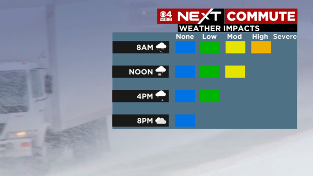
The travel conditions should also improve as the day wears on with, perhaps, just some side roads getting a fresh snow coating in spots this afternoon.
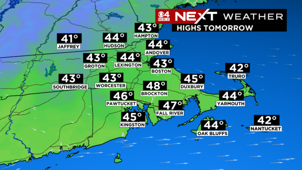
Highs Tomorrow will be in the mid 40s with some sunshine!
Finally, winter got you down? There are lots of spring milestones ahead, including the arrival of daylight saving time next weekend!
