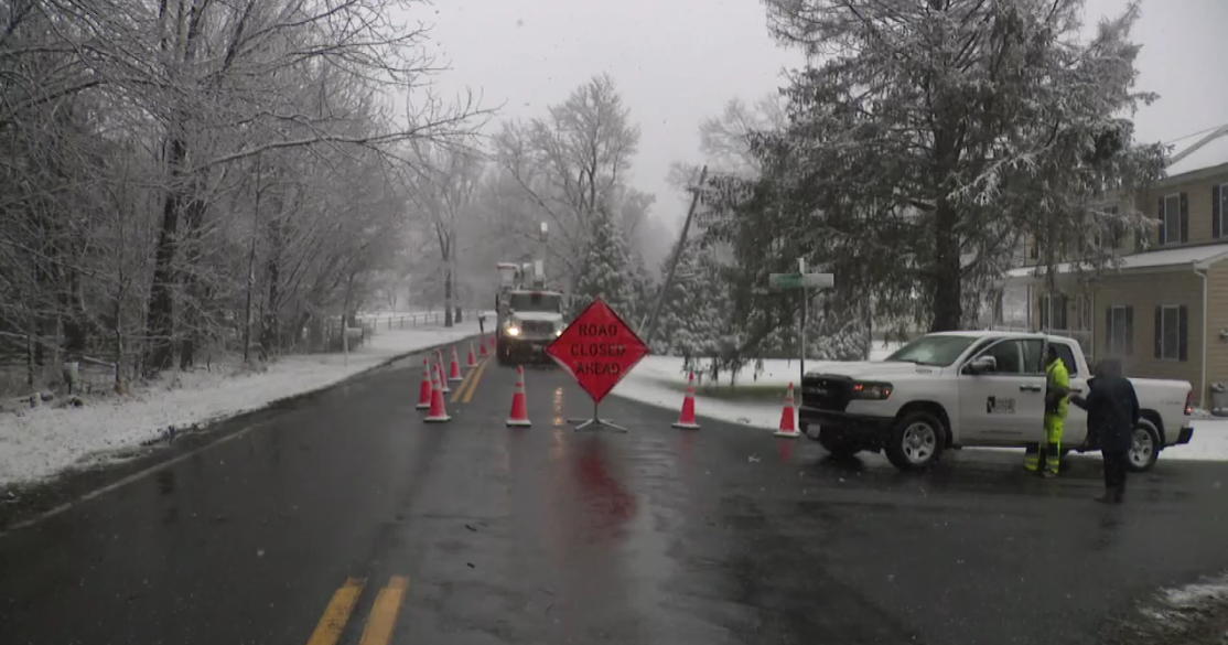
Blizzard Warning Ahead Of Third Nor'Easter, Over A Foot Of Snow Expected
BOSTON (CBS) -- Blizzard… check.
Bombogenesis… check.
Nor'easter… check.
Thundersnow… why not?
Third Nor'easter Could Bring Boston Two Feet Of Snow
Yup, it's still coming. There was some hope over the weekend that perhaps the storm may track a bit farther east and deliver only a glancing blow to southern New England, that hope is now gone.
Three nor'easters in 10 days!
The only comparison I can come up with is February of 2015, and after that happened we wondered if we would ever face another barrage like that in our lifetimes… well, 3 short years later, here we go again.
The blizzard warning has now been expanded to include the city of Boston and everywhere inside of Route 128 along with eastern Essex County, Plymouth County, Cape Cod and Martha's Vineyard.
Between the intense bands of snow and the powerful northeast winds, traveling is going to be an absolute nightmare on Tuesday, even impossible at times with near zero visibility.
In short, if you don't have to go out, stay home.
Both commutes will be severely impacted. Plows will struggle to keep up with the snow, falling 1-3" per hour within the heaviest bands. This will likely be the biggest snowfall of the season for most towns in eastern Mass., including Boston (beating 13.4" total back on January 4th).
Now for the specifics.
START TIME:
It ramps up quickly after sunrise.
You can expect inch per hour snowfall almost right off the bat.
PRECIPITATION TYPE:
This one is easy, snow.
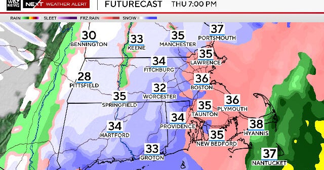
Other than perhaps a touch of rain on the outer Cape and Nantucket, the atmosphere on Wednesday is easily cold enough to support all snow for all of New England.
The consistency will not be as heavy and wet as the last storm in most areas. The heaviest snow will be found along the immediate coastline and over Cape Cod and the Islands. Otherwise, inland, the snow will take on a fairly typical feel, not too heavy, not fluffy.
Otherwise, inland, the snow will take on a fairly typical feel, actually on the fluffier side!
POWER OUTAGE CONCERNS:
The risk of power outages is not as high with this snow storm compared with the last.
This is largely due to the weight of the snow being slightly lower.
Closer to the coast and over southeastern Mass. the risk is a bit higher due to lower snow-liquid ratios, more wind and generally speaking, more snow.
WINDS, BLIZZARD CONCERNS:
The strongest winds, as usual, will be located along the coastline.
Winds are currently forecast to reach 55-65 mph from Cape Ann to coastal Plymouth County and over Cape Cod and the Islands. Expect gusts of 40-55 mph along the rest of the coast.
Inland gusts would top out between 20-40 mph.
Blizzard conditions are forecast to occur at times in eastern Mass. due to the intensity of the snow combined with the frequent, gusty winds lowering the visibility to near zero.
The best chance of this occurring would be in coastal Essex County, coastal Plymouth County and over Cape Cod and Martha's Vineyard.
COASTAL FLOODING:
With tides being fairly low astronomically, we do not anticipate any major coastal flooding.
During the Tuesday morning high tide (between 9-10 a.m.), minor to moderate coastal flooding/splash over is likely at most east-facing shorelines.
Wave heights just offshore will once again reach 20-30 feet along with a storm surge of 2.5 to 3.5 feet.
Areas most vulnerable to coastal flooding would be coastal Plymouth County, the north and east facing beaches in Barnstable County and Nantucket.
SNOWFALL AMOUNTS:
10-14 inches: Most of Worcester County and western Middlesex County. Also most of southern New Hampshire away from the coastline and up through central and northern New England.
The outer Cape and Islands will also fall in this range due to a much wetter snowfall and perhaps, a brief mix of rain.
14-18 plus inches: All of eastern Massachusetts, coastal New Hampshire, southern coastal Maine. This includes eastern Middlesex County, all of Essex County, Suffolk County (Boston), Norfolk County, Bristol and Plymouth counties and most of Cape Cod. Certainly will not be surprised to see some 20-24" totals. The greatest threat of over-performing current forecast amounts would be in southeastern Mass.
Given our current snowfall forecast, this would be the second greatest snowfall accumulation in one storm in Boston in the month of March. Note the last time we saw anything close to this was back in 2013.
END TIME:
The heaviest snow bands will taper off between 6-8 p.m. Tuesday. Most of the accumulation will have occurred at that point.
After 8 p.m., there will be leftover light to moderate areas of snow for the remainder of the night, into Wednesday morning.
Again, very little additional accumulation late Tuesday night into Wednesday morning.
WHEN WILL IT MELT:
Typically March snow doesn't hang around long. But, this time around, there is some serious cold coming after the storm.
Daytime highs through at least early next week will be stuck mainly in the 30s, perhaps briefly touching the low 40s on a few occasions. At least there aren't anymore nor'easters for a while, quiet times through the weekend. No promises after that.
And, as always, we urge that you stay tuned to WBZ-TV and CBSBoston.com for frequent updates before and during the storm!
We've got you covered!
Follow Terry on Twitter @TerryWBZ
